Direct Topo Map Texas
To zoom in, hover over the map of Direct
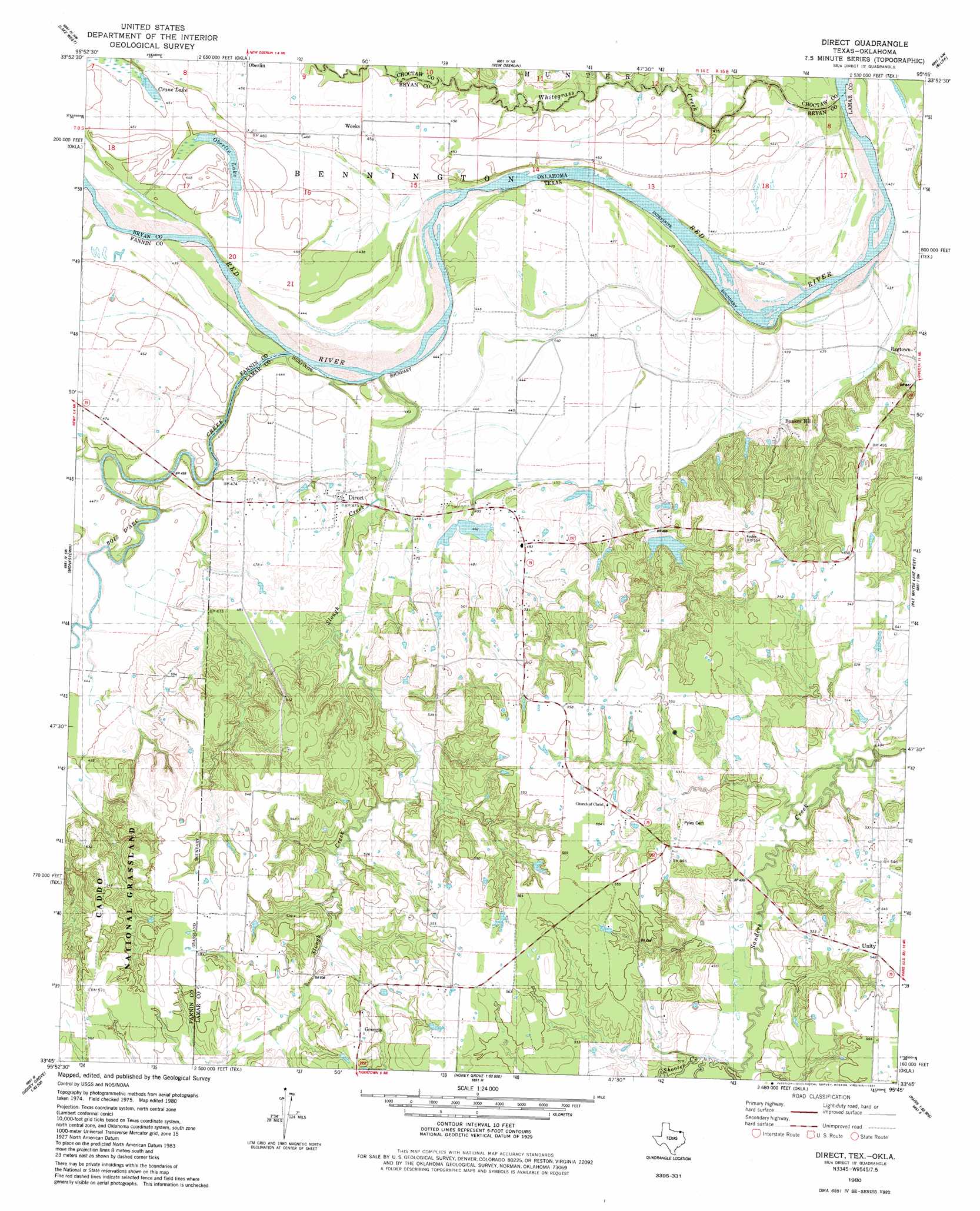
USGS Topo Quad 33095g7 - 1:24,000 scale
| Topo Map Name: | Direct |
| USGS Topo Quad ID: | 33095g7 |
| Print Size: | ca. 21 1/4" wide x 27" high |
| Southeast Coordinates: | 33.75° N latitude / 95.75° W longitude |
| Map Center Coordinates: | 33.8125° N latitude / 95.8125° W longitude |
| U.S. States: | TX, OK |
| Filename: | o33095g7.jpg |
| Download Map JPG Image: | Direct topo map 1:24,000 scale |
| Map Type: | Topographic |
| Topo Series: | 7.5´ |
| Map Scale: | 1:24,000 |
| Source of Map Images: | United States Geological Survey (USGS) |
| Alternate Map Versions: |
Direct TX 1980, updated 1981 Download PDF Buy paper map Direct TX 2010 Download PDF Buy paper map Direct TX 2013 Download PDF Buy paper map Direct TX 2016 Download PDF Buy paper map |
| FStopo: | US Forest Service topo Direct is available: Download FStopo PDF Download FStopo TIF |
1:24,000 Topo Quads surrounding Direct
Bennington North |
Boswell Sw |
Boswell |
Soper |
Hugo |
Bennington South |
Lake West |
New Oberlin |
Bluff |
Grant |
Telephone |
Monkstown |
Direct |
Pat Mayse Lake West |
Pat Mayse Lake East |
Lamasco |
Selfs |
Tigertown |
Toco |
Paris |
Dodd City |
Honey Grove |
Petty |
Roxton |
Biardstown |
> Back to 33095e1 at 1:100,000 scale
> Back to 33094a1 at 1:250,000 scale
> Back to U.S. Topo Maps home
Direct topo map: Gazetteer
Direct: Dams
Q B Stephens Lower Lake Dam elevation 158m 518′Soil Conservation Service Site 1 Dam elevation 139m 456′
Soil Conservation Service Site 2 Dam elevation 144m 472′
Soil Conservation Service Site 3 Dam elevation 148m 485′
Direct: Lakes
Crane Lake elevation 138m 452′Oberlin Lake elevation 136m 446′
Direct: Populated Places
Bunker Hill elevation 145m 475′Direct elevation 145m 475′
East Direct elevation 147m 482′
Georgia elevation 172m 564′
Oberlin elevation 139m 456′
Unity elevation 167m 547′
Weeks elevation 140m 459′
Direct: Reservoirs
Q B Stephens Lower Lake elevation 158m 518′Soil Conservation Service Site 1 Reservoir elevation 139m 456′
Soil Conservation Service Site 2 Reservoir elevation 144m 472′
Soil Conservation Service Site 3 Reservoir elevation 148m 485′
Direct: Streams
Bois d'Arc Creek elevation 130m 426′Carson Branch elevation 134m 439′
Dry Creek elevation 131m 429′
Shooter Creek elevation 164m 538′
Slough Creek elevation 129m 423′
Direct digital topo map on disk
Buy this Direct topo map showing relief, roads, GPS coordinates and other geographical features, as a high-resolution digital map file on DVD: