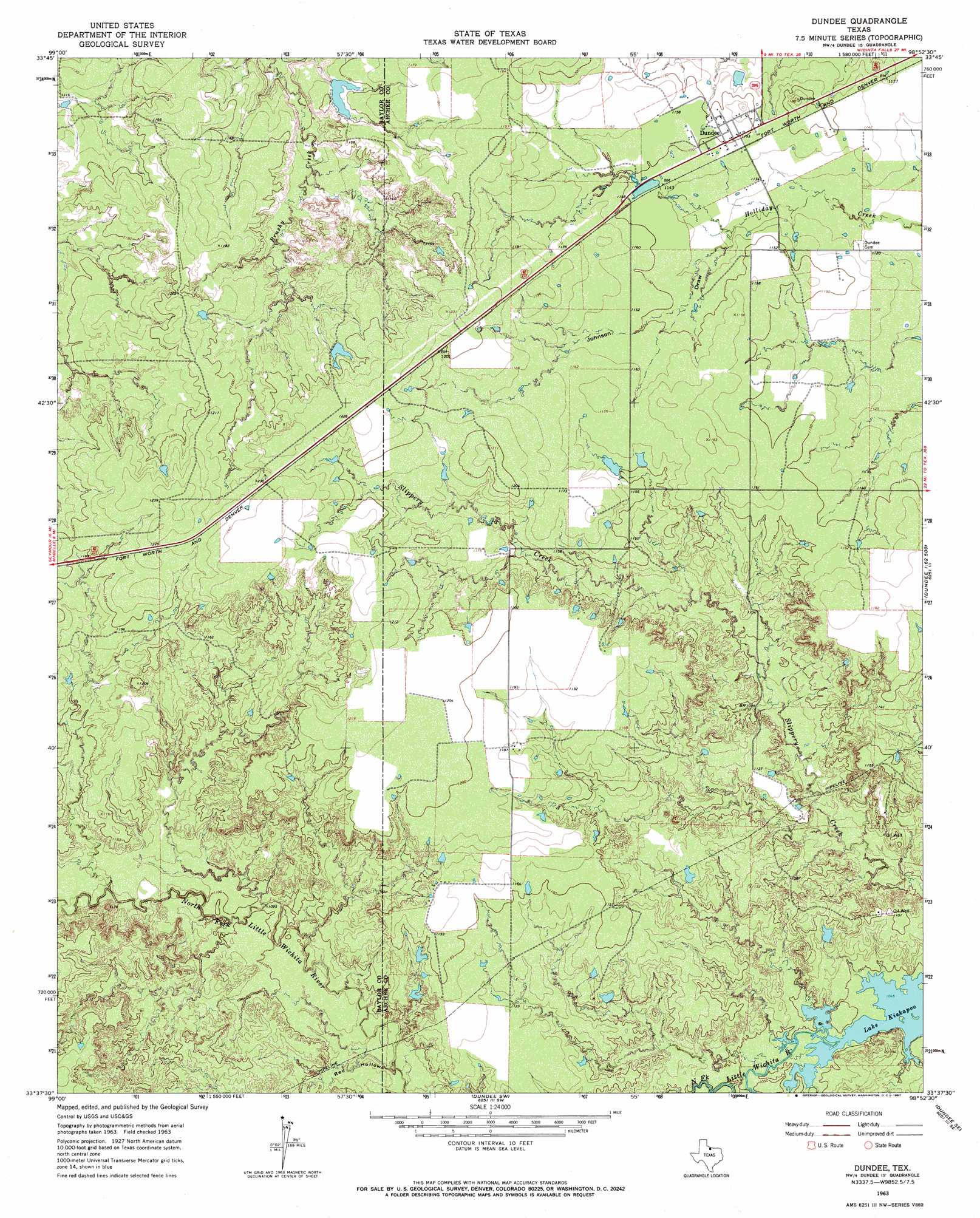
Dundee Topo Map Texas
To zoom in, hover over the map of Dundee
USGS Topo Quad 33098f8 - 1:24,000 scale
| Topo Map Name: | Dundee |
| USGS Topo Quad ID: | 33098f8 |
| Print Size: | ca. 21 1/4" wide x 27" high |
| Southeast Coordinates: | 33.625° N latitude / 98.875° W longitude |
| Map Center Coordinates: | 33.6875° N latitude / 98.9375° W longitude |
| U.S. State: | TX |
| Filename: | o33098f8.jpg |
| Download Map JPG Image: | Dundee topo map 1:24,000 scale |
| Map Type: | Topographic |
| Topo Series: | 7.5´ |
| Map Scale: | 1:24,000 |
| Source of Map Images: | United States Geological Survey (USGS) |
| Alternate Map Versions: |
Dundee TX 1963, updated 1967 Download PDF Buy paper map Dundee TX 2010 Download PDF Buy paper map Dundee TX 2012 Download PDF Buy paper map Dundee TX 2016 Download PDF Buy paper map |
1:24,000 Topo Quads surrounding Dundee
Grayback |
Lake Electra |
Beaver Creek |
Fowlkes |
Iowa Park |
Northeast Lake Kemp |
Franklin Bend |
Lake Diversion |
Mankins |
Holliday |
Southeast Lake Kemp |
Fulda |
Dundee |
Lake Kickapoo |
Dads Corner |
Seymour East |
Cope Branch |
Dundee Sw |
Dundee Se |
Archer City West |
Rock Canyon |
Westover |
Megargel |
Lake Olney |
Bobcat Bluff |
> Back to 33098e1 at 1:100,000 scale
> Back to 33098a1 at 1:250,000 scale
> Back to U.S. Topo Maps home
Dundee topo map: Gazetteer
Dundee: Dams
Brushy Tank Dam elevation 349m 1145′Gilmore Lake Dam elevation 348m 1141′
Dundee: Populated Places
Dundee elevation 351m 1151′Dundee: Reservoirs
Brushy Tank elevation 349m 1145′Gilmore Lake elevation 348m 1141′
Dundee: Valleys
Johnson Draw elevation 345m 1131′Red Hollow elevation 326m 1069′
Dundee digital topo map on disk
Buy this Dundee topo map showing relief, roads, GPS coordinates and other geographical features, as a high-resolution digital map file on DVD: