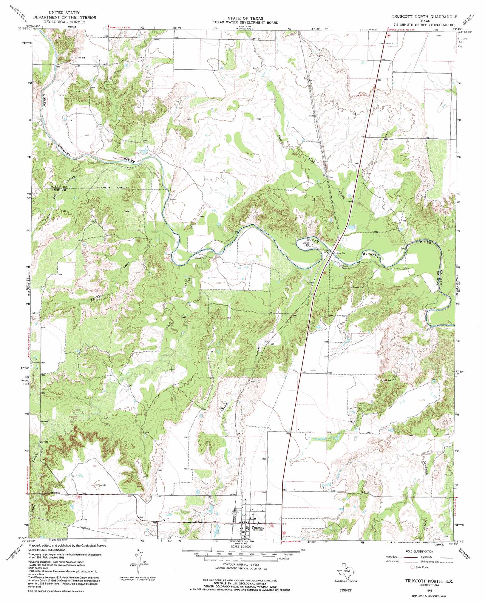
Truscott North Topo Map Texas
To zoom in, hover over the map of Truscott North
USGS Topo Quad 33099g7 - 1:24,000 scale
| Topo Map Name: | Truscott North |
| USGS Topo Quad ID: | 33099g7 |
| Print Size: | ca. 21 1/4" wide x 27" high |
| Southeast Coordinates: | 33.75° N latitude / 99.75° W longitude |
| Map Center Coordinates: | 33.8125° N latitude / 99.8125° W longitude |
| U.S. State: | TX |
| Filename: | o33099g7.jpg |
| Download Map JPG Image: | Truscott North topo map 1:24,000 scale |
| Map Type: | Topographic |
| Topo Series: | 7.5´ |
| Map Scale: | 1:24,000 |
| Source of Map Images: | United States Geological Survey (USGS) |
| Alternate Map Versions: |
Truscott North TX 1966, updated 1968 Download PDF Buy paper map Truscott North TX 1966, updated 1991 Download PDF Buy paper map Truscott North TX 2011 Download PDF Buy paper map Truscott North TX 2013 Download PDF Buy paper map Truscott North TX 2016 Download PDF Buy paper map |
1:24,000 Topo Quads surrounding Truscott North
Triangle Ranch |
Vivian |
Teacup Mountain |
Margaret |
Warrior Hollow |
Y Ranch |
Boiling Spring |
Foard City |
Crowell |
Thalia |
Lowrance Mountain |
Big Four Ranch |
Truscott North |
Halsell Ranch |
Colwell Creek |
Ox Yoke Creek |
Maverick Flat |
Truscott South |
Gilliland |
Vera |
Buzzard Peak |
Cedar Mountain |
Benjamin |
Rhineland |
Hefner |
> Back to 33099e1 at 1:100,000 scale
> Back to 33098a1 at 1:250,000 scale
> Back to U.S. Topo Maps home
Truscott North topo map: Gazetteer
Truscott North: Populated Places
Truscott elevation 465m 1525′Truscott North: Streams
Black Top Creek elevation 424m 1391′Bluff Creek elevation 419m 1374′
Buffalo Creek elevation 420m 1377′
China Creek elevation 416m 1364′
Salt Flat Creek elevation 413m 1354′
Truscott North digital topo map on disk
Buy this Truscott North topo map showing relief, roads, GPS coordinates and other geographical features, as a high-resolution digital map file on DVD: