Mound Springs Topo Map New Mexico
To zoom in, hover over the map of Mound Springs
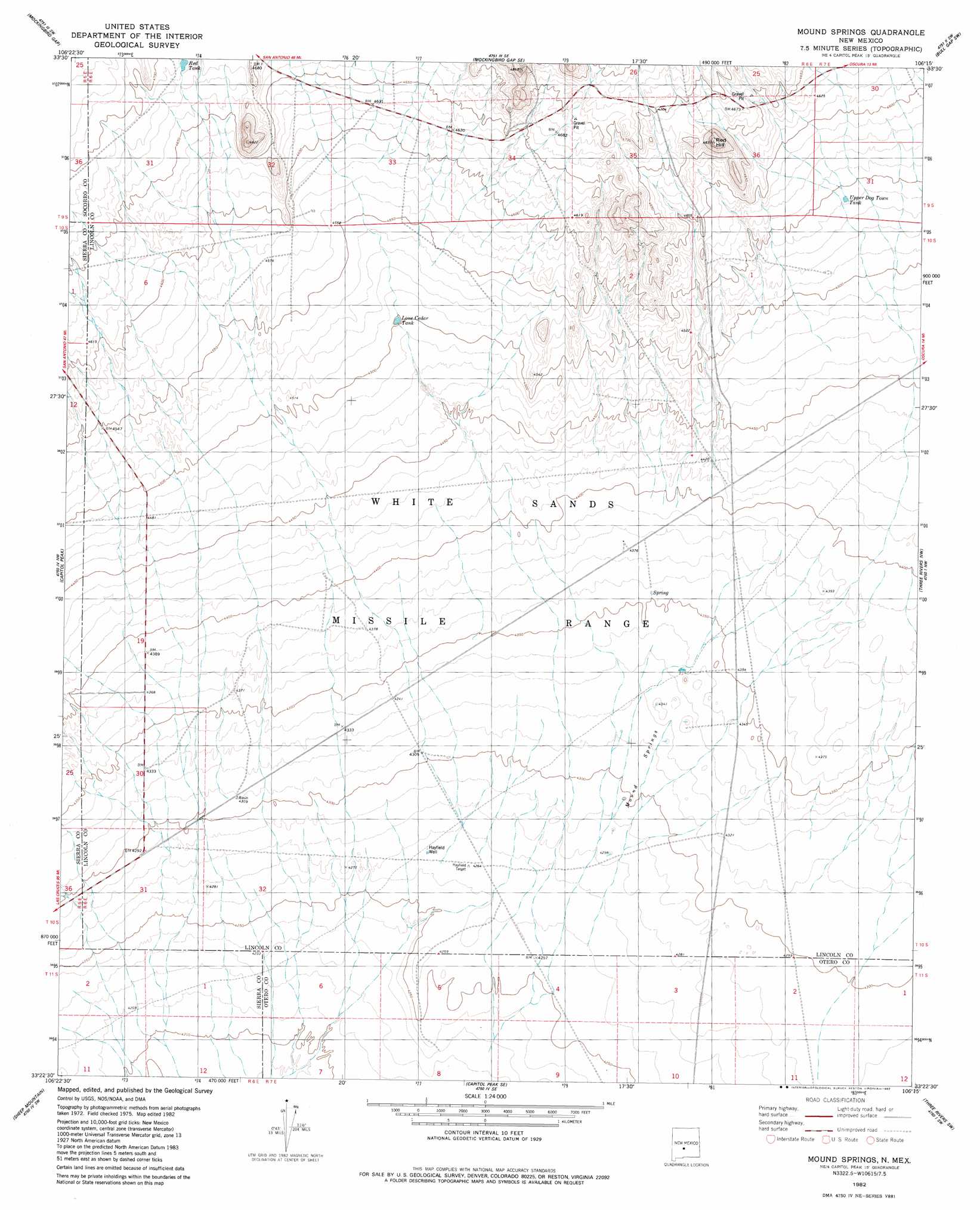
USGS Topo Quad 33106d3 - 1:24,000 scale
| Topo Map Name: | Mound Springs |
| USGS Topo Quad ID: | 33106d3 |
| Print Size: | ca. 21 1/4" wide x 27" high |
| Southeast Coordinates: | 33.375° N latitude / 106.25° W longitude |
| Map Center Coordinates: | 33.4375° N latitude / 106.3125° W longitude |
| U.S. State: | NM |
| Filename: | o33106d3.jpg |
| Download Map JPG Image: | Mound Springs topo map 1:24,000 scale |
| Map Type: | Topographic |
| Topo Series: | 7.5´ |
| Map Scale: | 1:24,000 |
| Source of Map Images: | United States Geological Survey (USGS) |
| Alternate Map Versions: |
Mound Springs NM 1982, updated 1982 Download PDF Buy paper map Mound Springs NM 2010 Download PDF Buy paper map Mound Springs NM 2013 Download PDF Buy paper map Mound Springs NM 2017 Download PDF Buy paper map |
1:24,000 Topo Quads surrounding Mound Springs
Greens Baber Well |
Trinity Site |
Oscura Peak |
Red Canyon |
Wagon Canyon |
Foster Well |
Mockingbird Gap |
Mockingbird Gap Se |
Bull Gap Sw |
Bull Gap |
Fairview Mountain |
Capitol Peak |
Mound Springs |
Three Rivers Nw |
Oscura |
Salinas Peak |
Sheep Mountain |
Capitol Peak Se |
Three Rivers Sw |
Three Rivers |
Tip Top Canyon |
Lumley Lake Nw |
Lumley Lake Ne |
Bitter Creek |
Tularosa Ne |
> Back to 33106a1 at 1:100,000 scale
> Back to 33106a1 at 1:250,000 scale
> Back to U.S. Topo Maps home
Mound Springs topo map: Gazetteer
Mound Springs: Reservoirs
Lone Cedar Tank elevation 1372m 4501′Red Tank elevation 1426m 4678′
Upper Dog Town Tank elevation 1385m 4543′
Mound Springs: Springs
Mound Springs elevation 1326m 4350′Mound Springs: Summits
Red Hill elevation 1467m 4812′Mound Springs: Wells
Hayfield Well elevation 1301m 4268′Mound Springs digital topo map on disk
Buy this Mound Springs topo map showing relief, roads, GPS coordinates and other geographical features, as a high-resolution digital map file on DVD: