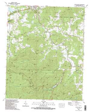
Coosa Bald Topo Map Georgia
To zoom in, hover over the map of Coosa Bald
USGS Topo Quad 34083g8 - 1:24,000 scale
| Topo Map Name: | Coosa Bald |
| USGS Topo Quad ID: | 34083g8 |
| Print Size: | ca. 21 1/4" wide x 27" high |
| Southeast Coordinates: | 34.75° N latitude / 83.875° W longitude |
| Map Center Coordinates: | 34.8125° N latitude / 83.9375° W longitude |
| U.S. State: | GA |
| Filename: | o34083g8.jpg |
| Download Map JPG Image: | Coosa Bald topo map 1:24,000 scale |
| Map Type: | Topographic |
| Topo Series: | 7.5´ |
| Map Scale: | 1:24,000 |
| Source of Map Images: | United States Geological Survey (USGS) |
| Alternate Map Versions: |
Coosa Bald GA 1935 Download PDF Buy paper map Coosa Bald GA 1938 Download PDF Buy paper map Coosa Bald GA 1938, updated 1959 Download PDF Buy paper map Coosa Bald GA 1938, updated 1963 Download PDF Buy paper map Coosa Bald GA 1965, updated 1975 Download PDF Buy paper map Coosa Bald GA 1965, updated 1975 Download PDF Buy paper map Coosa Bald GA 1988, updated 1988 Download PDF Buy paper map Coosa Bald GA 2011 Download PDF Buy paper map Coosa Bald GA 2014 Download PDF Buy paper map |
| FStopo: | US Forest Service topo Coosa Bald is available: Download FStopo PDF Download FStopo TIF |
1:24,000 Topo Quads surrounding Coosa Bald
> Back to 34083e1 at 1:100,000 scale
> Back to 34082a1 at 1:250,000 scale
> Back to U.S. Topo Maps home
Coosa Bald topo map: Gazetteer
Coosa Bald: Airports
Blairsville Airport elevation 573m 1879′Coosa Bald: Basins
Cindy Cove elevation 638m 2093′Cooks Cove elevation 618m 2027′
Owl Hollow elevation 599m 1965′
Coosa Bald: Bridges
Morgan Bridge elevation 561m 1840′Nicholson Bridge elevation 564m 1850′
Reece Bridge elevation 565m 1853′
Coosa Bald: Dams
Caldwell Lake Dam elevation 602m 1975′Lake Trahlyta Dam elevation 682m 2237′
Coosa Bald: Falls
Helton Creek Falls elevation 677m 2221′Coosa Bald: Gaps
Bridge Gap elevation 821m 2693′Bull Gap elevation 1060m 3477′
Burnett Gap elevation 859m 2818′
Calf Stomp Gap elevation 996m 3267′
Chestnut Cove Gap elevation 735m 2411′
Crawley Gap elevation 663m 2175′
Goober Gap elevation 658m 2158′
Jones Gap elevation 884m 2900′
Lark Gap elevation 820m 2690′
Locust Stake Gap elevation 780m 2559′
Owltown Gap elevation 670m 2198′
Pineflat Gap elevation 757m 2483′
Rich Gap elevation 657m 2155′
Tigue Gap elevation 956m 3136′
Whiteoak Stomp elevation 1059m 3474′
Wildcat Gap elevation 1152m 3779′
Wolfpen Gap elevation 1008m 3307′
Yellow Mountain Gap elevation 853m 2798′
Yellowhammer Gap elevation 1133m 3717′
Yellowjacket Gap elevation 1026m 3366′
Coosa Bald: Mines
Blairsville Quarry elevation 619m 2030′Coosa Bald: Populated Places
Caldwell (historical) elevation 633m 2076′Choestoe elevation 594m 1948′
Hood (historical) elevation 632m 2073′
Laura (historical) elevation 593m 1945′
Otto (historical) elevation 598m 1961′
Owltown elevation 604m 1981′
Coosa Bald: Reservoirs
Caldwell Lake elevation 602m 1975′Lake Trahlyta elevation 682m 2237′
Coosa Bald: Ridges
Allison Ridge elevation 647m 2122′Cob Ridge elevation 668m 2191′
Davis Ridge elevation 819m 2687′
Duncan Ridge elevation 1133m 3717′
Little Duncan Ridge elevation 717m 2352′
Long Ridge elevation 734m 2408′
Nelson Ridge elevation 722m 2368′
Pine Ridge elevation 676m 2217′
Rich Ridge elevation 1118m 3667′
Town Mountain elevation 681m 2234′
Coosa Bald: Streams
Akins Creek elevation 558m 1830′Allison Branch elevation 579m 1899′
Anderson Creek elevation 550m 1804′
Arkaqua Creek elevation 553m 1814′
Big Branch elevation 589m 1932′
Board Camp Creek elevation 854m 2801′
Bony Branch elevation 544m 1784′
Burnett Branch elevation 703m 2306′
Butternut Creek elevation 547m 1794′
Calf Stump Branch elevation 792m 2598′
Cooks Cove Branch elevation 577m 1893′
Coosa Creek elevation 548m 1797′
East Fork Coosa Creek elevation 571m 1873′
Fields Branch elevation 546m 1791′
Fortenberry Creek elevation 560m 1837′
Frady Branch elevation 636m 2086′
Garrett Creek elevation 806m 2644′
Gillespie Branch elevation 576m 1889′
Hatchet Creek elevation 631m 2070′
Hogpen Branch elevation 713m 2339′
Jones Branch elevation 772m 2532′
Lance Branch elevation 663m 2175′
Lawrence Branch elevation 545m 1788′
Logan Creek elevation 806m 2644′
Long Branch elevation 607m 1991′
Miller Cove Branch elevation 577m 1893′
Morgan Branch elevation 557m 1827′
Roaring Fork elevation 739m 2424′
Spiva Branch elevation 583m 1912′
Stewart Creek elevation 567m 1860′
Stink Creek elevation 576m 1889′
Tigue Branch elevation 871m 2857′
Town Creek elevation 568m 1863′
Trackrock Branch elevation 575m 1886′
West Fork Coosa Creek elevation 572m 1876′
West Fork Wolf Creek elevation 583m 1912′
Wildcat Branch elevation 624m 2047′
Wilson Branch elevation 561m 1840′
Wolf Creek elevation 565m 1853′
Coosa Bald: Summits
Ben Knob elevation 894m 2933′Big Grassy Knob elevation 1101m 3612′
Bowers Mountain elevation 924m 3031′
Buckeye Knob elevation 1138m 3733′
Chestnut Knob elevation 946m 3103′
Coosa Bald elevation 1303m 4274′
Crawley Mountain elevation 687m 2253′
Epps Mountain elevation 834m 2736′
Fisher Knob elevation 806m 2644′
Fort Mountain elevation 799m 2621′
Frady Mountain elevation 845m 2772′
Garland Knob elevation 1029m 3375′
Jacks Mountain elevation 786m 2578′
Little Bald elevation 1008m 3307′
Little Grassy Knob elevation 927m 3041′
Middle Bald elevation 1077m 3533′
Picketts Knob elevation 1041m 3415′
Rich Knob elevation 832m 2729′
Salem Top elevation 664m 2178′
Scruggs Top elevation 869m 2851′
Self Mountain elevation 722m 2368′
Sheriff Knob elevation 1034m 3392′
Wellborn Mountain elevation 721m 2365′
Wildcat Knob elevation 1197m 3927′
Wilson Mountain elevation 804m 2637′
Yellow Mountain elevation 956m 3136′
Coosa Bald: Trails
Coosa Backcountry Trail elevation 649m 2129′Coosa Bald: Valleys
Bowers Cove elevation 740m 2427′Chestnut Cove elevation 597m 1958′
Hospital Cove elevation 650m 2132′
Miller Cove elevation 584m 1916′
Nance Payne Cove elevation 651m 2135′
Nelson Cove elevation 596m 1955′
Sosebee Cove elevation 644m 2112′
Stewart Cove elevation 563m 1847′
Coosa Bald digital topo map on disk
Buy this Coosa Bald topo map showing relief, roads, GPS coordinates and other geographical features, as a high-resolution digital map file on DVD:
South Carolina, Western North Carolina & Northeastern Georgia
Buy digital topo maps: South Carolina, Western North Carolina & Northeastern Georgia


