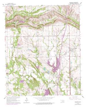
Springer Topo Map Oklahoma
To zoom in, hover over the map of Springer
USGS Topo Quad 34097c2 - 1:24,000 scale
| Topo Map Name: | Springer |
| USGS Topo Quad ID: | 34097c2 |
| Print Size: | ca. 21 1/4" wide x 27" high |
| Southeast Coordinates: | 34.25° N latitude / 97.125° W longitude |
| Map Center Coordinates: | 34.3125° N latitude / 97.1875° W longitude |
| U.S. State: | OK |
| Filename: | o34097c2.jpg |
| Download Map JPG Image: | Springer topo map 1:24,000 scale |
| Map Type: | Topographic |
| Topo Series: | 7.5´ |
| Map Scale: | 1:24,000 |
| Source of Map Images: | United States Geological Survey (USGS) |
| Alternate Map Versions: |
Springer OK 1964, updated 1965 Download PDF Buy paper map Springer OK 1964, updated 1976 Download PDF Buy paper map Springer OK 1964, updated 1978 Download PDF Buy paper map Springer OK 2010 Download PDF Buy paper map Springer OK 2012 Download PDF Buy paper map Springer OK 2016 Download PDF Buy paper map |
1:24,000 Topo Quads surrounding Springer
> Back to 34097a1 at 1:100,000 scale
> Back to 34096a1 at 1:250,000 scale
> Back to U.S. Topo Maps home
Springer topo map: Gazetteer
Springer: Dams
Caddo Creek Site 11 Dam elevation 243m 797′Caddo Creek Site 12 Dam elevation 246m 807′
Caddo Creek Site 13 Dam elevation 235m 770′
Caddo Creek Site 14 Dam elevation 240m 787′
Caddo Creek Site 17 Dam elevation 258m 846′
Caddo Creek Site 18 Dam elevation 240m 787′
Caddo Creek Site 27 Dam elevation 311m 1020′
D C Fitzgerald Dam elevation 267m 875′
Noble-Sea Cattle Company Dam elevation 226m 741′
Oknoname 01901 Dam elevation 251m 823′
Oknoname 01902 Dam elevation 247m 810′
Springer: Falls
Henry House Falls elevation 277m 908′Springer: Oilfields
Caddo Pool Oil Field elevation 234m 767′Springer: Populated Places
Glenn elevation 274m 898′Springer elevation 280m 918′
Springer: Reservoirs
Ardmore Club Lake elevation 245m 803′Caddo Creek Site 11 Reservoir elevation 243m 797′
Caddo Creek Site 12 Reservoir elevation 246m 807′
Caddo Creek Site 13 Reservoir elevation 235m 770′
Caddo Creek Site 14 Reservoir elevation 240m 787′
Caddo Creek Site 17 Reservoir elevation 258m 846′
Caddo Creek Site 18 Reservoir elevation 240m 787′
Caddo Creek Site 27 Reservoir elevation 311m 1020′
Fitzgerald Reservoir elevation 267m 875′
Noble-Sea Cattle Company Reservoir elevation 226m 741′
Oknoname 01901 Reservoir elevation 251m 823′
Oknoname 01902 Reservoir elevation 247m 810′
Springer: Streams
Buzzard Creek elevation 221m 725′Grindstone Creek elevation 231m 757′
Henry House Creek elevation 236m 774′
Philips Creek elevation 232m 761′
Rock Creek elevation 227m 744′
Salt Branch elevation 239m 784′
Sullivan Creek elevation 234m 767′
Springer digital topo map on disk
Buy this Springer topo map showing relief, roads, GPS coordinates and other geographical features, as a high-resolution digital map file on DVD:


