Ardmore East Topo Map Oklahoma
To zoom in, hover over the map of Ardmore East
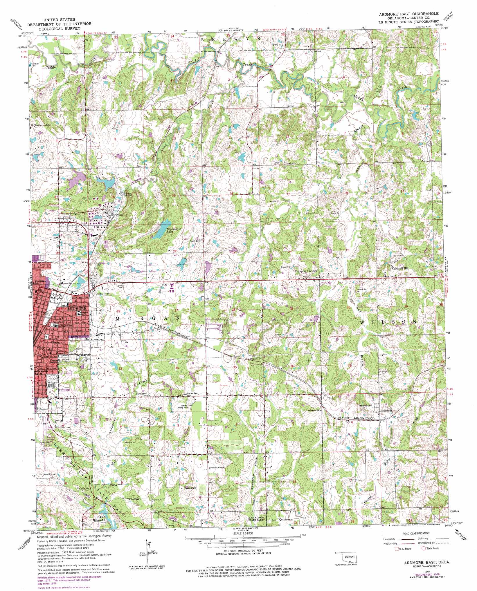
USGS Topo Quad 34097b1 - 1:24,000 scale
| Topo Map Name: | Ardmore East |
| USGS Topo Quad ID: | 34097b1 |
| Print Size: | ca. 21 1/4" wide x 27" high |
| Southeast Coordinates: | 34.125° N latitude / 97° W longitude |
| Map Center Coordinates: | 34.1875° N latitude / 97.0625° W longitude |
| U.S. State: | OK |
| Filename: | o34097b1.jpg |
| Download Map JPG Image: | Ardmore East topo map 1:24,000 scale |
| Map Type: | Topographic |
| Topo Series: | 7.5´ |
| Map Scale: | 1:24,000 |
| Source of Map Images: | United States Geological Survey (USGS) |
| Alternate Map Versions: |
Ardmore East OK 1964, updated 1965 Download PDF Buy paper map Ardmore East OK 1964, updated 1977 Download PDF Buy paper map Ardmore East OK 1964, updated 1978 Download PDF Buy paper map Ardmore East OK 2009 Download PDF Buy paper map Ardmore East OK 2013 Download PDF Buy paper map Ardmore East OK 2016 Download PDF Buy paper map |
1:24,000 Topo Quads surrounding Ardmore East
Fox Ne |
Turner Falls |
Dougherty |
Sulphur South |
Mill Creek |
Milo |
Springer |
Gene Autry |
Nebo |
Troy |
Lone Grove |
Ardmore West |
Ardmore East |
Mannsville |
Ravia |
Healdton Se |
Overbrook |
Lake Murray |
Mcmillan |
Madill |
Burneyville |
Marietta West |
Marietta East |
Lebanon |
Shay |
> Back to 34097a1 at 1:100,000 scale
> Back to 34096a1 at 1:250,000 scale
> Back to U.S. Topo Maps home
Ardmore East topo map: Gazetteer
Ardmore East: Airports
Ardmore Downtown Executive Airport elevation 246m 807′Roberts Airport elevation 268m 879′
Ardmore East: Dams
Carter 1 Dam elevation 247m 810′Chickasaw Lake Dam elevation 248m 813′
Mckown Lake Dam elevation 240m 787′
Moore Pond Dam elevation 249m 816′
Ardmore East: Parks
Fraley Park elevation 267m 875′Whittington Park elevation 263m 862′
Ardmore East: Populated Places
Caldwell Hill elevation 251m 823′Dripping Springs elevation 250m 820′
Provence elevation 270m 885′
Ardmore East: Reservoirs
Carter 1 Reservoir elevation 247m 810′Chickasaw Lake elevation 248m 813′
Mckown Lake elevation 240m 787′
Moore Pond elevation 249m 816′
Ardmore East: Streams
Deadman Branch elevation 215m 705′Sand Branch elevation 205m 672′
Sand Creek elevation 210m 688′
West Anadarche Creek elevation 228m 748′
Ardmore East digital topo map on disk
Buy this Ardmore East topo map showing relief, roads, GPS coordinates and other geographical features, as a high-resolution digital map file on DVD: