Engelhard West Topo Map North Carolina
To zoom in, hover over the map of Engelhard West
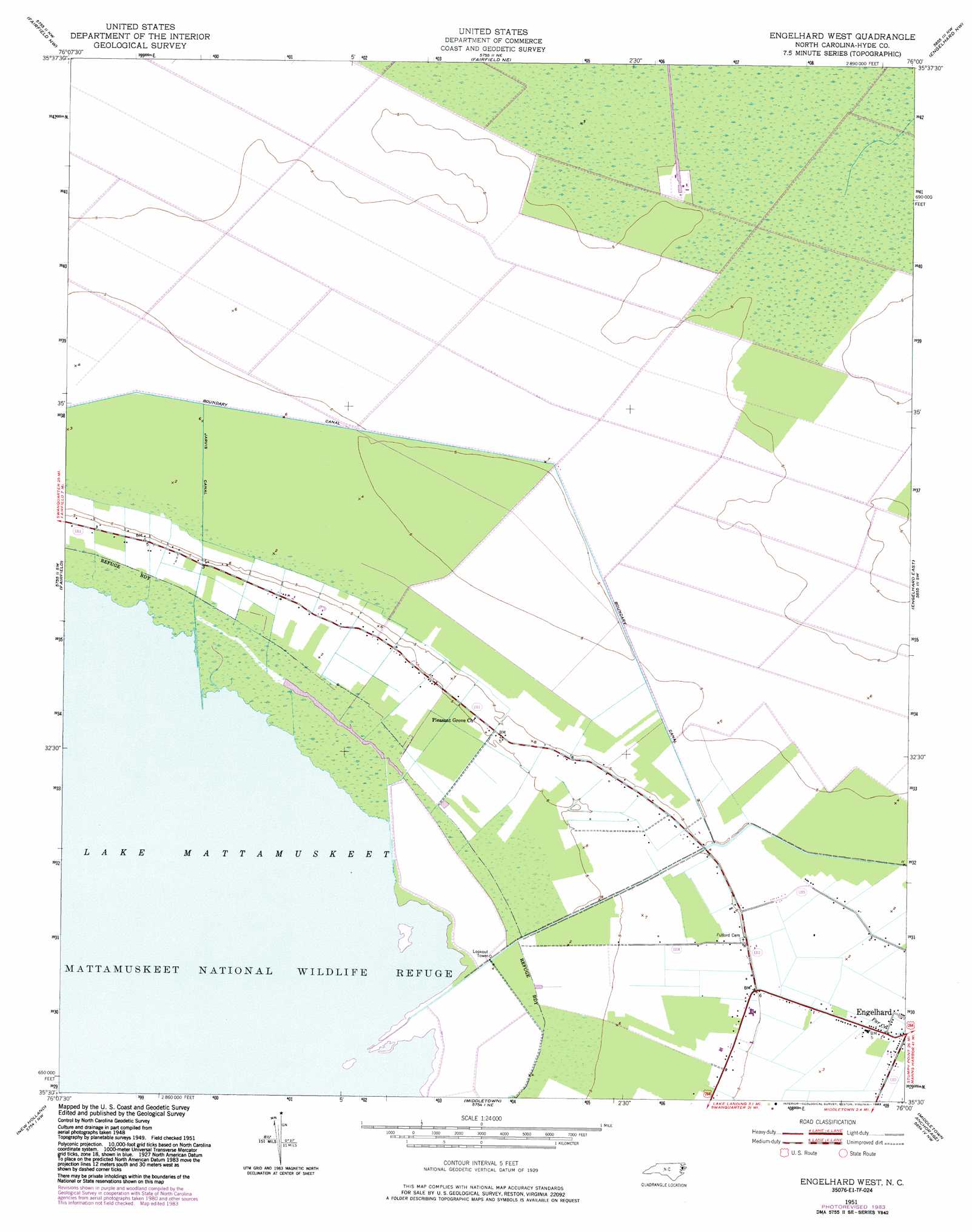
USGS Topo Quad 35076e1 - 1:24,000 scale
| Topo Map Name: | Engelhard West |
| USGS Topo Quad ID: | 35076e1 |
| Print Size: | ca. 21 1/4" wide x 27" high |
| Southeast Coordinates: | 35.5° N latitude / 76° W longitude |
| Map Center Coordinates: | 35.5625° N latitude / 76.0625° W longitude |
| U.S. State: | NC |
| Filename: | o35076e1.jpg |
| Download Map JPG Image: | Engelhard West topo map 1:24,000 scale |
| Map Type: | Topographic |
| Topo Series: | 7.5´ |
| Map Scale: | 1:24,000 |
| Source of Map Images: | United States Geological Survey (USGS) |
| Alternate Map Versions: |
Engelhard West NC 1951, updated 1953 Download PDF Buy paper map Engelhard West NC 1951, updated 1973 Download PDF Buy paper map Engelhard West NC 1951, updated 1977 Download PDF Buy paper map Engelhard West NC 1951, updated 1983 Download PDF Buy paper map Engelhard West NC 2000, updated 2002 Download PDF Buy paper map Engelhard West NC 2010 Download PDF Buy paper map Engelhard West NC 2013 Download PDF Buy paper map Engelhard West NC 2016 Download PDF Buy paper map |
1:24,000 Topo Quads surrounding Engelhard West
Creswell Se |
Scotia |
Frying Pan |
Buffalo City |
East Lake Se |
New Lake |
Fairfield Nw |
Fairfield Ne |
Engelhard Nw |
Engelhard Ne |
New Lake Se |
Fairfield |
Engelhard West |
Engelhard East |
Long Shoal Point |
Swanquarter |
New Holland |
Middletown Anchorage |
||
Great Island |
Bluff Point |
Middletown |
> Back to 35076e1 at 1:100,000 scale
> Back to 35076a1 at 1:250,000 scale
> Back to U.S. Topo Maps home
Engelhard West digital topo map on disk
Buy this Engelhard West topo map showing relief, roads, GPS coordinates and other geographical features, as a high-resolution digital map file on DVD:
Atlantic Coast (NY, NJ, PA, DE, MD, VA, NC)
Buy digital topo maps: Atlantic Coast (NY, NJ, PA, DE, MD, VA, NC)
 map DVD")