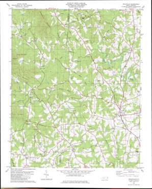
Polkville Topo Map North Carolina
To zoom in, hover over the map of Polkville
USGS Topo Quad 35081d6 - 1:24,000 scale
| Topo Map Name: | Polkville |
| USGS Topo Quad ID: | 35081d6 |
| Print Size: | ca. 21 1/4" wide x 27" high |
| Southeast Coordinates: | 35.375° N latitude / 81.625° W longitude |
| Map Center Coordinates: | 35.4375° N latitude / 81.6875° W longitude |
| U.S. State: | NC |
| Filename: | o35081d6.jpg |
| Download Map JPG Image: | Polkville topo map 1:24,000 scale |
| Map Type: | Topographic |
| Topo Series: | 7.5´ |
| Map Scale: | 1:24,000 |
| Source of Map Images: | United States Geological Survey (USGS) |
| Alternate Map Versions: |
Polkville NC 1982, updated 1983 Download PDF Buy paper map Polkville NC 2002, updated 2003 Download PDF Buy paper map Polkville NC 2010 Download PDF Buy paper map Polkville NC 2013 Download PDF Buy paper map Polkville NC 2016 Download PDF Buy paper map |
1:24,000 Topo Quads surrounding Polkville
> Back to 35081a1 at 1:100,000 scale
> Back to 35080a1 at 1:250,000 scale
> Back to U.S. Topo Maps home
Polkville topo map: Gazetteer
Polkville: Airports
Cleveland Airport elevation 309m 1013′Polkville: Populated Places
Cleveland Mills (historical) elevation 280m 918′Delight elevation 313m 1026′
Duncans Creek elevation 337m 1105′
Five Points elevation 316m 1036′
Hollis elevation 364m 1194′
Hopewell elevation 318m 1043′
New House elevation 328m 1076′
Polkville elevation 327m 1072′
Polkville: Streams
Big Branch elevation 259m 849′Big Springs Branch elevation 286m 938′
Cub Creek elevation 277m 908′
Dark Hollow Branch elevation 269m 882′
Duncans Creek elevation 265m 869′
East Fork Brushy Creek elevation 264m 866′
Flag Branch elevation 256m 839′
Green Branch elevation 344m 1128′
Hinton Creek elevation 257m 843′
Isham Fork elevation 295m 967′
Long Branch elevation 273m 895′
Mountain Creek elevation 283m 928′
No Business Creek elevation 272m 892′
Parker Branch elevation 277m 908′
Taylor Branch elevation 338m 1108′
Thompson Branch elevation 277m 908′
Wards Creek elevation 268m 879′
West Fork Brushy Creek elevation 261m 856′
Polkville: Summits
Jack Moore Mountain elevation 407m 1335′Lisenberry Mountain elevation 484m 1587′
Piney Mountain elevation 345m 1131′
Tom Price Mountain elevation 475m 1558′
Polkville digital topo map on disk
Buy this Polkville topo map showing relief, roads, GPS coordinates and other geographical features, as a high-resolution digital map file on DVD:
South Carolina, Western North Carolina & Northeastern Georgia
Buy digital topo maps: South Carolina, Western North Carolina & Northeastern Georgia


