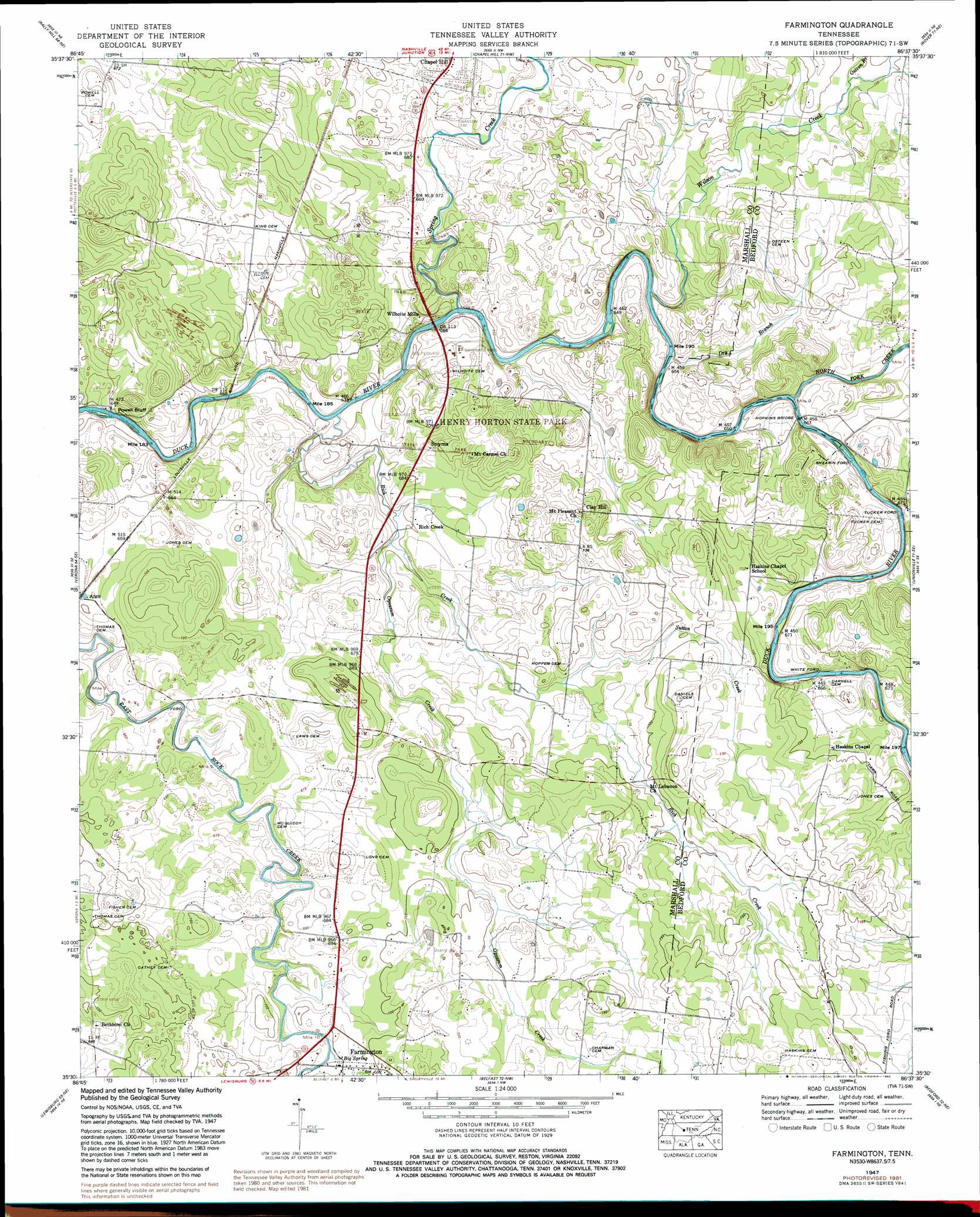
Farmington Topo Map Tennessee
To zoom in, hover over the map of Farmington
USGS Topo Quad 35086e6 - 1:24,000 scale
| Topo Map Name: | Farmington |
| USGS Topo Quad ID: | 35086e6 |
| Print Size: | ca. 21 1/4" wide x 27" high |
| Southeast Coordinates: | 35.5° N latitude / 86.625° W longitude |
| Map Center Coordinates: | 35.5625° N latitude / 86.6875° W longitude |
| U.S. State: | TN |
| Filename: | o35086e6.jpg |
| Download Map JPG Image: | Farmington topo map 1:24,000 scale |
| Map Type: | Topographic |
| Topo Series: | 7.5´ |
| Map Scale: | 1:24,000 |
| Source of Map Images: | United States Geological Survey (USGS) |
| Alternate Map Versions: |
Farmington TN 1936 Download PDF Buy paper map Farmington TN 1947, updated 1948 Download PDF Buy paper map Farmington TN 1947, updated 1965 Download PDF Buy paper map Farmington TN 1947, updated 1968 Download PDF Buy paper map Farmington TN 1947, updated 1982 Download PDF Buy paper map Farmington TN 2010 Download PDF Buy paper map Farmington TN 2013 Download PDF Buy paper map Farmington TN 2016 Download PDF Buy paper map |
1:24,000 Topo Quads surrounding Farmington
Spring Hill |
Bethesda |
College Grove |
Rockvale |
Murfreesboro |
Carters Creek |
Rally Hill |
Chapel Hill |
Rover |
Fosterville |
Glendale |
Verona |
Farmington |
Unionville |
Deason |
Campbells Station |
Lewisburg |
Belfast |
Bedford |
Shelbyville |
Brick Church |
Cornersville |
Petersburg |
Belleville |
Lynchburg West |
> Back to 35086e1 at 1:100,000 scale
> Back to 35086a1 at 1:250,000 scale
> Back to U.S. Topo Maps home
Farmington topo map: Gazetteer
Farmington: Bridges
Hopkins Bridge elevation 192m 629′Morris Bridge (historical) elevation 192m 629′
Farmington: Cliffs
Powell Bluff elevation 187m 613′Farmington: Crossings
Shearin Ford elevation 193m 633′Tucker Ford elevation 194m 636′
White Ford elevation 194m 636′
Farmington: Parks
Henry Horton State Park elevation 202m 662′Farmington: Populated Places
Clay Hill elevation 225m 738′Farmington elevation 210m 688′
Laws Hill elevation 221m 725′
Rich Creek elevation 199m 652′
Smyrna elevation 207m 679′
Wilhoite Mills elevation 201m 659′
Farmington: Springs
Big Spring elevation 209m 685′Farmington: Streams
Dry Branch elevation 194m 636′North Fork Creek elevation 192m 629′
Opossum Creek elevation 196m 643′
Osteen Branch elevation 211m 692′
Rich Creek elevation 192m 629′
Spring Creek elevation 194m 636′
Sutton Creek elevation 206m 675′
Wilson Creek elevation 193m 633′
Farmington digital topo map on disk
Buy this Farmington topo map showing relief, roads, GPS coordinates and other geographical features, as a high-resolution digital map file on DVD: