Keota Topo Map Oklahoma
To zoom in, hover over the map of Keota
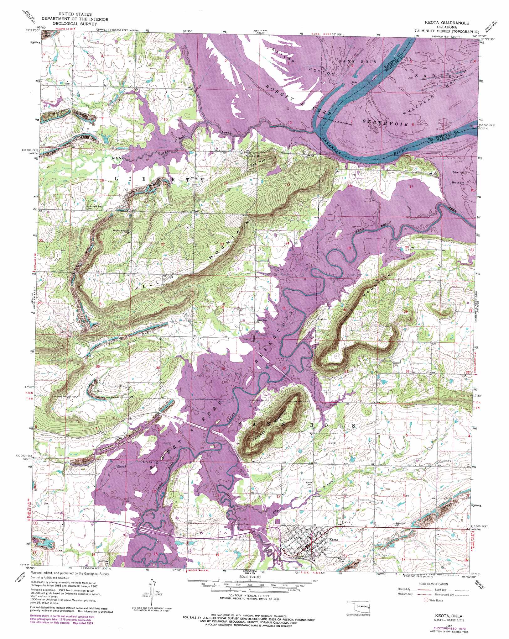
USGS Topo Quad 35094c8 - 1:24,000 scale
| Topo Map Name: | Keota |
| USGS Topo Quad ID: | 35094c8 |
| Print Size: | ca. 21 1/4" wide x 27" high |
| Southeast Coordinates: | 35.25° N latitude / 94.875° W longitude |
| Map Center Coordinates: | 35.3125° N latitude / 94.9375° W longitude |
| U.S. State: | OK |
| Filename: | o35094c8.jpg |
| Download Map JPG Image: | Keota topo map 1:24,000 scale |
| Map Type: | Topographic |
| Topo Series: | 7.5´ |
| Map Scale: | 1:24,000 |
| Source of Map Images: | United States Geological Survey (USGS) |
| Alternate Map Versions: |
Keota OK 1967, updated 1968 Download PDF Buy paper map Keota OK 1967, updated 1979 Download PDF Buy paper map Keota OK 2010 Download PDF Buy paper map Keota OK 2012 Download PDF Buy paper map Keota OK 2016 Download PDF Buy paper map |
1:24,000 Topo Quads surrounding Keota
Webbers Falls |
Gore |
Blackgum |
Marble City |
Brushy |
Holt Mountain |
Stigler Ne |
Vian |
Sallisaw |
Gans |
Stigler West |
Stigler East |
Keota |
Robert S Kerr Dam |
Muldrow Sw |
Sans Bois |
Lafayette |
Mccurtain |
Bokoshe |
Panama |
Kinta |
Lequire |
Mccurtain Sw |
Potato Peaks |
Poteau West |
> Back to 35094a1 at 1:100,000 scale
> Back to 35094a1 at 1:250,000 scale
> Back to U.S. Topo Maps home
Keota topo map: Gazetteer
Keota: Bends
Mulehead Bottom elevation 140m 459′Keota: Dams
Oknoname 361002 Dam elevation 153m 501′Keota: Populated Places
Keota elevation 153m 501′Red Hill elevation 158m 518′
Keota: Reservoirs
Oknoname 061002 Reservoir elevation 153m 501′Keota: Streams
Elm Branch elevation 140m 459′Little Sans Bois Creek elevation 140m 459′
Otter Creek elevation 140m 459′
Shoat Creek elevation 140m 459′
Keota: Summits
Bellow Mountain elevation 261m 856′Foliart Mountain elevation 254m 833′
Hancock Mountain elevation 263m 862′
Red Hill elevation 208m 682′
Keota digital topo map on disk
Buy this Keota topo map showing relief, roads, GPS coordinates and other geographical features, as a high-resolution digital map file on DVD: