Sans Bois Topo Map Oklahoma
To zoom in, hover over the map of Sans Bois
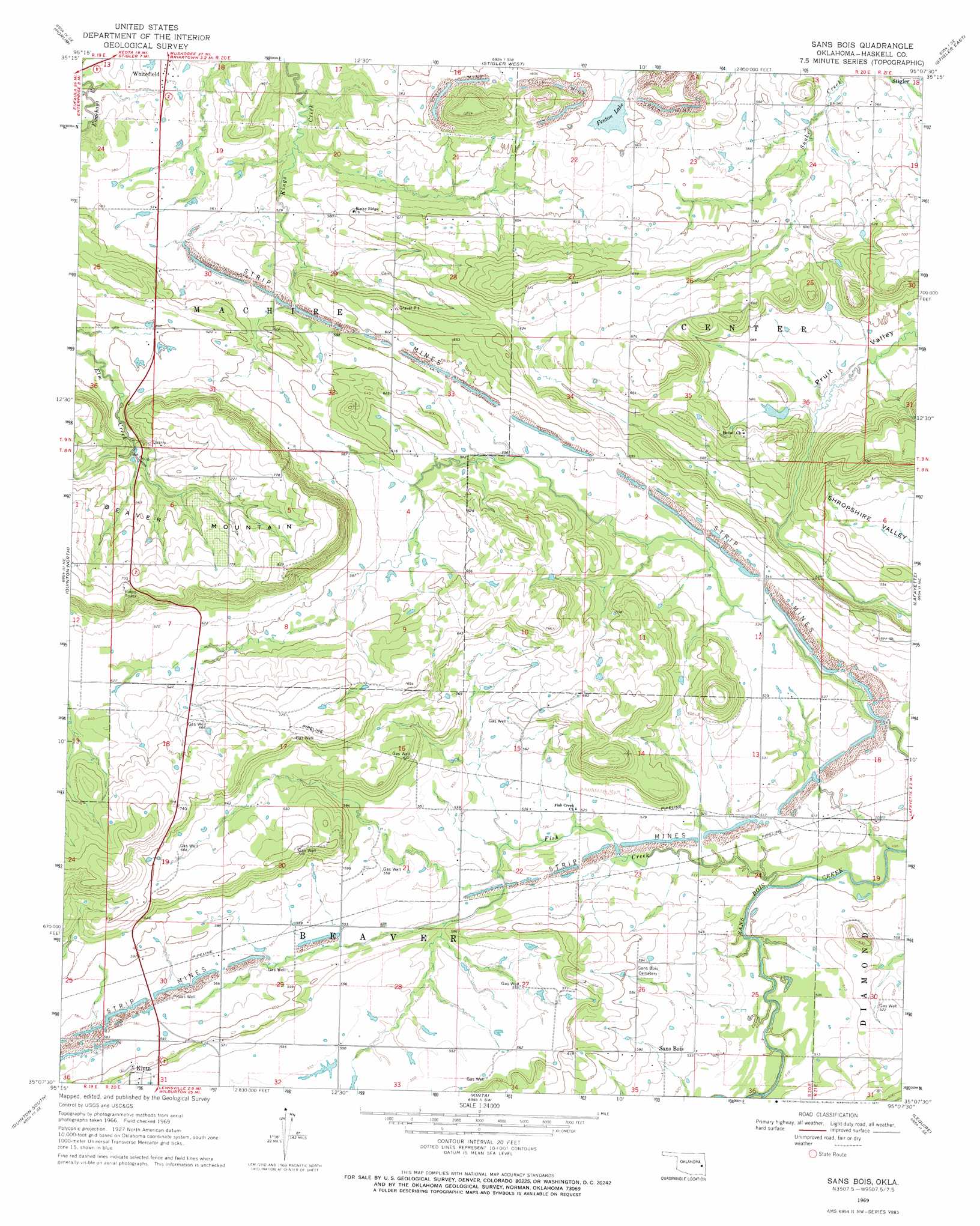
USGS Topo Quad 35095b2 - 1:24,000 scale
| Topo Map Name: | Sans Bois |
| USGS Topo Quad ID: | 35095b2 |
| Print Size: | ca. 21 1/4" wide x 27" high |
| Southeast Coordinates: | 35.125° N latitude / 95.125° W longitude |
| Map Center Coordinates: | 35.1875° N latitude / 95.1875° W longitude |
| U.S. State: | OK |
| Filename: | o35095b2.jpg |
| Download Map JPG Image: | Sans Bois topo map 1:24,000 scale |
| Map Type: | Topographic |
| Topo Series: | 7.5´ |
| Map Scale: | 1:24,000 |
| Source of Map Images: | United States Geological Survey (USGS) |
| Alternate Map Versions: |
Sans Bois OK 1969, updated 1971 Download PDF Buy paper map Sans Bois OK 2010 Download PDF Buy paper map Sans Bois OK 2012 Download PDF Buy paper map Sans Bois OK 2016 Download PDF Buy paper map |
1:24,000 Topo Quads surrounding Sans Bois
Warner Nw |
Warner |
Holt Mountain |
Stigler Ne |
Vian |
Texanna |
Porum |
Stigler West |
Stigler East |
Keota |
Enterprise |
Quinton North |
Sans Bois |
Lafayette |
Mccurtain |
Featherston |
Quinton South |
Kinta |
Lequire |
Mccurtain Sw |
Gowen |
Wilburton |
Panola |
Red Oak |
Leflore |
> Back to 35095a1 at 1:100,000 scale
> Back to 35094a1 at 1:250,000 scale
> Back to U.S. Topo Maps home
Sans Bois topo map: Gazetteer
Sans Bois: Dams
Fenton Lake Dam elevation 176m 577′Sans Bois: Populated Places
Sans Bois elevation 162m 531′Sans Bois: Reservoirs
Fenton Lake elevation 178m 583′Sans Bois: Streams
Fish Creek elevation 153m 501′Sans Bois: Valleys
Pruit Valley elevation 168m 551′Sans Bois digital topo map on disk
Buy this Sans Bois topo map showing relief, roads, GPS coordinates and other geographical features, as a high-resolution digital map file on DVD: