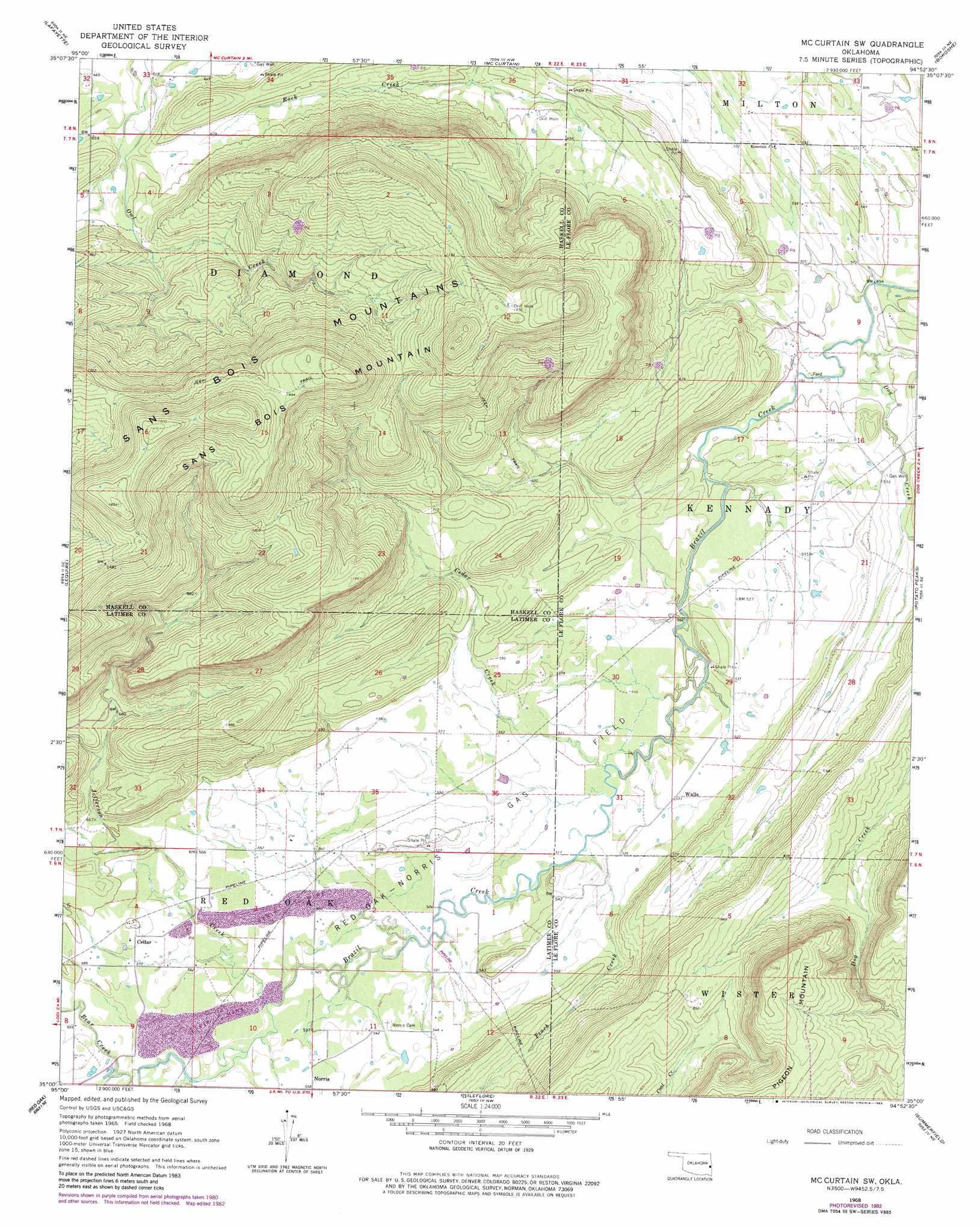
Mccurtain Sw Topo Map Oklahoma
To zoom in, hover over the map of Mccurtain Sw
USGS Topo Quad 35094a8 - 1:24,000 scale
| Topo Map Name: | Mccurtain Sw |
| USGS Topo Quad ID: | 35094a8 |
| Print Size: | ca. 21 1/4" wide x 27" high |
| Southeast Coordinates: | 35° N latitude / 94.875° W longitude |
| Map Center Coordinates: | 35.0625° N latitude / 94.9375° W longitude |
| U.S. State: | OK |
| Filename: | o35094a8.jpg |
| Download Map JPG Image: | Mccurtain Sw topo map 1:24,000 scale |
| Map Type: | Topographic |
| Topo Series: | 7.5´ |
| Map Scale: | 1:24,000 |
| Source of Map Images: | United States Geological Survey (USGS) |
| Alternate Map Versions: |
Mc Curtain SW OK 1968, updated 1969 Download PDF Buy paper map Mc Curtain SW OK 1968, updated 1983 Download PDF Buy paper map McCurtain SW OK 2010 Download PDF Buy paper map McCurtain SW OK 2012 Download PDF Buy paper map McCurtain SW OK 2016 Download PDF Buy paper map |
1:24,000 Topo Quads surrounding Mccurtain Sw
Stigler West |
Stigler East |
Keota |
Robert S Kerr Dam |
Muldrow Sw |
Sans Bois |
Lafayette |
Mccurtain |
Bokoshe |
Panama |
Kinta |
Lequire |
Mccurtain Sw |
Potato Peaks |
Poteau West |
Panola |
Red Oak |
Leflore |
Summerfield |
Wister |
Baker Mountain |
Talihina |
Blackjack Ridge |
Leflore Se |
Hodgens |
> Back to 35094a1 at 1:100,000 scale
> Back to 35094a1 at 1:250,000 scale
> Back to U.S. Topo Maps home
Mccurtain Sw topo map: Gazetteer
Mccurtain Sw: Oilfields
Red Oak-Norris Gas Field elevation 162m 531′Mccurtain Sw: Populated Places
Cedar elevation 180m 590′Walls elevation 162m 531′
Mccurtain Sw: Streams
Bear Creek elevation 165m 541′Dog Creek elevation 146m 479′
Jefferson Creek elevation 161m 528′
Peach Creek elevation 158m 518′
Mccurtain Sw: Summits
Pigeon Mountain elevation 388m 1272′Sans Bois Mountain elevation 513m 1683′
Mccurtain Sw digital topo map on disk
Buy this Mccurtain Sw topo map showing relief, roads, GPS coordinates and other geographical features, as a high-resolution digital map file on DVD: