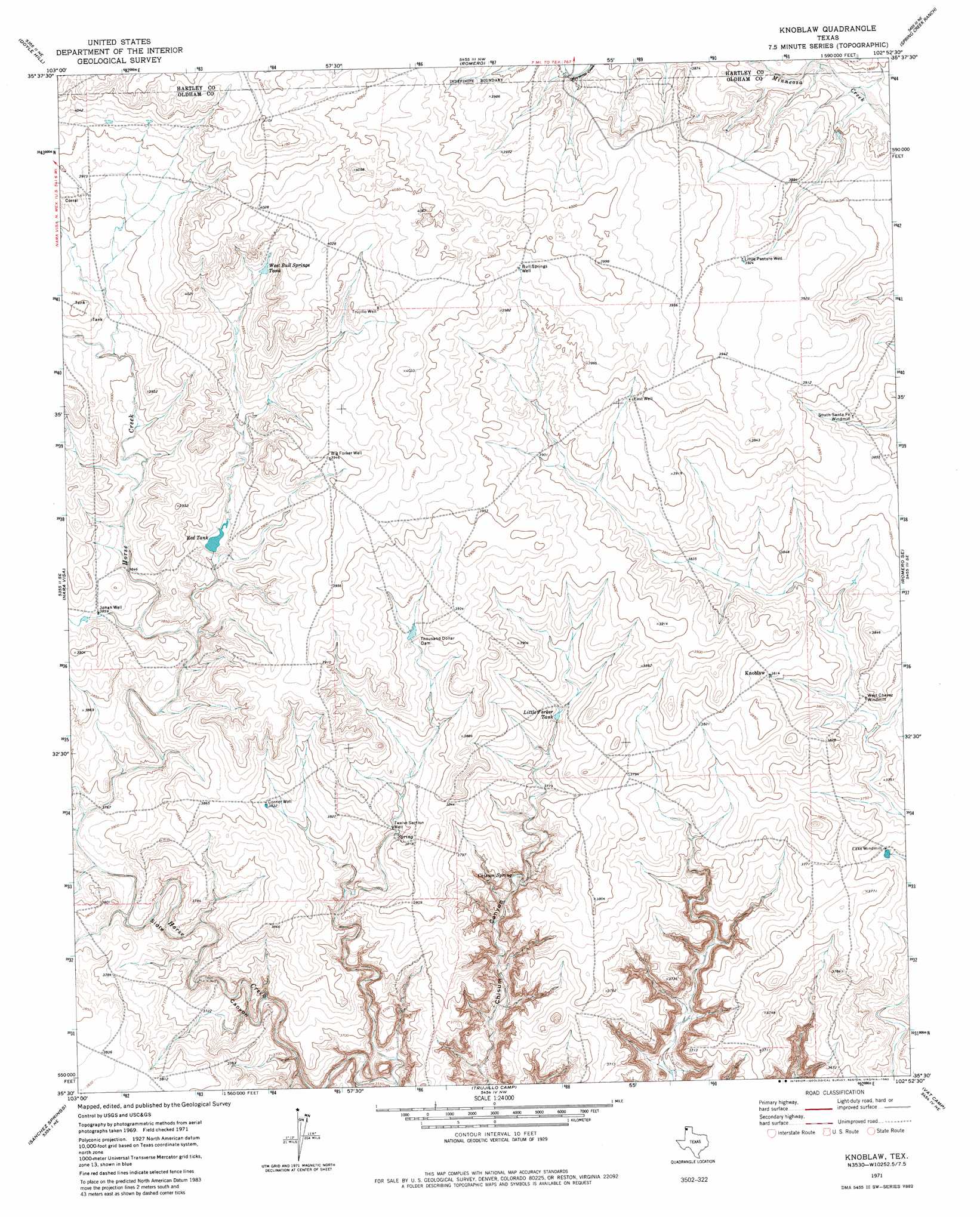
Knoblaw Topo Map Texas
To zoom in, hover over the map of Knoblaw
USGS Topo Quad 35102e8 - 1:24,000 scale
| Topo Map Name: | Knoblaw |
| USGS Topo Quad ID: | 35102e8 |
| Print Size: | ca. 21 1/4" wide x 27" high |
| Southeast Coordinates: | 35.5° N latitude / 102.875° W longitude |
| Map Center Coordinates: | 35.5625° N latitude / 102.9375° W longitude |
| U.S. State: | TX |
| Filename: | o35102e8.jpg |
| Download Map JPG Image: | Knoblaw topo map 1:24,000 scale |
| Map Type: | Topographic |
| Topo Series: | 7.5´ |
| Map Scale: | 1:24,000 |
| Source of Map Images: | United States Geological Survey (USGS) |
| Alternate Map Versions: |
Knoblaw TX 1971, updated 1973 Download PDF Buy paper map Knoblaw TX 1971, updated 1982 Download PDF Buy paper map Knoblaw TX 2010 Download PDF Buy paper map Knoblaw TX 2012 Download PDF Buy paper map Knoblaw TX 2016 Download PDF Buy paper map |
1:24,000 Topo Quads surrounding Knoblaw
Centerville Corner |
Amistad Se |
Whiteaker Ranch |
Middle Water |
King Sw |
Kerlin Hill |
Doyle Hill |
Romero |
Spring Creek Ranch |
Pedarosa Camp |
Obar |
Nara Visa |
Knoblaw |
Romero Se |
Humdinger Spring |
Cammak Camp |
Sanchez Springs |
Trujillo Camp |
Vat Camp |
Big George Tank |
Blue Hole |
Martin Draw |
Signal Spring |
Signal Spring Se |
Adrian |
> Back to 35102e1 at 1:100,000 scale
> Back to 35102a1 at 1:250,000 scale
> Back to U.S. Topo Maps home
Knoblaw topo map: Gazetteer
Knoblaw: Dams
Thousand Dollar Dam elevation 1184m 3884′Knoblaw: Lakes
Lake Windmill elevation 1138m 3733′Knoblaw: Populated Places
Knoblaw elevation 1163m 3815′Knoblaw: Reservoirs
Little Forker Tank elevation 1164m 3818′Red Tank elevation 1179m 3868′
West Bull Spring Tank elevation 1211m 3973′
Knoblaw: Springs
Chisum Spring elevation 1123m 3684′Knoblaw: Valleys
Sidle Canyon elevation 1080m 3543′Sidle Canyon elevation 1080m 3543′
Knoblaw: Wells
Big Forker Well elevation 1204m 3950′Bull Springs Well elevation 1214m 3982′
Corner Well elevation 1170m 3838′
East Well elevation 1198m 3930′
Jonah Well elevation 1177m 3861′
Little Pasture Well elevation 1197m 3927′
Trujillo Well elevation 1218m 3996′
Twelve Section Well elevation 1157m 3795′
Knoblaw digital topo map on disk
Buy this Knoblaw topo map showing relief, roads, GPS coordinates and other geographical features, as a high-resolution digital map file on DVD: