Signal Spring Topo Map Texas
To zoom in, hover over the map of Signal Spring
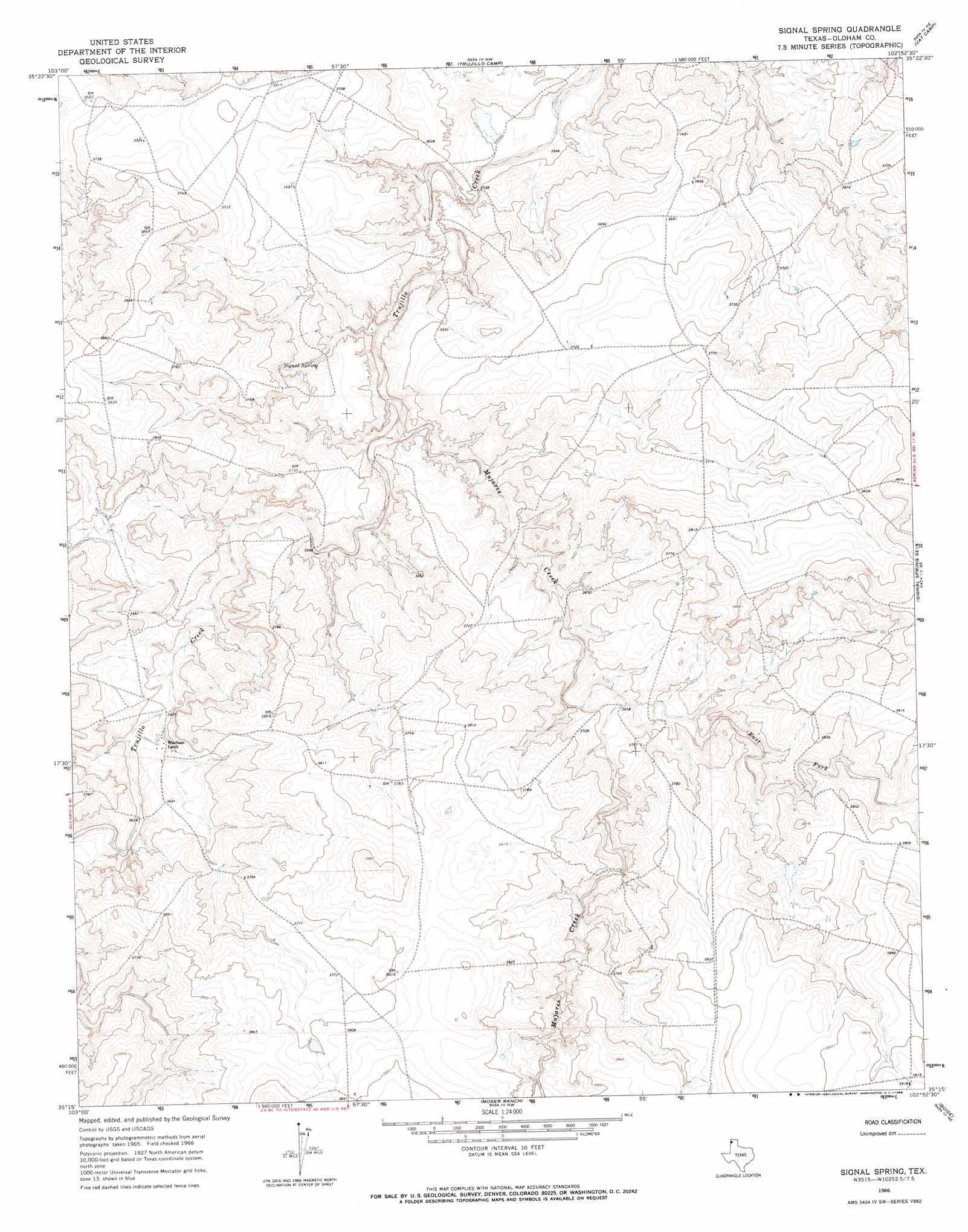
USGS Topo Quad 35102c8 - 1:24,000 scale
| Topo Map Name: | Signal Spring |
| USGS Topo Quad ID: | 35102c8 |
| Print Size: | ca. 21 1/4" wide x 27" high |
| Southeast Coordinates: | 35.25° N latitude / 102.875° W longitude |
| Map Center Coordinates: | 35.3125° N latitude / 102.9375° W longitude |
| U.S. State: | TX |
| Filename: | o35102c8.jpg |
| Download Map JPG Image: | Signal Spring topo map 1:24,000 scale |
| Map Type: | Topographic |
| Topo Series: | 7.5´ |
| Map Scale: | 1:24,000 |
| Source of Map Images: | United States Geological Survey (USGS) |
| Alternate Map Versions: |
Signal Spring TX 1966, updated 1968 Download PDF Buy paper map Signal Spring TX 2010 Download PDF Buy paper map Signal Spring TX 2012 Download PDF Buy paper map Signal Spring TX 2016 Download PDF Buy paper map |
1:24,000 Topo Quads surrounding Signal Spring
Obar |
Nara Visa |
Knoblaw |
Romero Se |
Humdinger Spring |
Cammak Camp |
Sanchez Springs |
Trujillo Camp |
Vat Camp |
Big George Tank |
Blue Hole |
Martin Draw |
Signal Spring |
Signal Spring Se |
Adrian |
Bard |
Glenrio |
Moser Ranch |
Boise |
Simms Nw |
Riley Camp |
Rock Camp |
Sand Point |
Norton Lake |
Simms |
> Back to 35102a1 at 1:100,000 scale
> Back to 35102a1 at 1:250,000 scale
> Back to U.S. Topo Maps home
Signal Spring topo map: Gazetteer
Signal Spring: Springs
Signal Spring elevation 1127m 3697′Signal Spring: Streams
East Fork Mujares Creek elevation 1116m 3661′Mujares Creek elevation 1092m 3582′
Signal Spring digital topo map on disk
Buy this Signal Spring topo map showing relief, roads, GPS coordinates and other geographical features, as a high-resolution digital map file on DVD: