Tucumcari Se Topo Map New Mexico
To zoom in, hover over the map of Tucumcari Se
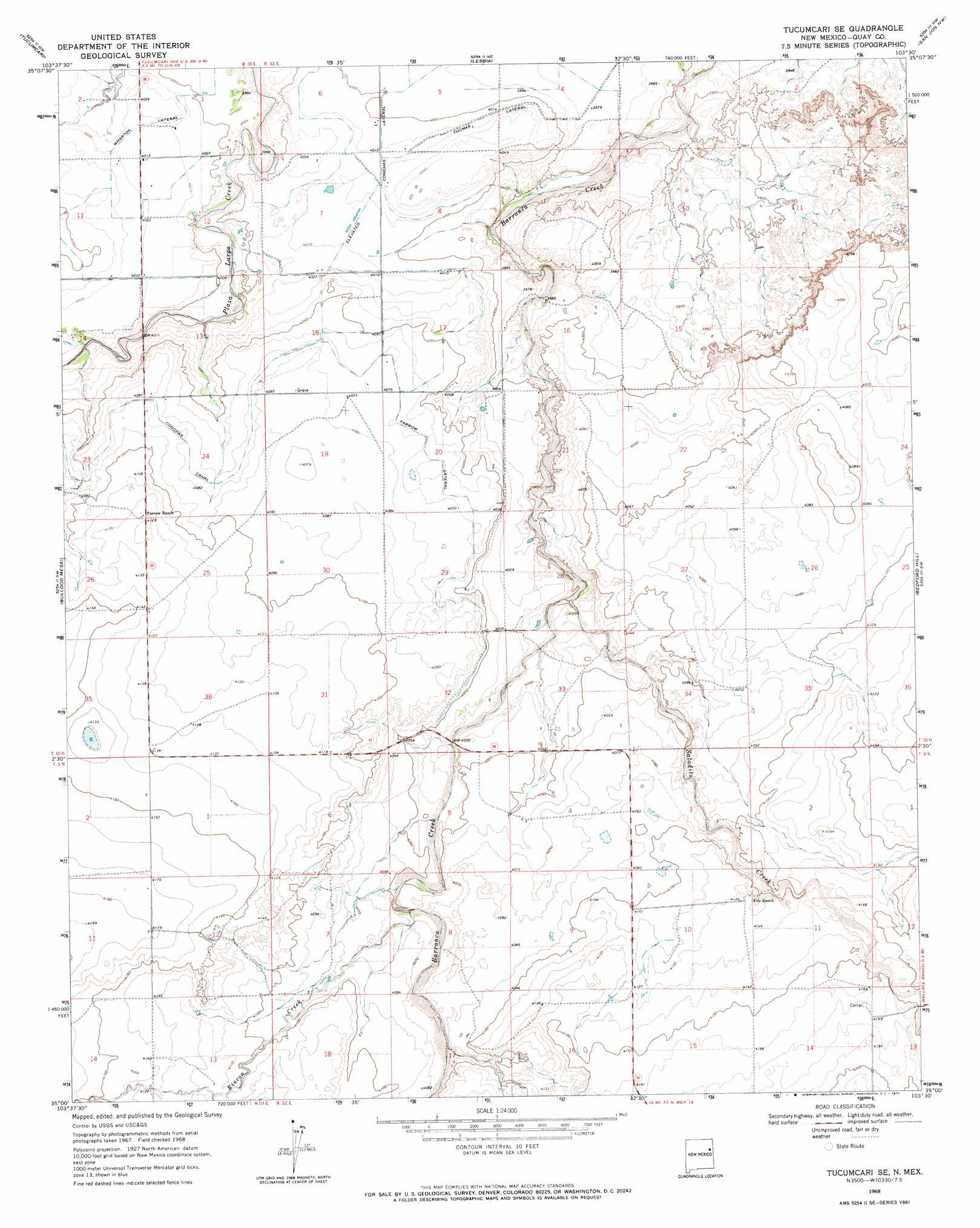
USGS Topo Quad 35103a5 - 1:24,000 scale
| Topo Map Name: | Tucumcari Se |
| USGS Topo Quad ID: | 35103a5 |
| Print Size: | ca. 21 1/4" wide x 27" high |
| Southeast Coordinates: | 35° N latitude / 103.5° W longitude |
| Map Center Coordinates: | 35.0625° N latitude / 103.5625° W longitude |
| U.S. State: | NM |
| Filename: | o35103a5.jpg |
| Download Map JPG Image: | Tucumcari Se topo map 1:24,000 scale |
| Map Type: | Topographic |
| Topo Series: | 7.5´ |
| Map Scale: | 1:24,000 |
| Source of Map Images: | United States Geological Survey (USGS) |
| Alternate Map Versions: |
Tucumcari SE NM 1968, updated 1971 Download PDF Buy paper map Tucumcari SE NM 2010 Download PDF Buy paper map Tucumcari SE NM 2013 Download PDF Buy paper map Tucumcari SE NM 2017 Download PDF Buy paper map |
1:24,000 Topo Quads surrounding Tucumcari Se
Trinchera Creek |
Bascom Camp |
Hudson |
Logan South |
Tuscocoillo Canyon |
Liberty Mesa |
Tucumcari |
Lesbia |
San Jon Nw |
Porter |
Briscoe Ranch |
Bulldog Mesa |
Tucumcari Se |
Bedford Hill |
San Jon |
Quay |
Mesa Redonda |
Norton |
Apache Canyon |
Wheatland |
Jordan |
Ragland |
Forrest |
Grady Sw |
Grady |
> Back to 35103a1 at 1:100,000 scale
> Back to 35102a1 at 1:250,000 scale
> Back to U.S. Topo Maps home
Tucumcari Se topo map: Gazetteer
Tucumcari Se: Canals
Farrow Lateral elevation 1241m 4071′Wharton Lateral elevation 1225m 4019′
Tucumcari Se: Streams
Apache Creek elevation 1265m 4150′Rincon Creek elevation 1235m 4051′
Saladito Creek elevation 1220m 4002′
Tucumcari Se digital topo map on disk
Buy this Tucumcari Se topo map showing relief, roads, GPS coordinates and other geographical features, as a high-resolution digital map file on DVD: