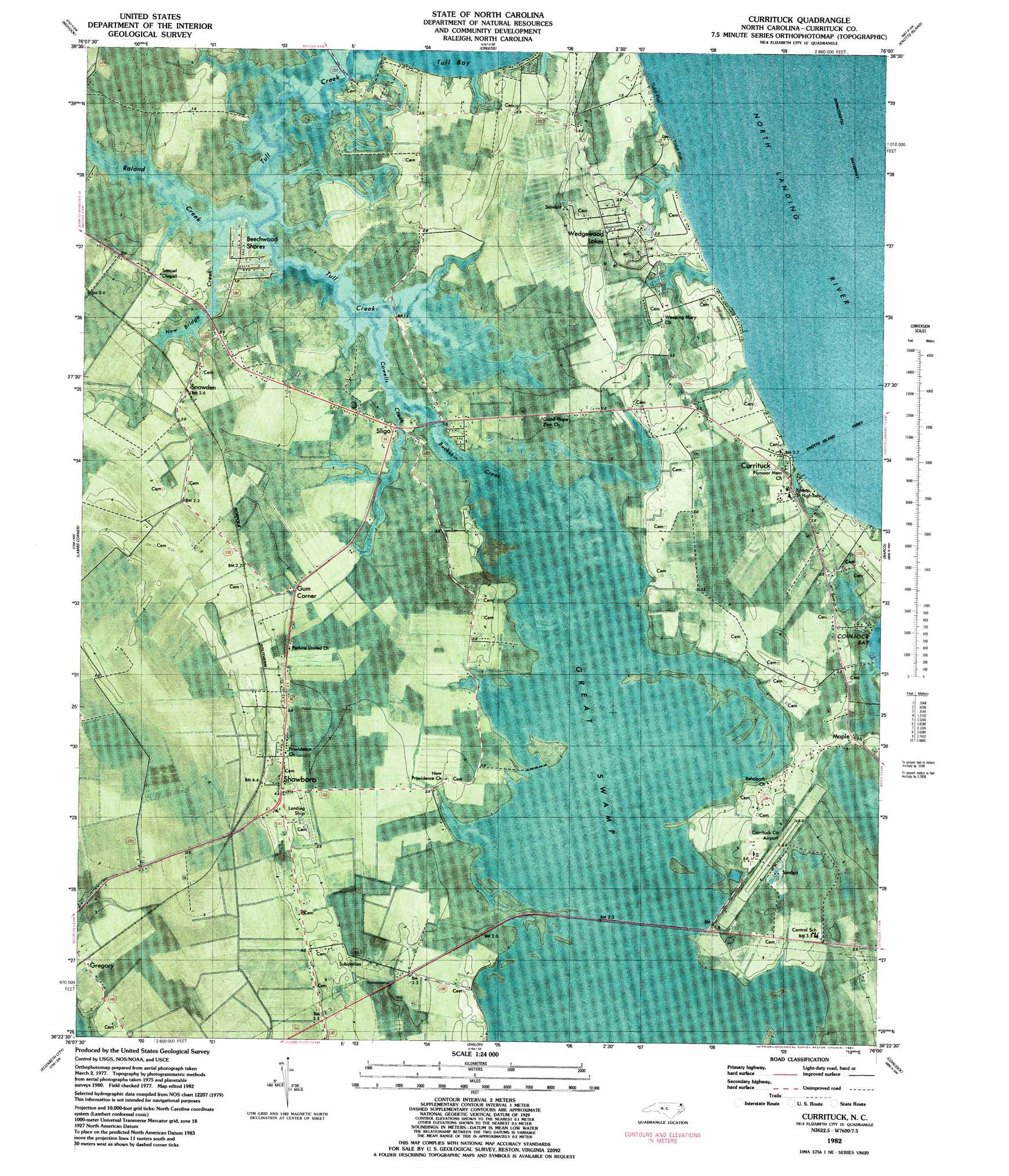
Currituck Topo Map North Carolina
To zoom in, hover over the map of Currituck
USGS Topo Quad 36076d1 - 1:24,000 scale
| Topo Map Name: | Currituck |
| USGS Topo Quad ID: | 36076d1 |
| Print Size: | ca. 21 1/4" wide x 27" high |
| Southeast Coordinates: | 36.375° N latitude / 76° W longitude |
| Map Center Coordinates: | 36.4375° N latitude / 76.0625° W longitude |
| U.S. State: | NC |
| Filename: | p36076d1.jpg |
| Download Map JPG Image: | Currituck topo map 1:24,000 scale |
| Map Type: | Orthophoto |
| Topo Series: | 7.5´ |
| Map Scale: | 1:24,000 |
| Source of Map Images: | United States Geological Survey (USGS) |
| Alternate Map Versions: |
Currituck NC 1982, updated 1983 Download PDF Buy paper map Currituck NC 1982, updated 1987 Download PDF Buy paper map Currituck NC 1999, updated 2002 Download PDF Buy paper map Currituck NC 2010 Download PDF Buy paper map Currituck NC 2013 Download PDF Buy paper map Currituck NC 2016 Download PDF Buy paper map |
1:24,000 Topo Quads surrounding Currituck
Deep Creek |
Fentress |
Pleasant Ridge |
North Bay |
|
Lake Drummond Se |
Moyock |
Creeds |
Knotts Island |
|
South Mills |
Lambs Corner |
Currituck |
Barco |
Corolla |
Pasquotank |
Elizabeth City |
Shiloh |
Coinjock |
Mossey Islands |
Nixonton |
Weeksville |
Wade Point |
Camden Point |
Jarvisburg |
> Back to 36076a1 at 1:100,000 scale
> Back to 36076a1 at 1:250,000 scale
> Back to U.S. Topo Maps home
Currituck topo map: Gazetteer
Currituck: Airports
Currituck County Airport elevation 0m 0′Ferebee Landing Strip elevation 3m 9′
Currituck: Populated Places
Beechwood Shores elevation 1m 3′Corner Gum elevation 1m 3′
Currituck elevation 2m 6′
Gregory elevation 2m 6′
Maple elevation 1m 3′
New Providence elevation 4m 13′
Shawboro elevation 4m 13′
Sligo elevation 0m 0′
Snowden elevation 2m 6′
Suburban Mobile Home Park elevation 2m 6′
Tulls elevation 2m 6′
Wedgewood Lakes elevation 2m 6′
Currituck: Post Offices
Currituck Post Office elevation 3m 9′Maple Post Office elevation 1m 3′
Shawboro Post Office elevation 4m 13′
Currituck: Ridges
Indian Ridge (historical) elevation 5m 16′Currituck: Streams
Buckskin Creek elevation 0m 0′Cowells Creek elevation 0m 0′
New Bridge Creek elevation 0m 0′
New Bridge Creek elevation 0m 0′
Roland Creek elevation 0m 0′
Tull Creek elevation 0m 0′
Currituck digital topo map on disk
Buy this Currituck topo map showing relief, roads, GPS coordinates and other geographical features, as a high-resolution digital map file on DVD:
Atlantic Coast (NY, NJ, PA, DE, MD, VA, NC)
Buy digital topo maps: Atlantic Coast (NY, NJ, PA, DE, MD, VA, NC)
 map DVD")