Lovelaceville Topo Map Kentucky
To zoom in, hover over the map of Lovelaceville
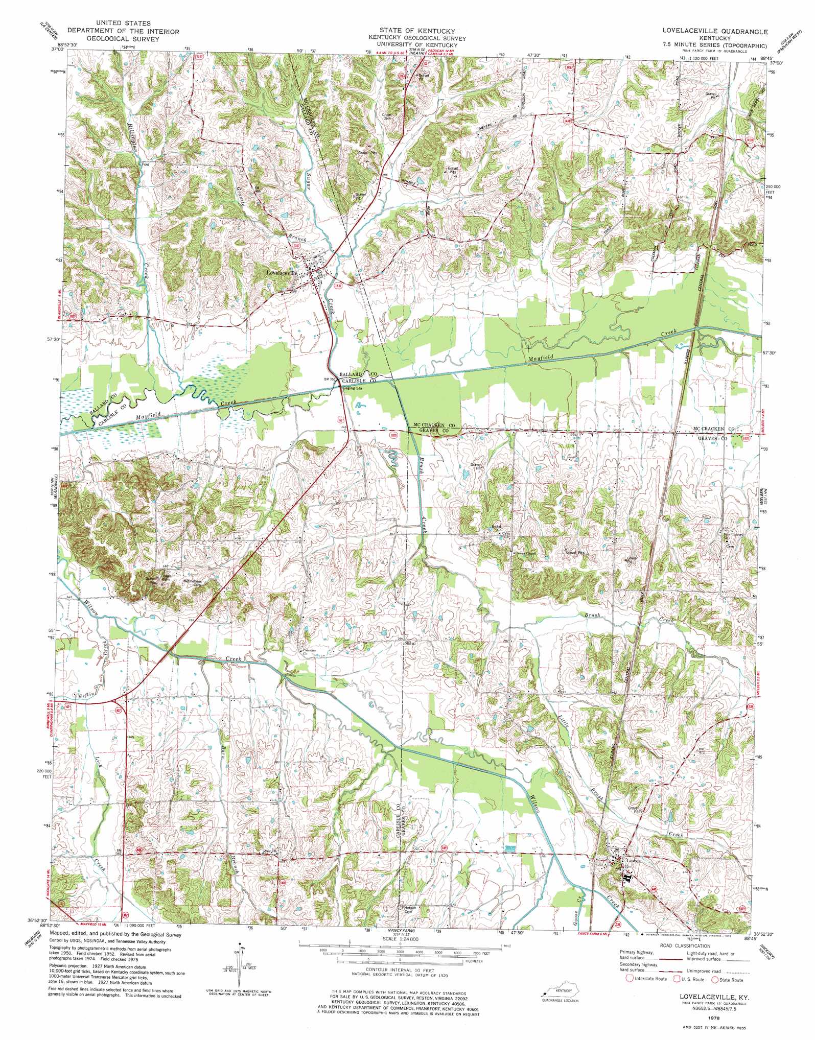
USGS Topo Quad 36088h7 - 1:24,000 scale
| Topo Map Name: | Lovelaceville |
| USGS Topo Quad ID: | 36088h7 |
| Print Size: | ca. 21 1/4" wide x 27" high |
| Southeast Coordinates: | 36.875° N latitude / 88.75° W longitude |
| Map Center Coordinates: | 36.9375° N latitude / 88.8125° W longitude |
| U.S. State: | KY |
| Filename: | o36088h7.jpg |
| Download Map JPG Image: | Lovelaceville topo map 1:24,000 scale |
| Map Type: | Topographic |
| Topo Series: | 7.5´ |
| Map Scale: | 1:24,000 |
| Source of Map Images: | United States Geological Survey (USGS) |
| Alternate Map Versions: |
Lovelaceville KY 2010 Download PDF Buy paper map Lovelaceville KY 2013 Download PDF Buy paper map Lovelaceville KY 2016 Download PDF Buy paper map |
1:24,000 Topo Quads surrounding Lovelaceville
Olmsted |
Bandana |
Joppa |
Metropolis |
Paducah Ne |
Barlow |
La Center |
Heath |
Paducah West |
Paducah East |
Wickliffe |
Blandville |
Lovelaceville |
Melber |
Symsonia |
Arlington |
Milburn |
Fancy Farm |
Hickory |
Westplains |
Oakton |
Clinton |
Dublin |
Mayfield |
Farmington |
> Back to 36088e1 at 1:100,000 scale
> Back to 36088a1 at 1:250,000 scale
> Back to U.S. Topo Maps home
Lovelaceville topo map: Gazetteer
Lovelaceville: Airports
Terry Field elevation 113m 370′Lovelaceville: Populated Places
Lovelaceville elevation 112m 367′Lowes elevation 143m 469′
Lovelaceville: Streams
Barn Branch elevation 104m 341′Billington Creek elevation 101m 331′
Brush Creek elevation 103m 337′
Goose Creek elevation 115m 377′
Granite Branch elevation 109m 357′
Heflin Creek elevation 104m 341′
Lick Creek elevation 107m 351′
Little Brush Creek elevation 113m 370′
Sugar Creek elevation 105m 344′
Lovelaceville digital topo map on disk
Buy this Lovelaceville topo map showing relief, roads, GPS coordinates and other geographical features, as a high-resolution digital map file on DVD: