East Prairie Topo Map Missouri
To zoom in, hover over the map of East Prairie
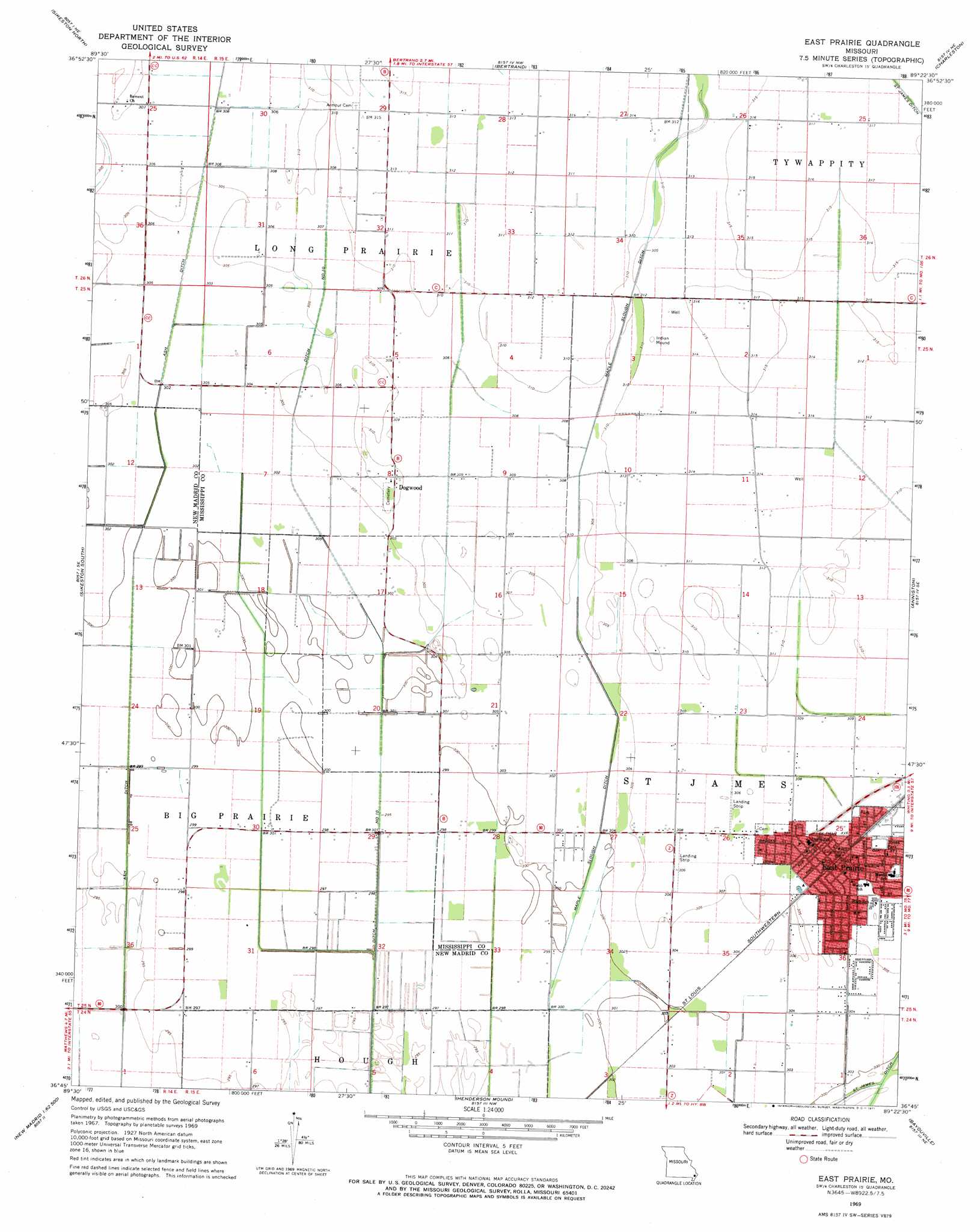
USGS Topo Quad 36089g4 - 1:24,000 scale
| Topo Map Name: | East Prairie |
| USGS Topo Quad ID: | 36089g4 |
| Print Size: | ca. 21 1/4" wide x 27" high |
| Southeast Coordinates: | 36.75° N latitude / 89.375° W longitude |
| Map Center Coordinates: | 36.8125° N latitude / 89.4375° W longitude |
| U.S. State: | MO |
| Filename: | o36089g4.jpg |
| Download Map JPG Image: | East Prairie topo map 1:24,000 scale |
| Map Type: | Topographic |
| Topo Series: | 7.5´ |
| Map Scale: | 1:24,000 |
| Source of Map Images: | United States Geological Survey (USGS) |
| Alternate Map Versions: |
East Prairie MO 1969, updated 1971 Download PDF Buy paper map East Prairie MO 2012 Download PDF Buy paper map East Prairie MO 2015 Download PDF Buy paper map |
1:24,000 Topo Quads surrounding East Prairie
Oran |
Morley |
Thebes Sw |
Cache |
Cairo |
Vanduser |
Sikeston North |
Bertrand |
Charleston |
Wyatt |
Morehouse |
Sikeston South |
East Prairie |
Anniston |
Wickliffe Sw |
Charter Oak |
Kewanee |
Henderson Mound |
Bayouville |
Wolf Island |
Catron |
New Madrid |
Hubbard Lake |
Bondurant |
Hickman |
> Back to 36089e1 at 1:100,000 scale
> Back to 36088a1 at 1:250,000 scale
> Back to U.S. Topo Maps home
East Prairie topo map: Gazetteer
East Prairie: Canals
Ash Ditch elevation 90m 295′Maple Slough Ditch elevation 92m 301′
East Prairie: Populated Places
Dogwood elevation 95m 311′East Prairie elevation 93m 305′
East Prairie digital topo map on disk
Buy this East Prairie topo map showing relief, roads, GPS coordinates and other geographical features, as a high-resolution digital map file on DVD: