Red Rock Topo Map Oklahoma
To zoom in, hover over the map of Red Rock
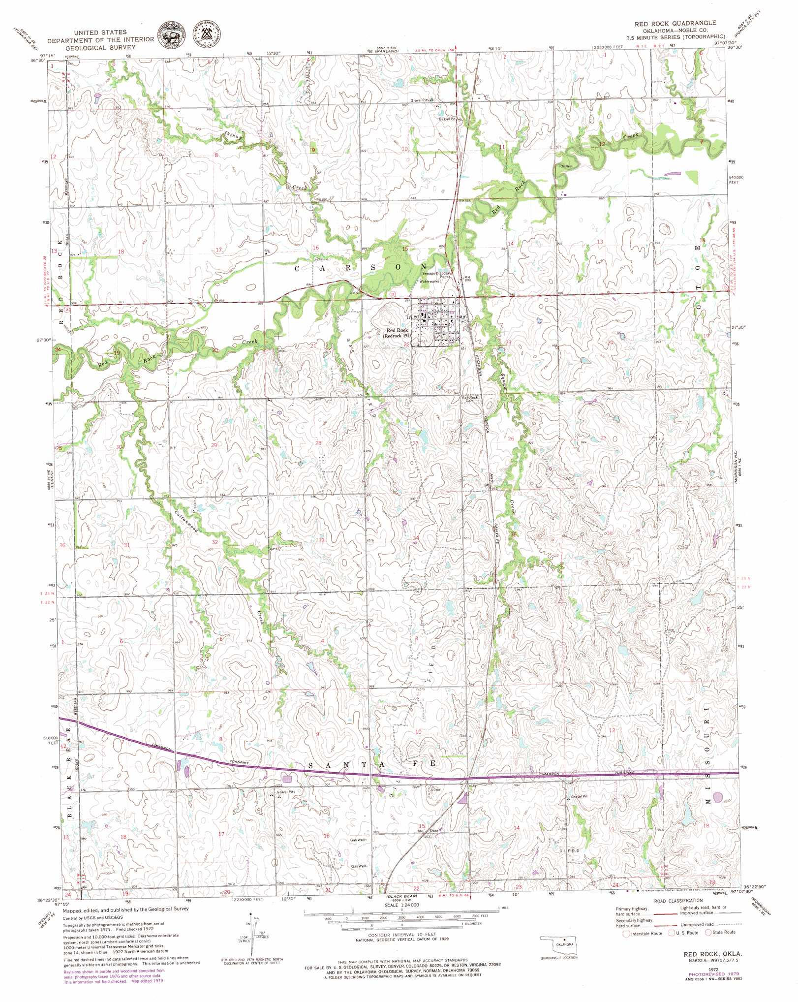
USGS Topo Quad 36097d2 - 1:24,000 scale
| Topo Map Name: | Red Rock |
| USGS Topo Quad ID: | 36097d2 |
| Print Size: | ca. 21 1/4" wide x 27" high |
| Southeast Coordinates: | 36.375° N latitude / 97.125° W longitude |
| Map Center Coordinates: | 36.4375° N latitude / 97.1875° W longitude |
| U.S. State: | OK |
| Filename: | o36097d2.jpg |
| Download Map JPG Image: | Red Rock topo map 1:24,000 scale |
| Map Type: | Topographic |
| Topo Series: | 7.5´ |
| Map Scale: | 1:24,000 |
| Source of Map Images: | United States Geological Survey (USGS) |
| Alternate Map Versions: |
Red Rock OK 1972, updated 1974 Download PDF Buy paper map Red Rock OK 1972, updated 1979 Download PDF Buy paper map Red Rock OK 2009 Download PDF Buy paper map Red Rock OK 2012 Download PDF Buy paper map Red Rock OK 2016 Download PDF Buy paper map |
1:24,000 Topo Quads surrounding Red Rock
Eddy |
Tonkawa |
Ponca City Nw |
Ponca City |
Charley Creek East |
Billings |
Tonkawa Se |
Marland |
Ponca City Se |
Prettyhair Creek |
Perry Nw |
Ceres |
Red Rock |
Morrison Ne |
Watchorn |
Lucien |
Perry |
Black Bear |
Morrison |
Lela |
Orlando West |
Orlando East |
Lake Carl Blackwell |
Stillwater North |
Glencoe |
> Back to 36097a1 at 1:100,000 scale
> Back to 36096a1 at 1:250,000 scale
> Back to U.S. Topo Maps home
Red Rock topo map: Gazetteer
Red Rock: Dams
Lower Red Rock Creek Site 18 Dam elevation 287m 941′Lower Red Rock Creek Site 21 Dam elevation 280m 918′
Lower Red Rock Creek Site 23 Dam elevation 274m 898′
Oknoname 103006 Dam elevation 291m 954′
Red Rock: Populated Places
Otoe elevation 314m 1030′Red Rock elevation 283m 928′
Red Rock: Post Offices
Redrock Post Office elevation 282m 925′Red Rock: Reservoirs
Lower Red Rock Creek Site 18 Reservoir elevation 287m 941′Lower Red Rock Creek Site 21 Reservoir elevation 280m 918′
Lower Red Rock Creek Site 23 Reservoir elevation 274m 898′
Oknoname 103006 Reservoir elevation 291m 954′
Red Rock: Streams
Cottonwood Creek elevation 268m 879′Legend Creek elevation 267m 875′
Skinny Creek elevation 270m 885′
Red Rock digital topo map on disk
Buy this Red Rock topo map showing relief, roads, GPS coordinates and other geographical features, as a high-resolution digital map file on DVD: