Orlando West Topo Map Oklahoma
To zoom in, hover over the map of Orlando West
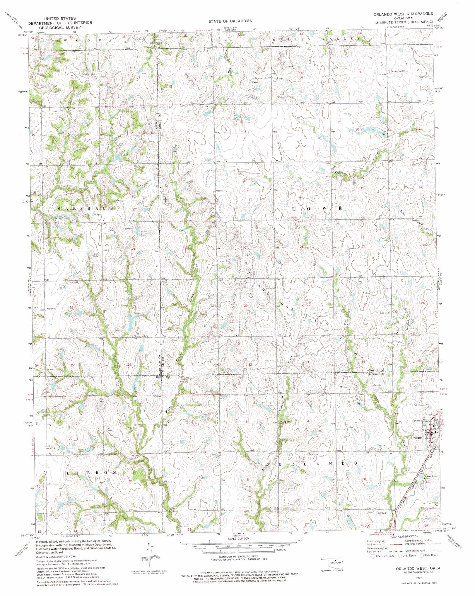
USGS Topo Quad 36097b4 - 1:24,000 scale
| Topo Map Name: | Orlando West |
| USGS Topo Quad ID: | 36097b4 |
| Print Size: | ca. 21 1/4" wide x 27" high |
| Southeast Coordinates: | 36.125° N latitude / 97.375° W longitude |
| Map Center Coordinates: | 36.1875° N latitude / 97.4375° W longitude |
| U.S. State: | OK |
| Filename: | o36097b4.jpg |
| Download Map JPG Image: | Orlando West topo map 1:24,000 scale |
| Map Type: | Topographic |
| Topo Series: | 7.5´ |
| Map Scale: | 1:24,000 |
| Source of Map Images: | United States Geological Survey (USGS) |
| Alternate Map Versions: |
Orlando West OK 1974, updated 1977 Download PDF Buy paper map Orlando West OK 2010 Download PDF Buy paper map Orlando West OK 2012 Download PDF Buy paper map Orlando West OK 2016 Download PDF Buy paper map |
1:24,000 Topo Quads surrounding Orlando West
Breckinridge |
Garber |
Perry Nw |
Ceres |
Red Rock |
Fairmont |
Covington |
Lucien |
Perry |
Black Bear |
Marshall West |
Marshall East |
Orlando West |
Orlando East |
Lake Carl Blackwell |
Lovell |
Bridge Creek |
Mulhall |
Clear Creek |
Stillwater Sw |
Crescent Nw |
Crescent |
Guthrie North |
Langston |
Coyle |
> Back to 36097a1 at 1:100,000 scale
> Back to 36096a1 at 1:250,000 scale
> Back to U.S. Topo Maps home
Orlando West topo map: Gazetteer
Orlando West: Dams
Oknoname 083041 Dam elevation 323m 1059′Oknoname 103002 Dam elevation 345m 1131′
Oknoname 103003 Dam elevation 352m 1154′
Orlando West: Populated Places
Orlando elevation 334m 1095′Orlando West: Reservoirs
Oknoname 083041 Reservoir elevation 323m 1059′Oknoname 103002 Reservoir elevation 345m 1131′
Oknoname 103003 Reservoir elevation 352m 1154′
Orlando West digital topo map on disk
Buy this Orlando West topo map showing relief, roads, GPS coordinates and other geographical features, as a high-resolution digital map file on DVD: