Bolin Ne Topo Map Texas
To zoom in, hover over the map of Bolin Ne
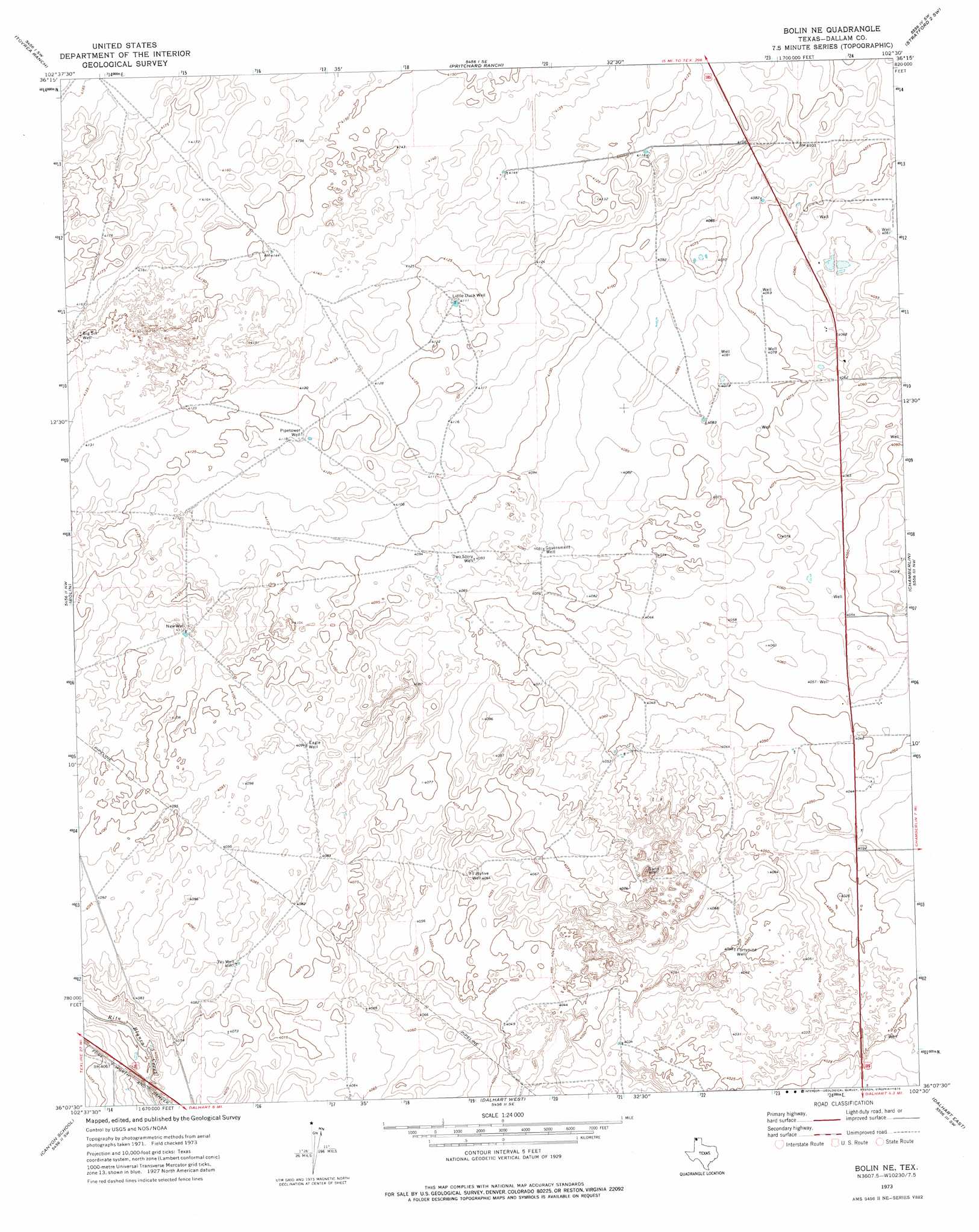
USGS Topo Quad 36102b5 - 1:24,000 scale
| Topo Map Name: | Bolin Ne |
| USGS Topo Quad ID: | 36102b5 |
| Print Size: | ca. 21 1/4" wide x 27" high |
| Southeast Coordinates: | 36.125° N latitude / 102.5° W longitude |
| Map Center Coordinates: | 36.1875° N latitude / 102.5625° W longitude |
| U.S. State: | TX |
| Filename: | o36102b5.jpg |
| Download Map JPG Image: | Bolin Ne topo map 1:24,000 scale |
| Map Type: | Topographic |
| Topo Series: | 7.5´ |
| Map Scale: | 1:24,000 |
| Source of Map Images: | United States Geological Survey (USGS) |
| Alternate Map Versions: |
Bolin NE TX 1973, updated 1976 Download PDF Buy paper map Bolin NE TX 2010 Download PDF Buy paper map Bolin NE TX 2012 Download PDF Buy paper map Bolin NE TX 2016 Download PDF Buy paper map |
1:24,000 Topo Quads surrounding Bolin Ne
Buffalo Springs |
Coldwater West |
Coldwater East |
Stratford 2 Nw |
Stratford 2 Ne |
Perico |
Tovrea Ranch |
Pritchard Ranch |
Stratford 2 Sw |
Stratford 2 Se |
Wharton Ranch |
Bolin |
Bolin Ne |
Chamberlin |
Wilco Ne |
Wells Ranch |
Canyon School |
Dalhart West |
Dalhart East |
Wilco |
Syndicate Hills |
King |
Pardue Camp |
Hartley |
Hartley Ne |
> Back to 36102a1 at 1:100,000 scale
> Back to 36102a1 at 1:250,000 scale
> Back to U.S. Topo Maps home
Bolin Ne topo map: Gazetteer
Bolin Ne: Wells
Big Six Well elevation 1265m 4150′Eagle Well elevation 1249m 4097′
Fiftyfive Well elevation 1237m 4058′
Fortynine Well elevation 1235m 4051′
Government Well elevation 1247m 4091′
Little Duck Well elevation 1253m 4110′
New Well elevation 1253m 4110′
Pipetower Well elevation 1256m 4120′
Three VS Well elevation 1244m 4081′
Two Story Well elevation 1247m 4091′
Bolin Ne digital topo map on disk
Buy this Bolin Ne topo map showing relief, roads, GPS coordinates and other geographical features, as a high-resolution digital map file on DVD: