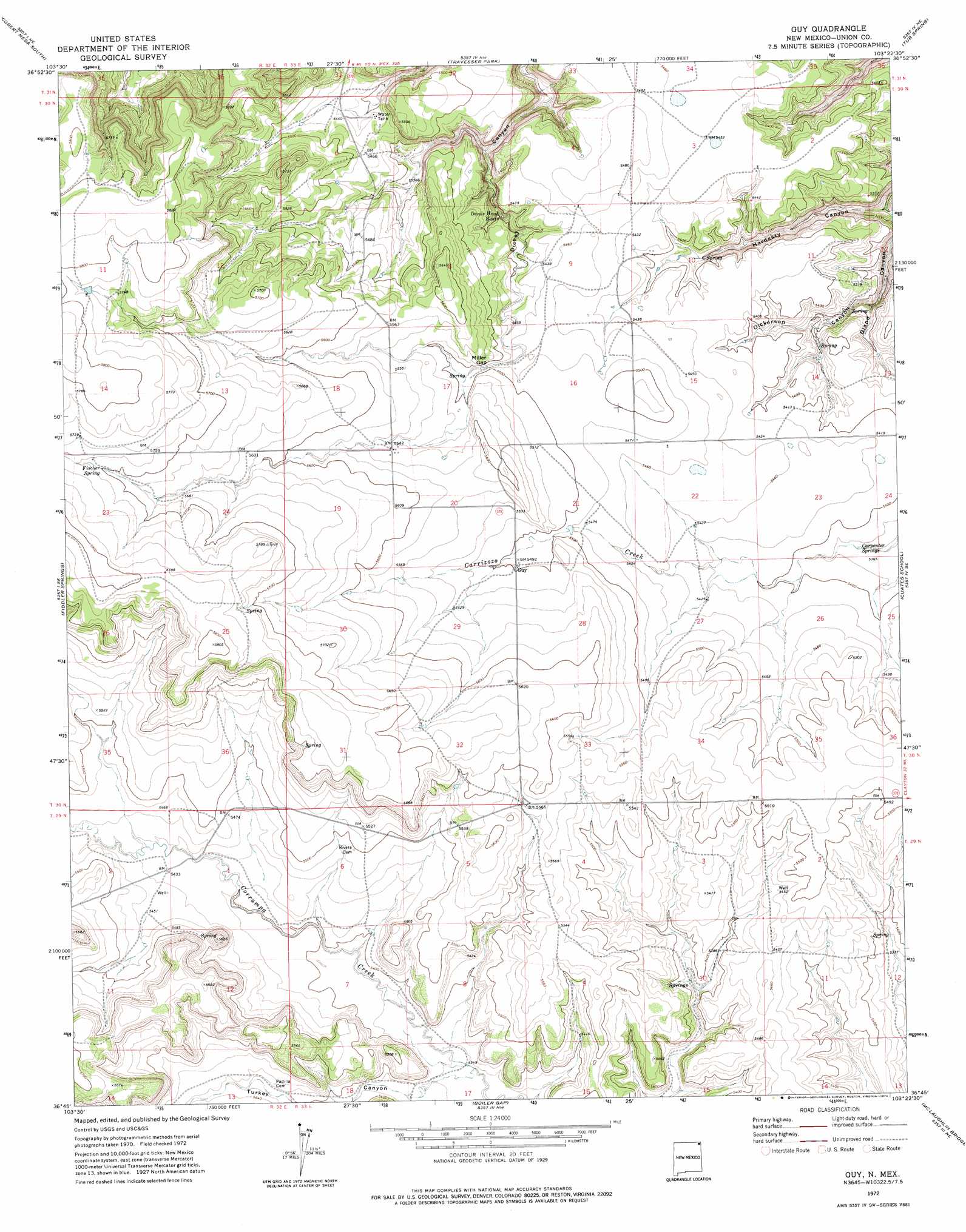
Guy Topo Map New Mexico
To zoom in, hover over the map of Guy
USGS Topo Quad 36103g4 - 1:24,000 scale
| Topo Map Name: | Guy |
| USGS Topo Quad ID: | 36103g4 |
| Print Size: | ca. 21 1/4" wide x 27" high |
| Southeast Coordinates: | 36.75° N latitude / 103.375° W longitude |
| Map Center Coordinates: | 36.8125° N latitude / 103.4375° W longitude |
| U.S. State: | NM |
| Filename: | o36103g4.jpg |
| Download Map JPG Image: | Guy topo map 1:24,000 scale |
| Map Type: | Topographic |
| Topo Series: | 7.5´ |
| Map Scale: | 1:24,000 |
| Source of Map Images: | United States Geological Survey (USGS) |
| Alternate Map Versions: |
Guy NM 1972, updated 1974 Download PDF Buy paper map Guy NM 2010 Download PDF Buy paper map Guy NM 2013 Download PDF Buy paper map Guy NM 2017 Download PDF Buy paper map |
1:24,000 Topo Quads surrounding Guy
Pine Canyon |
Cobert Mesa North |
Jesus Canyon |
Dennis Canyon |
Furnish Canyon West |
Cross L Ranch |
Cobert Mesa South |
Travesser Park |
Tub Spring |
Wedding Cake Butte |
Cross L Ranch Sw |
Fiddler Springs |
Guy |
Cuates School |
Atencio |
Wetherly Lake |
Blind Gap |
Boiler Gap |
Mclaughlin Bridge |
Seneca |
Grenville Sw |
Grenville |
Mount Dora |
Bible Top Butte |
Rabbit Ear Mountain |
> Back to 36103e1 at 1:100,000 scale
> Back to 36102a1 at 1:250,000 scale
> Back to U.S. Topo Maps home
Guy topo map: Gazetteer
Guy: Gaps
Miller Gap elevation 1674m 5492′Guy: Lakes
Devils Wash Basin elevation 1627m 5337′Guy: Populated Places
Guy elevation 1677m 5501′Guy: Post Offices
Guy Post Office (historical) elevation 1677m 5501′Guy: Springs
Carpenter Springs elevation 1637m 5370′Fischer Spring elevation 1739m 5705′
Guy: Valleys
Bland Canyon elevation 1557m 5108′Dickerson Canyon elevation 1584m 5196′
Hardesty Canyon elevation 1557m 5108′
Turkey Canyon elevation 1632m 5354′
Guy digital topo map on disk
Buy this Guy topo map showing relief, roads, GPS coordinates and other geographical features, as a high-resolution digital map file on DVD: