Taylor Ranch Topo Map New Mexico
To zoom in, hover over the map of Taylor Ranch
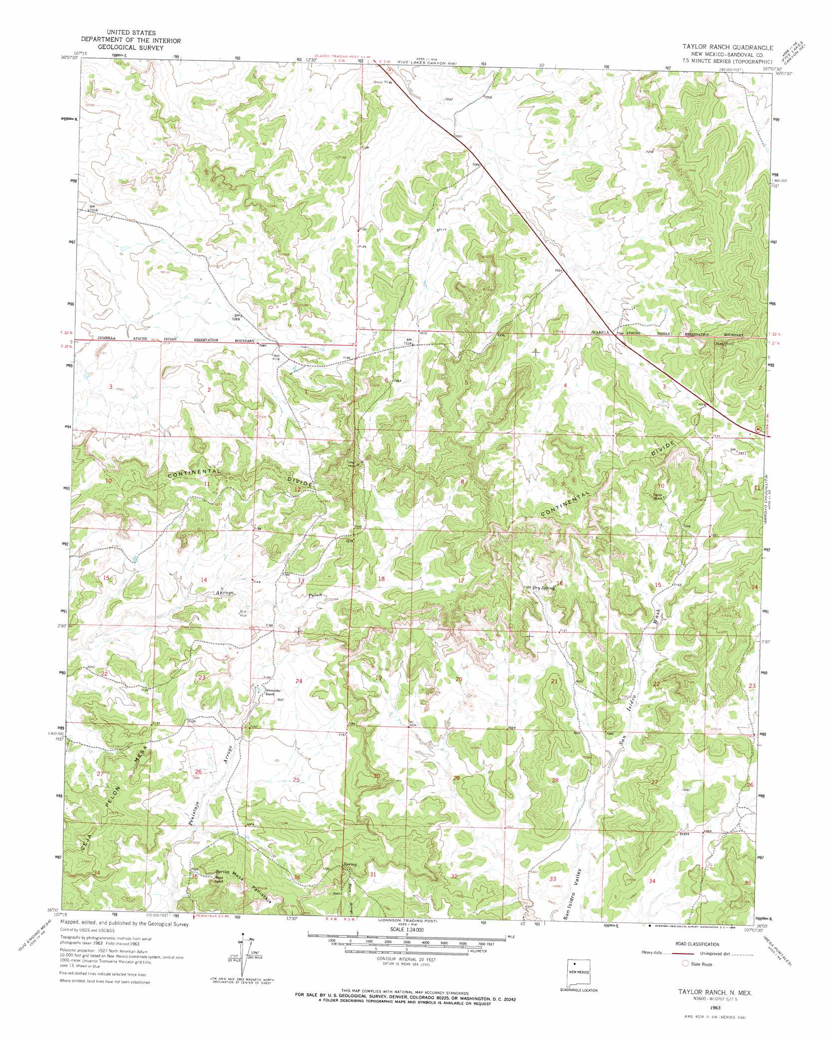
USGS Topo Quad 36107a2 - 1:24,000 scale
| Topo Map Name: | Taylor Ranch |
| USGS Topo Quad ID: | 36107a2 |
| Print Size: | ca. 21 1/4" wide x 27" high |
| Southeast Coordinates: | 36° N latitude / 107.125° W longitude |
| Map Center Coordinates: | 36.0625° N latitude / 107.1875° W longitude |
| U.S. State: | NM |
| Filename: | o36107a2.jpg |
| Download Map JPG Image: | Taylor Ranch topo map 1:24,000 scale |
| Map Type: | Topographic |
| Topo Series: | 7.5´ |
| Map Scale: | 1:24,000 |
| Source of Map Images: | United States Geological Survey (USGS) |
| Alternate Map Versions: |
Taylor Ranch NM 1963, updated 1966 Download PDF Buy paper map Taylor Ranch NM 2010 Download PDF Buy paper map Taylor Ranch NM 2013 Download PDF Buy paper map Taylor Ranch NM 2017 Download PDF Buy paper map |
1:24,000 Topo Quads surrounding Taylor Ranch
Tafoya Canyon |
Otero Store |
Billy Rice Canyon |
Lindrith |
Laguna Gurule |
Counselor |
Tancosa Windmill |
Five Lakes Canyon Nw |
Five Lakes Canyon Ne |
Regina |
Mule Dam |
Deer Mesa |
Taylor Ranch |
Arroyo Chijuillita |
Cuba |
Star Lake |
Ojo Encino Mesa |
Johnson Trading Post |
Mesa Portales |
San Pablo |
Rincon Marquez |
Tinian |
Wolf Stand |
Headcut Reservoir |
La Ventana |
> Back to 36107a1 at 1:100,000 scale
> Back to 36106a1 at 1:250,000 scale
> Back to U.S. Topo Maps home
Taylor Ranch topo map: Gazetteer
Taylor Ranch: Dams
Encino Detention Dam Number 63 elevation 2154m 7066′Taylor Ranch: Mines
Crook Number Two Group elevation 2153m 7063′Landers elevation 2172m 7125′
Taylor elevation 2141m 7024′
Taylor Ranch: Springs
Dry Spring elevation 2182m 7158′Taylor Ranch: Summits
Ceja Pelon Mesa elevation 2209m 7247′Mesa Penistaja elevation 2196m 7204′
Taylor Ranch digital topo map on disk
Buy this Taylor Ranch topo map showing relief, roads, GPS coordinates and other geographical features, as a high-resolution digital map file on DVD: