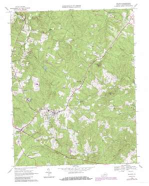
Dillwyn Topo Map Virginia
To zoom in, hover over the map of Dillwyn
USGS Topo Quad 37078e4 - 1:24,000 scale
| Topo Map Name: | Dillwyn |
| USGS Topo Quad ID: | 37078e4 |
| Print Size: | ca. 21 1/4" wide x 27" high |
| Southeast Coordinates: | 37.5° N latitude / 78.375° W longitude |
| Map Center Coordinates: | 37.5625° N latitude / 78.4375° W longitude |
| U.S. State: | VA |
| Filename: | o37078e4.jpg |
| Download Map JPG Image: | Dillwyn topo map 1:24,000 scale |
| Map Type: | Topographic |
| Topo Series: | 7.5´ |
| Map Scale: | 1:24,000 |
| Source of Map Images: | United States Geological Survey (USGS) |
| Alternate Map Versions: |
Dillwyn VA 1968, updated 1971 Download PDF Buy paper map Dillwyn VA 1968, updated 1984 Download PDF Buy paper map Dillwyn VA 1968, updated 1987 Download PDF Buy paper map Dillwyn VA 2010 Download PDF Buy paper map Dillwyn VA 2013 Download PDF Buy paper map Dillwyn VA 2016 Download PDF Buy paper map |
1:24,000 Topo Quads surrounding Dillwyn
> Back to 37078e1 at 1:100,000 scale
> Back to 37078a1 at 1:250,000 scale
> Back to U.S. Topo Maps home
Dillwyn topo map: Gazetteer
Dillwyn: Dams
Kennedys Dam elevation 142m 465′Willis River Number 5e Dam elevation 123m 403′
Dillwyn: Populated Places
Allenslevel elevation 166m 544′Alpha elevation 183m 600′
Dillwyn elevation 190m 623′
Eldridge Mill elevation 107m 351′
Rosney elevation 119m 390′
Sprouses Corner elevation 196m 643′
Dillwyn: Reservoirs
Dillwyn Lake elevation 155m 508′Kennedys Pond elevation 142m 465′
Dillwyn: Ridges
The Ridge elevation 173m 567′Dillwyn: Streams
Flat Creek elevation 96m 314′Gold Mine Branch elevation 124m 406′
Lick Branch elevation 106m 347′
Peyton Creek elevation 116m 380′
Rosney Creek elevation 123m 403′
Tower Branch elevation 113m 370′
Dillwyn: Summits
Buffards Mountain elevation 217m 711′Tower Hill elevation 189m 620′
Dillwyn digital topo map on disk
Buy this Dillwyn topo map showing relief, roads, GPS coordinates and other geographical features, as a high-resolution digital map file on DVD:
Western Virginia & Southern West Virginia
Buy digital topo maps: Western Virginia & Southern West Virginia


