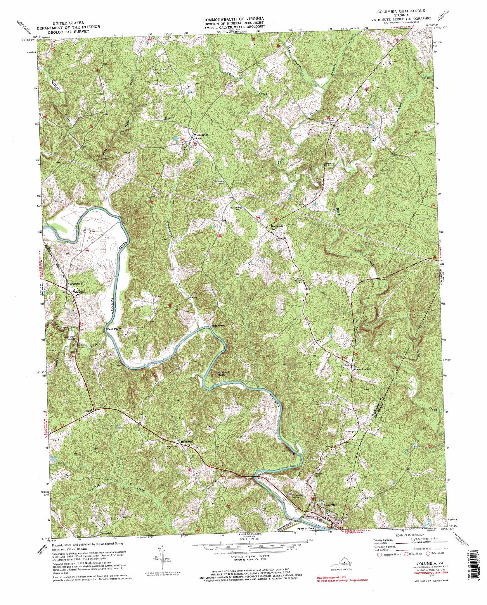
Columbia Topo Map Virginia
To zoom in, hover over the map of Columbia
USGS Topo Quad 37078g2 - 1:24,000 scale
| Topo Map Name: | Columbia |
| USGS Topo Quad ID: | 37078g2 |
| Print Size: | ca. 21 1/4" wide x 27" high |
| Southeast Coordinates: | 37.75° N latitude / 78.125° W longitude |
| Map Center Coordinates: | 37.8125° N latitude / 78.1875° W longitude |
| U.S. State: | VA |
| Filename: | o37078g2.jpg |
| Download Map JPG Image: | Columbia topo map 1:24,000 scale |
| Map Type: | Topographic |
| Topo Series: | 7.5´ |
| Map Scale: | 1:24,000 |
| Source of Map Images: | United States Geological Survey (USGS) |
| Alternate Map Versions: |
Columbia VA 1970, updated 1972 Download PDF Buy paper map Columbia VA 1970, updated 1984 Download PDF Buy paper map Columbia VA 1970, updated 1984 Download PDF Buy paper map Columbia VA 2010 Download PDF Buy paper map Columbia VA 2013 Download PDF Buy paper map Columbia VA 2016 Download PDF Buy paper map |
1:24,000 Topo Quads surrounding Columbia
Charlottesville East |
Keswick |
Boswells Tavern |
Louisa |
Mineral |
Simeon |
Boyd Tavern |
Zion Crossroads |
Ferncliff |
Pendleton |
Scottsville |
Palmyra |
Columbia |
Caledonia |
South Anna |
Diana Mills |
Arvonia |
Lakeside Village |
Cartersville |
Goochland |
Dillwyn |
Gold Hill |
Whiteville |
Trenholm |
Powhatan |
> Back to 37078e1 at 1:100,000 scale
> Back to 37078a1 at 1:250,000 scale
> Back to U.S. Topo Maps home
Columbia topo map: Gazetteer
Columbia: Bends
Hells Bend elevation 60m 196′Columbia: Bridges
Cosby Bridge elevation 74m 242′Griffin Bridge elevation 62m 203′
Columbia: Capes
East Point elevation 61m 200′Point of Fork elevation 58m 190′
Columbia: Parks
Carys Creek Wayside elevation 79m 259′Columbia: Populated Places
Carysbrook elevation 97m 318′Cloverdale elevation 118m 387′
Columbia elevation 63m 206′
Dixie elevation 117m 383′
Holmhead elevation 117m 383′
Rasawek (historical) elevation 59m 193′
Stage Junction elevation 123m 403′
Wilmington elevation 124m 406′
Columbia: Streams
Able Creek elevation 64m 209′Carys Creek elevation 61m 200′
East Branch elevation 73m 239′
Kent Branch elevation 82m 269′
Long Island Creek elevation 61m 200′
Phils Creek elevation 79m 259′
Rivanna River elevation 55m 180′
Roundabout Creek elevation 60m 196′
Venable Creek elevation 82m 269′
Williams Creek elevation 68m 223′
Columbia: Summits
Buzzard Rock elevation 99m 324′Columbia digital topo map on disk
Buy this Columbia topo map showing relief, roads, GPS coordinates and other geographical features, as a high-resolution digital map file on DVD:
Western Virginia & Southern West Virginia
Buy digital topo maps: Western Virginia & Southern West Virginia