Crofton Topo Map Kentucky
To zoom in, hover over the map of Crofton
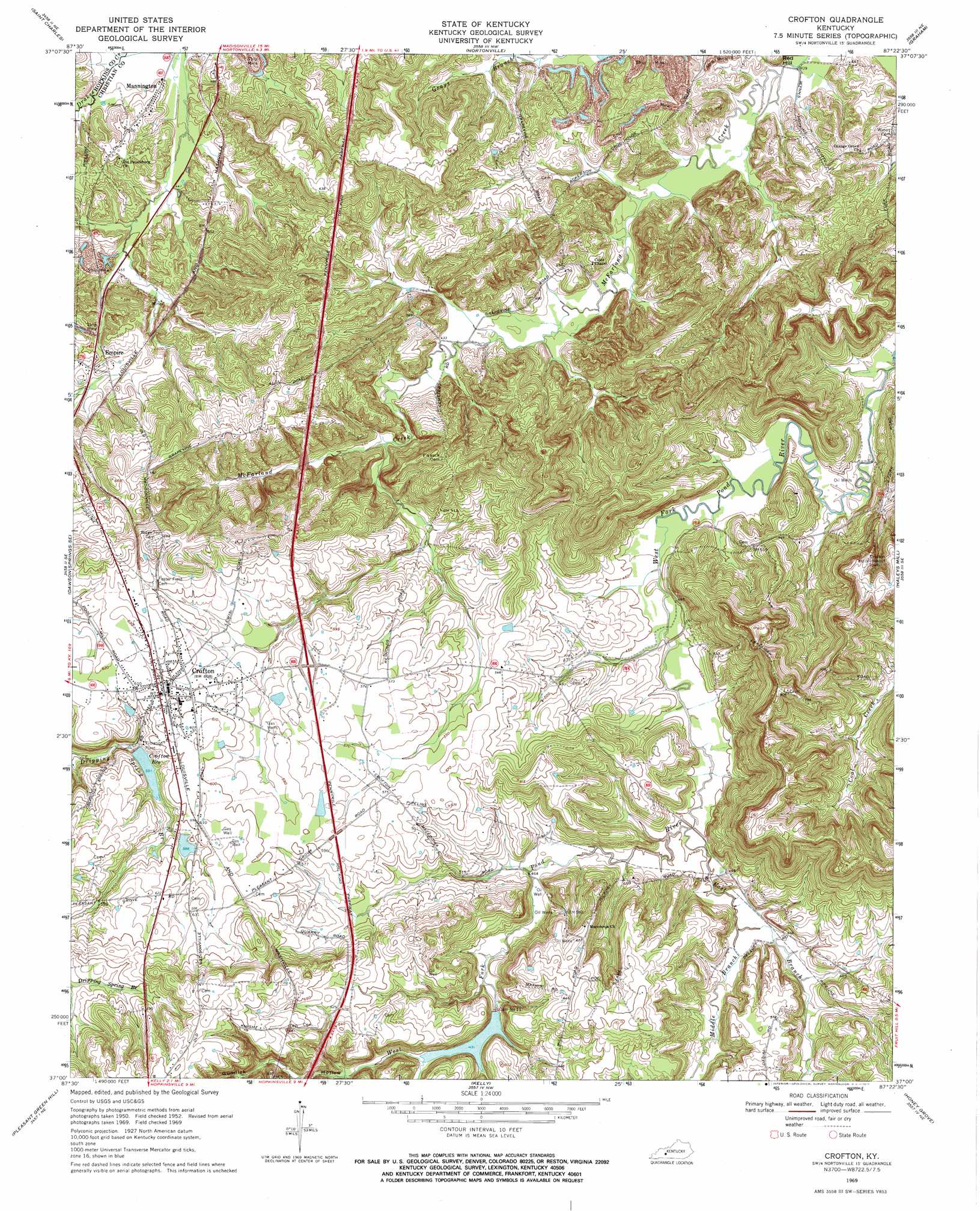
USGS Topo Quad 37087a4 - 1:24,000 scale
| Topo Map Name: | Crofton |
| USGS Topo Quad ID: | 37087a4 |
| Print Size: | ca. 21 1/4" wide x 27" high |
| Southeast Coordinates: | 37° N latitude / 87.375° W longitude |
| Map Center Coordinates: | 37.0625° N latitude / 87.4375° W longitude |
| U.S. State: | KY |
| Filename: | o37087a4.jpg |
| Download Map JPG Image: | Crofton topo map 1:24,000 scale |
| Map Type: | Topographic |
| Topo Series: | 7.5´ |
| Map Scale: | 1:24,000 |
| Source of Map Images: | United States Geological Survey (USGS) |
| Alternate Map Versions: |
Crofton KY 1952, updated 1954 Download PDF Buy paper map Crofton KY 1969, updated 1971 Download PDF Buy paper map Crofton KY 2010 Download PDF Buy paper map Crofton KY 2013 Download PDF Buy paper map Crofton KY 2016 Download PDF Buy paper map |
1:24,000 Topo Quads surrounding Crofton
Coiltown |
Madisonville West |
Madisonville East |
Millport |
Central City West |
Dawson Springs |
Saint Charles |
Nortonville |
Graham |
Greenville |
Dawson Springs Sw |
Dawson Springs Se |
Crofton |
Haleys Mill |
Kirkmansville |
Gracey |
Pleasant Green Hill |
Kelly |
Honey Grove |
Allegre |
Caledonia |
Church Hill |
Hopkinsville |
Pembroke |
Elkton |
> Back to 37087a1 at 1:100,000 scale
> Back to 37086a1 at 1:250,000 scale
> Back to U.S. Topo Maps home
Crofton topo map: Gazetteer
Crofton: Dams
Dam Number 11 elevation 150m 492′Crofton: Populated Places
Crofton elevation 182m 597′Empire elevation 157m 515′
Mannington elevation 139m 456′
Crofton: Reservoirs
Crofton Reservoir elevation 168m 551′Crofton: Streams
Browns Creek elevation 130m 426′East Branch Pond River elevation 134m 439′
Middle Branch Pond River elevation 137m 449′
Thompson Creek elevation 151m 495′
Crofton: Valleys
Gumlick Hollow elevation 151m 495′Crofton digital topo map on disk
Buy this Crofton topo map showing relief, roads, GPS coordinates and other geographical features, as a high-resolution digital map file on DVD: