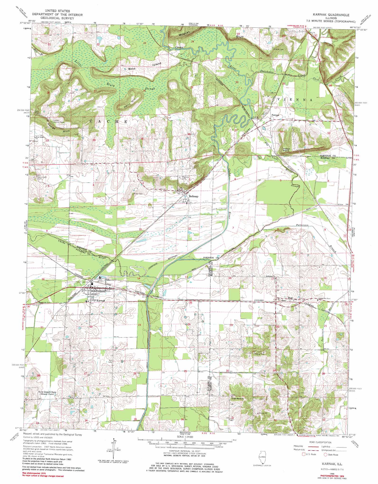
Karnak Topo Map Illinois
To zoom in, hover over the map of Karnak
USGS Topo Quad 37088c8 - 1:24,000 scale
| Topo Map Name: | Karnak |
| USGS Topo Quad ID: | 37088c8 |
| Print Size: | ca. 21 1/4" wide x 27" high |
| Southeast Coordinates: | 37.25° N latitude / 88.875° W longitude |
| Map Center Coordinates: | 37.3125° N latitude / 88.9375° W longitude |
| U.S. State: | IL |
| Filename: | o37088c8.jpg |
| Download Map JPG Image: | Karnak topo map 1:24,000 scale |
| Map Type: | Topographic |
| Topo Series: | 7.5´ |
| Map Scale: | 1:24,000 |
| Source of Map Images: | United States Geological Survey (USGS) |
| Alternate Map Versions: |
Karnak IL 1966, updated 1967 Download PDF Buy paper map Karnak IL 1966, updated 1982 Download PDF Buy paper map Karnak IL 1966, updated 1982 Download PDF Buy paper map Karnak IL 2012 Download PDF Buy paper map Karnak IL 2015 Download PDF Buy paper map |
1:24,000 Topo Quads surrounding Karnak
Makanda |
Lick Creek |
Goreville |
Creal Springs |
Stonefort |
Anna |
Mount Pleasant |
Vienna |
Bloomfield |
Glendale |
Dongola |
Cypress |
Karnak |
Mermet |
Reevesville |
Pulaski |
Olmsted |
Bandana |
Joppa |
Metropolis |
Cairo |
Barlow |
La Center |
Heath |
Paducah West |
> Back to 37088a1 at 1:100,000 scale
> Back to 37088a1 at 1:250,000 scale
> Back to U.S. Topo Maps home
Karnak topo map: Gazetteer
Karnak: Cliffs
George Bluff elevation 147m 482′Indian Point elevation 132m 433′
Wildcat Bluff elevation 119m 390′
Karnak: Islands
Boss Island elevation 116m 380′Karnak: Parks
Cache River State Natural Area elevation 116m 380′Cave Creek Glade Nature Preserve elevation 111m 364′
Heron Pond Preserve elevation 106m 347′
Little Black Slough Nature Preserve elevation 105m 344′
Karnak: Populated Places
Belknap elevation 123m 403′Boaz elevation 110m 360′
Forman elevation 107m 351′
Karnak elevation 104m 341′
Karnak: Post Offices
Ash Ridge Post Office (historical) elevation 148m 485′Lincoln Green Post Office (historical) elevation 120m 393′
Karnak: Streams
Bear Branch elevation 105m 344′Cave Creek elevation 104m 341′
Dutchman Creek elevation 104m 341′
Old Cache River elevation 99m 324′
Patterson Branch elevation 103m 337′
Karnak: Summits
Hairy Hill elevation 145m 475′Karnak: Swamps
Little Black Slough elevation 105m 344′Karnak digital topo map on disk
Buy this Karnak topo map showing relief, roads, GPS coordinates and other geographical features, as a high-resolution digital map file on DVD: