Mount Pleasant Topo Map Illinois
To zoom in, hover over the map of Mount Pleasant
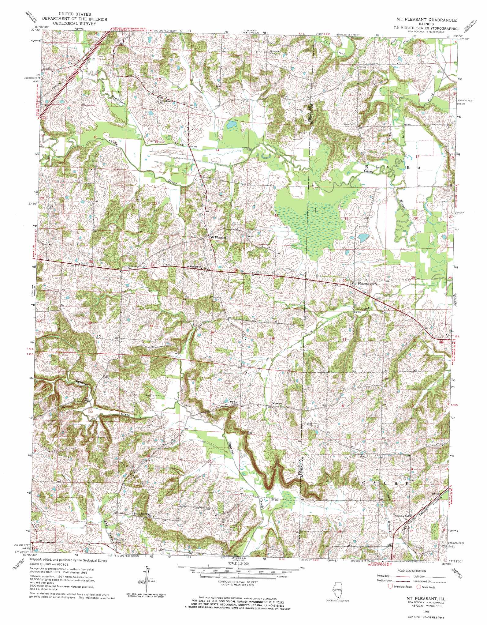
USGS Topo Quad 37089d1 - 1:24,000 scale
| Topo Map Name: | Mount Pleasant |
| USGS Topo Quad ID: | 37089d1 |
| Print Size: | ca. 21 1/4" wide x 27" high |
| Southeast Coordinates: | 37.375° N latitude / 89° W longitude |
| Map Center Coordinates: | 37.4375° N latitude / 89.0625° W longitude |
| U.S. State: | IL |
| Filename: | o37089d1.jpg |
| Download Map JPG Image: | Mount Pleasant topo map 1:24,000 scale |
| Map Type: | Topographic |
| Topo Series: | 7.5´ |
| Map Scale: | 1:24,000 |
| Source of Map Images: | United States Geological Survey (USGS) |
| Alternate Map Versions: |
Mt Pleasant IL 1966, updated 1967 Download PDF Buy paper map Mount Pleasant IL 2012 Download PDF Buy paper map Mount Pleasant IL 2015 Download PDF Buy paper map |
1:24,000 Topo Quads surrounding Mount Pleasant
Pomona |
Carbondale |
Crab Orchard Lake |
Marion |
Crab Orchard |
Cobden |
Makanda |
Lick Creek |
Goreville |
Creal Springs |
Jonesboro |
Anna |
Mount Pleasant |
Vienna |
Bloomfield |
Mill Creek |
Dongola |
Cypress |
Karnak |
Mermet |
Tamms |
Pulaski |
Olmsted |
Bandana |
Joppa |
> Back to 37089a1 at 1:100,000 scale
> Back to 37088a1 at 1:250,000 scale
> Back to U.S. Topo Maps home
Mount Pleasant topo map: Gazetteer
Mount Pleasant: Populated Places
Elvira elevation 139m 456′Moscow elevation 131m 429′
Mount Pleasant elevation 151m 495′
Pleasant Grove elevation 134m 439′
Mount Pleasant: Streams
Bradshaw Creek elevation 116m 380′Buck Branch elevation 116m 380′
Buck Run elevation 110m 360′
Lick Creek elevation 113m 370′
Mount Pleasant digital topo map on disk
Buy this Mount Pleasant topo map showing relief, roads, GPS coordinates and other geographical features, as a high-resolution digital map file on DVD: