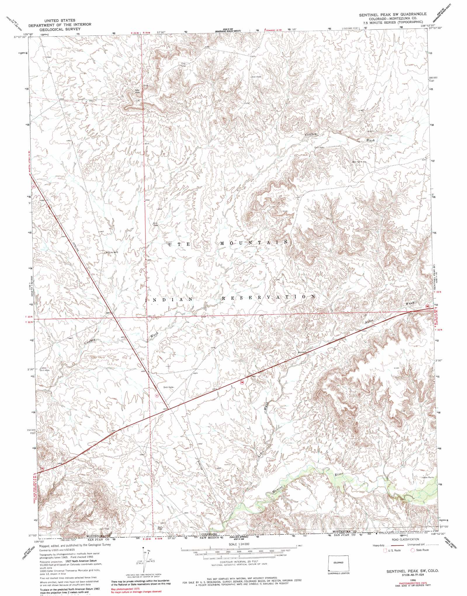
Sentinel Peak Sw Topo Map Colorado
To zoom in, hover over the map of Sentinel Peak Sw
USGS Topo Quad 37108a8 - 1:24,000 scale
| Topo Map Name: | Sentinel Peak Sw |
| USGS Topo Quad ID: | 37108a8 |
| Print Size: | ca. 21 1/4" wide x 27" high |
| Southeast Coordinates: | 37° N latitude / 108.875° W longitude |
| Map Center Coordinates: | 37.0625° N latitude / 108.9375° W longitude |
| U.S. State: | CO |
| Filename: | o37108a8.jpg |
| Download Map JPG Image: | Sentinel Peak Sw topo map 1:24,000 scale |
| Map Type: | Topographic |
| Topo Series: | 7.5´ |
| Map Scale: | 1:24,000 |
| Source of Map Images: | United States Geological Survey (USGS) |
| Alternate Map Versions: |
Sentinel Peak SW CO 1966, updated 1969 Download PDF Buy paper map Sentinel Peak SW CO 1966, updated 1970 Download PDF Buy paper map Sentinel Peak SW CO 1966, updated 1986 Download PDF Buy paper map Sentinel Peak SW CO 2010 Download PDF Buy paper map Sentinel Peak SW CO 2013 Download PDF Buy paper map Sentinel Peak SW CO 2016 Download PDF Buy paper map |
1:24,000 Topo Quads surrounding Sentinel Peak Sw
Navajo Canyon |
Wickiup Canyon |
Bowdish Canyon |
Battle Rock |
Mud Creek |
Aneth |
Peters Nipple |
Mariano Wash West |
Mariano Wash East |
Towaoc |
Yellow Rock Point West |
Aneth Se |
Sentinel Peak Sw |
Sentinel Peak Se |
Tanner Mesa |
Cow Butte |
Teec Nos Pos |
Sallies Spring |
Canal Creek |
Skinney Rock |
Pastora Peak |
Beclabito |
Rocky Point |
Rattlesnake |
Shiprock |
> Back to 37108a1 at 1:100,000 scale
> Back to 37108a1 at 1:250,000 scale
> Back to U.S. Topo Maps home
Sentinel Peak Sw digital topo map on disk
Buy this Sentinel Peak Sw topo map showing relief, roads, GPS coordinates and other geographical features, as a high-resolution digital map file on DVD: