Tanner Mesa Topo Map Colorado
To zoom in, hover over the map of Tanner Mesa
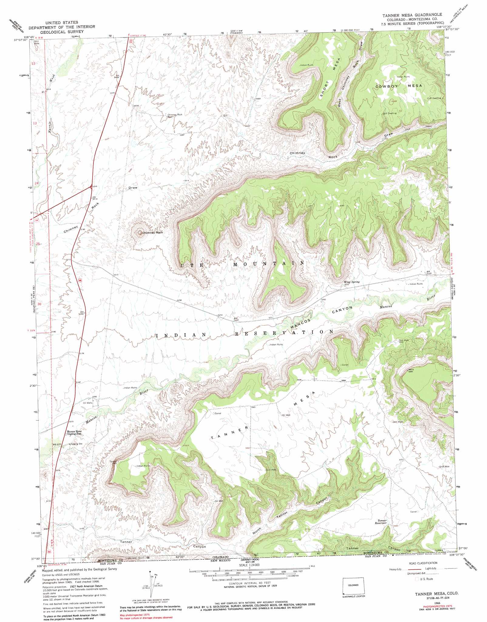
USGS Topo Quad 37108a6 - 1:24,000 scale
| Topo Map Name: | Tanner Mesa |
| USGS Topo Quad ID: | 37108a6 |
| Print Size: | ca. 21 1/4" wide x 27" high |
| Southeast Coordinates: | 37° N latitude / 108.625° W longitude |
| Map Center Coordinates: | 37.0625° N latitude / 108.6875° W longitude |
| U.S. State: | CO |
| Filename: | o37108a6.jpg |
| Download Map JPG Image: | Tanner Mesa topo map 1:24,000 scale |
| Map Type: | Topographic |
| Topo Series: | 7.5´ |
| Map Scale: | 1:24,000 |
| Source of Map Images: | United States Geological Survey (USGS) |
| Alternate Map Versions: |
Tanner Mesa CO 1966, updated 1969 Download PDF Buy paper map Tanner Mesa CO 1966, updated 1969 Download PDF Buy paper map Tanner Mesa CO 1966, updated 1986 Download PDF Buy paper map Tanner Mesa CO 2010 Download PDF Buy paper map Tanner Mesa CO 2013 Download PDF Buy paper map Tanner Mesa CO 2016 Download PDF Buy paper map |
1:24,000 Topo Quads surrounding Tanner Mesa
Bowdish Canyon |
Battle Rock |
Mud Creek |
Cortez |
Point Lookout |
Mariano Wash West |
Mariano Wash East |
Towaoc |
Wetherill Mesa |
Moccasin Mesa |
Sentinel Peak Sw |
Sentinel Peak Se |
Tanner Mesa |
Moqui Canyon |
Greasewood Canyon |
Sallies Spring |
Canal Creek |
Skinney Rock |
Palmer Mesa |
Heifer Point |
Rocky Point |
Rattlesnake |
Shiprock |
Chimney Rock |
Waterflow |
> Back to 37108a1 at 1:100,000 scale
> Back to 37108a1 at 1:250,000 scale
> Back to U.S. Topo Maps home
Tanner Mesa topo map: Gazetteer
Tanner Mesa: Pillars
Chimney Rock elevation 1861m 6105′Tanner Mesa: Reservoirs
Tanner Reservoir elevation 1743m 5718′Tanner Mesa: Springs
Wing Spring elevation 1619m 5311′Tanner Mesa: Summits
Cowboy Mesa elevation 1892m 6207′Short Mesa elevation 1928m 6325′
Tanner Mesa elevation 1608m 5275′
Tanner Mesa: Valleys
Mancos Canyon elevation 1568m 5144′North Tanner Canyon elevation 1599m 5246′
West Chimney Rock Draw elevation 1693m 5554′
Tanner Mesa: Wells
Chimney Rock Well elevation 1647m 5403′Tanner Mesa digital topo map on disk
Buy this Tanner Mesa topo map showing relief, roads, GPS coordinates and other geographical features, as a high-resolution digital map file on DVD: