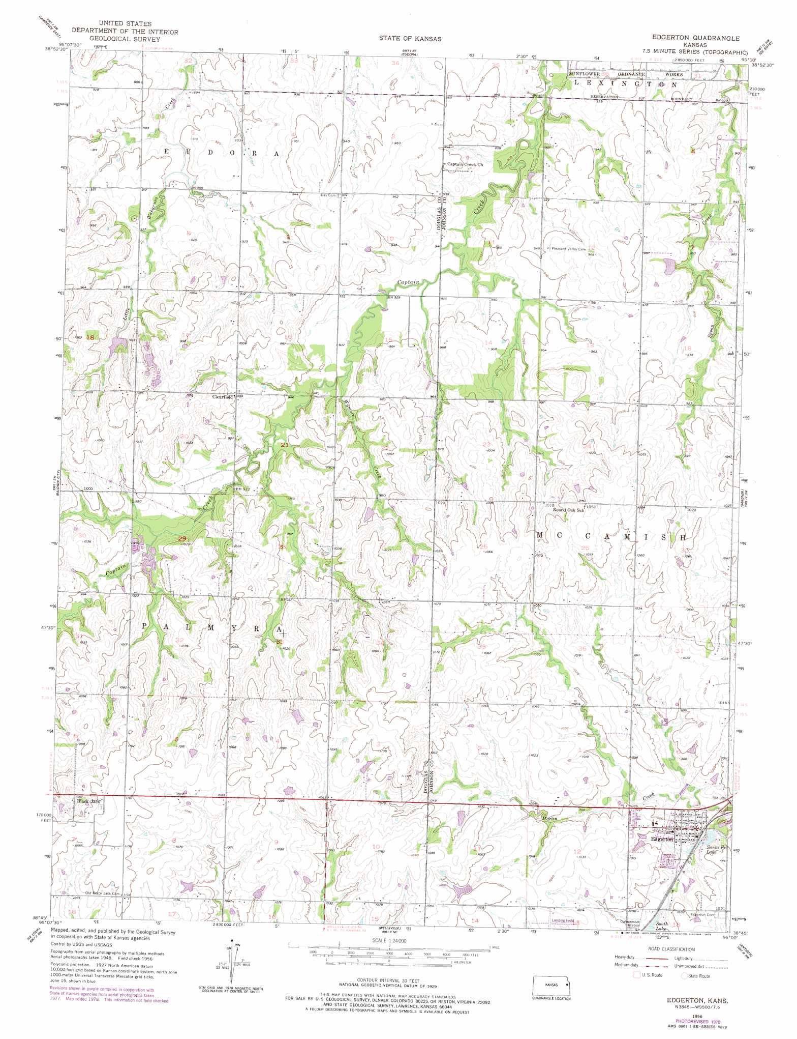
Edgerton Topo Map Kansas
To zoom in, hover over the map of Edgerton
USGS Topo Quad 38095g1 - 1:24,000 scale
| Topo Map Name: | Edgerton |
| USGS Topo Quad ID: | 38095g1 |
| Print Size: | ca. 21 1/4" wide x 27" high |
| Southeast Coordinates: | 38.75° N latitude / 95° W longitude |
| Map Center Coordinates: | 38.8125° N latitude / 95.0625° W longitude |
| U.S. State: | KS |
| Filename: | o38095g1.jpg |
| Download Map JPG Image: | Edgerton topo map 1:24,000 scale |
| Map Type: | Topographic |
| Topo Series: | 7.5´ |
| Map Scale: | 1:24,000 |
| Source of Map Images: | United States Geological Survey (USGS) |
| Alternate Map Versions: |
Edgerton KS 1956, updated 1958 Download PDF Buy paper map Edgerton KS 1956, updated 1978 Download PDF Buy paper map Edgerton KS 2009 Download PDF Buy paper map Edgerton KS 2012 Download PDF Buy paper map Edgerton KS 2015 Download PDF Buy paper map |
1:24,000 Topo Quads surrounding Edgerton
Williamstown |
Midland |
Tonganoxie |
Bonner Springs |
Edwardsville |
Lawrence West |
Lawrence East |
Eudora |
De Soto |
Olathe |
Lone Star |
Baldwin City |
Edgerton |
Gardner |
Ocheltree |
Ottawa North |
Le Loup |
Wellsville |
Antioch |
Spring Hill |
Ottawa South |
Peoria |
Rantoul |
Paola West |
Paola East |
> Back to 38095e1 at 1:100,000 scale
> Back to 38094a1 at 1:250,000 scale
> Back to U.S. Topo Maps home
Edgerton topo map: Gazetteer
Edgerton: Airports
Konitz Airport elevation 318m 1043′Edgerton: Lakes
Edgerton City Lake elevation 295m 967′Edgerton: Parks
Martin Creek Park elevation 307m 1007′Edgerton: Populated Places
Black Jack elevation 337m 1105′Clearfield elevation 305m 1000′
Edgerton elevation 305m 1000′
Edgerton Mobile Home Park elevation 308m 1010′
Prairie Center (historical) elevation 297m 974′
Edgerton: Post Offices
Edgerton Post Office elevation 305m 1000′Edgerton: Reservoirs
Santa Fe Lake elevation 290m 951′South Lake elevation 298m 977′
Edgerton: Streams
Wymore Creek elevation 286m 938′Edgerton digital topo map on disk
Buy this Edgerton topo map showing relief, roads, GPS coordinates and other geographical features, as a high-resolution digital map file on DVD: