Newton Topo Map Kansas
To zoom in, hover over the map of Newton
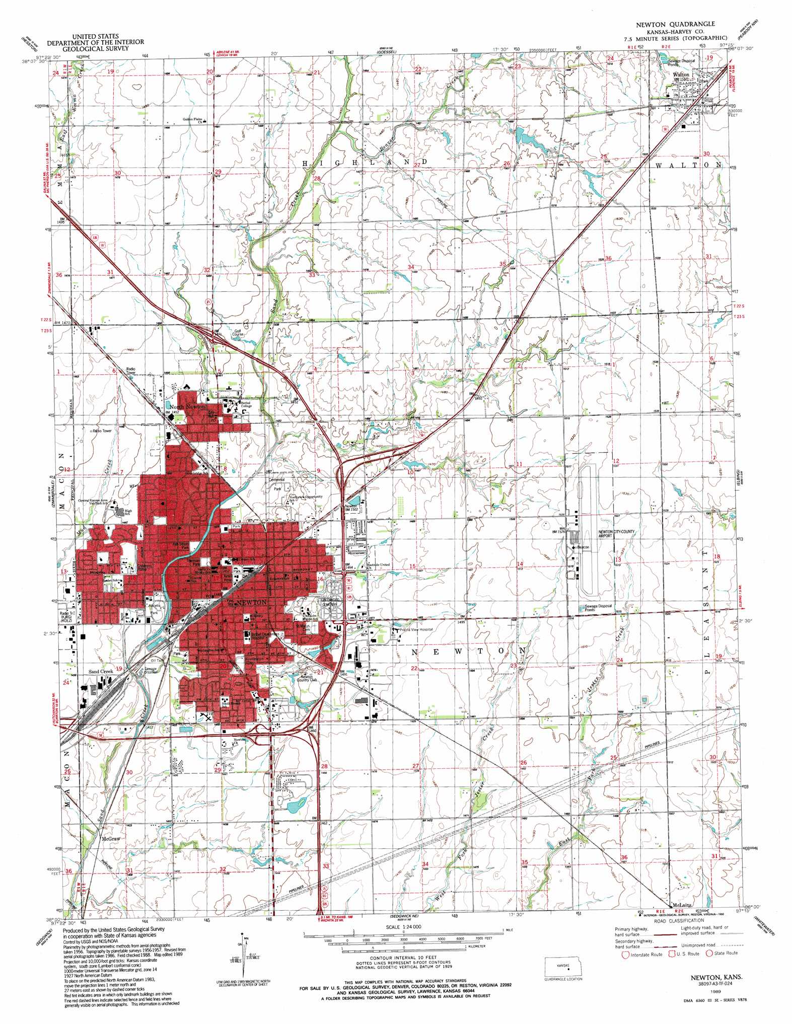
USGS Topo Quad 38097a3 - 1:24,000 scale
| Topo Map Name: | Newton |
| USGS Topo Quad ID: | 38097a3 |
| Print Size: | ca. 21 1/4" wide x 27" high |
| Southeast Coordinates: | 38° N latitude / 97.25° W longitude |
| Map Center Coordinates: | 38.0625° N latitude / 97.3125° W longitude |
| U.S. State: | KS |
| Filename: | o38097a3.jpg |
| Download Map JPG Image: | Newton topo map 1:24,000 scale |
| Map Type: | Topographic |
| Topo Series: | 7.5´ |
| Map Scale: | 1:24,000 |
| Source of Map Images: | United States Geological Survey (USGS) |
| Alternate Map Versions: |
Newton KS 1957, updated 1958 Download PDF Buy paper map Newton KS 1957, updated 1978 Download PDF Buy paper map Newton KS 1989, updated 1990 Download PDF Buy paper map Newton KS 2009 Download PDF Buy paper map Newton KS 2012 Download PDF Buy paper map Newton KS 2015 Download PDF Buy paper map |
1:24,000 Topo Quads surrounding Newton
Mcpherson Se |
Canton Sw |
Lehigh |
Hillsboro |
Marion |
Moundridge |
Hesston |
Goessel |
Peabody Nw |
Peabody |
Halstead |
Zimmerdale |
Newton |
Elbing |
Peabody Se |
Bentley |
Sedgwick |
Sedgwick Ne |
Whitewater |
Potwin |
Colwich |
Maize |
Valley Center |
Greenwich |
Benton |
> Back to 38097a1 at 1:100,000 scale
> Back to 38096a1 at 1:250,000 scale
> Back to U.S. Topo Maps home
Newton topo map: Gazetteer
Newton: Airports
Eightyone Airport elevation 448m 1469′Newton City-County Airport elevation 465m 1525′
Newton: Parks
Themian Park elevation 437m 1433′Washington Park elevation 433m 1420′
Newton: Populated Places
McGraw elevation 428m 1404′Newton elevation 441m 1446′
North Newton elevation 438m 1437′
Sand Creek elevation 436m 1430′
Walton elevation 467m 1532′
Newton: Streams
Beaver Creek elevation 439m 1440′Newton digital topo map on disk
Buy this Newton topo map showing relief, roads, GPS coordinates and other geographical features, as a high-resolution digital map file on DVD: