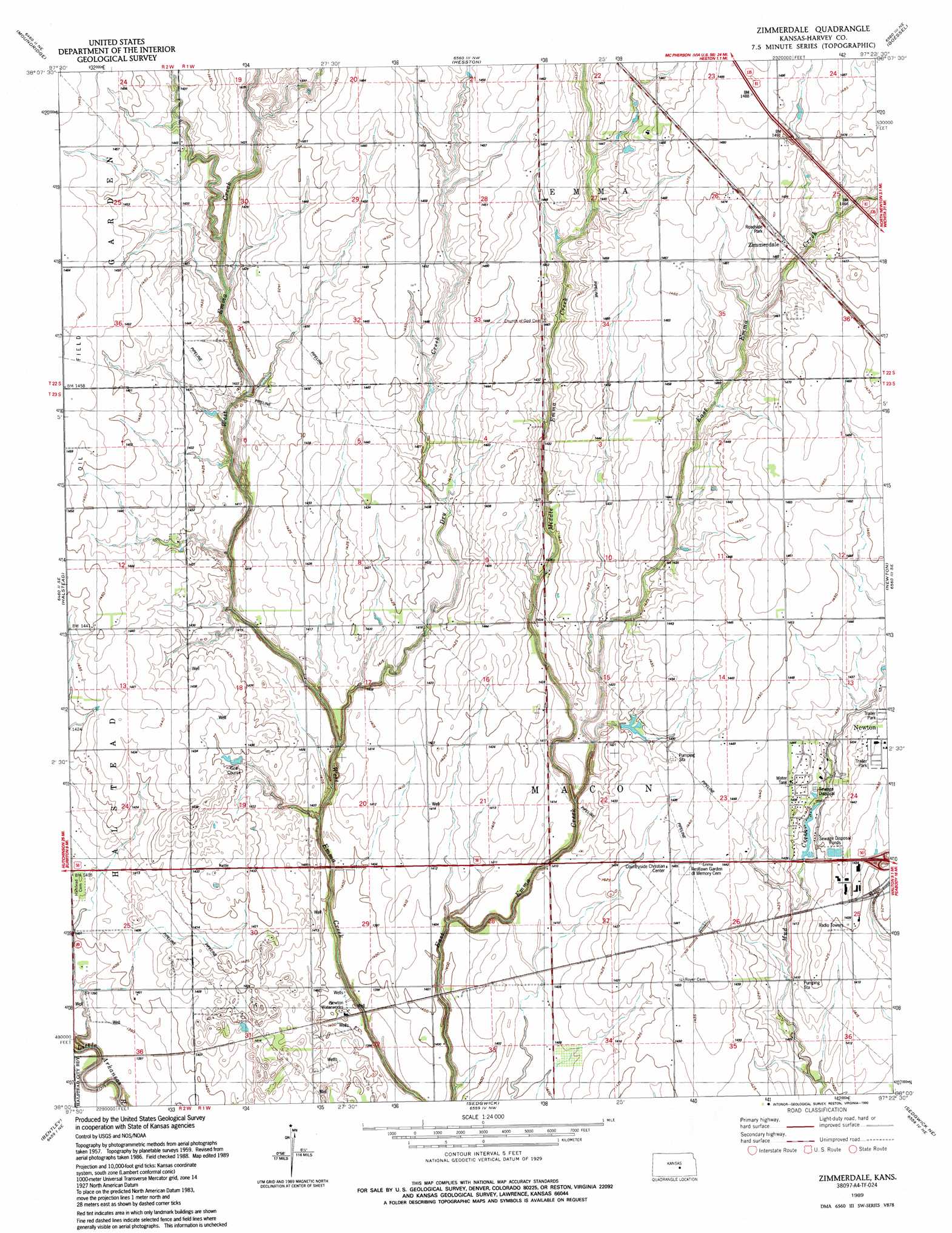
Zimmerdale Topo Map Kansas
To zoom in, hover over the map of Zimmerdale
USGS Topo Quad 38097a4 - 1:24,000 scale
| Topo Map Name: | Zimmerdale |
| USGS Topo Quad ID: | 38097a4 |
| Print Size: | ca. 21 1/4" wide x 27" high |
| Southeast Coordinates: | 38° N latitude / 97.375° W longitude |
| Map Center Coordinates: | 38.0625° N latitude / 97.4375° W longitude |
| U.S. State: | KS |
| Filename: | o38097a4.jpg |
| Download Map JPG Image: | Zimmerdale topo map 1:24,000 scale |
| Map Type: | Topographic |
| Topo Series: | 7.5´ |
| Map Scale: | 1:24,000 |
| Source of Map Images: | United States Geological Survey (USGS) |
| Alternate Map Versions: |
Zimmerdale KS 1959, updated 1960 Download PDF Buy paper map Zimmerdale KS 1959, updated 1976 Download PDF Buy paper map Zimmerdale KS 1959, updated 1978 Download PDF Buy paper map Zimmerdale KS 1959, updated 1979 Download PDF Buy paper map Zimmerdale KS 1989, updated 1990 Download PDF Buy paper map Zimmerdale KS 2009 Download PDF Buy paper map Zimmerdale KS 2012 Download PDF Buy paper map Zimmerdale KS 2015 Download PDF Buy paper map |
1:24,000 Topo Quads surrounding Zimmerdale
Mcpherson South |
Mcpherson Se |
Canton Sw |
Lehigh |
Hillsboro |
Halstead Nw |
Moundridge |
Hesston |
Goessel |
Peabody Nw |
Burrton |
Halstead |
Zimmerdale |
Newton |
Elbing |
Patterson |
Bentley |
Sedgwick |
Sedgwick Ne |
Whitewater |
Mount Hope |
Colwich |
Maize |
Valley Center |
Greenwich |
> Back to 38097a1 at 1:100,000 scale
> Back to 38096a1 at 1:250,000 scale
> Back to U.S. Topo Maps home
Zimmerdale topo map: Gazetteer
Zimmerdale: Airports
Weaver Ranch Airport elevation 453m 1486′Zimmerdale: Populated Places
Zimmerdale elevation 447m 1466′Zimmerdale: Streams
Dry Creek elevation 424m 1391′Middle Emma Creek elevation 425m 1394′
Zimmerdale digital topo map on disk
Buy this Zimmerdale topo map showing relief, roads, GPS coordinates and other geographical features, as a high-resolution digital map file on DVD: