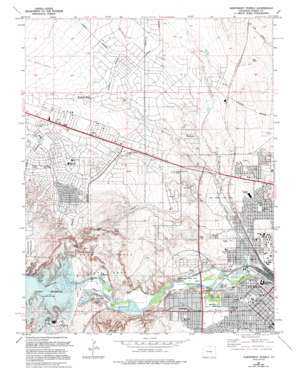
Northwest Pueblo Topo Map Colorado
To zoom in, hover over the map of Northwest Pueblo
USGS Topo Quad 38104c6 - 1:24,000 scale
| Topo Map Name: | Northwest Pueblo |
| USGS Topo Quad ID: | 38104c6 |
| Print Size: | ca. 21 1/4" wide x 27" high |
| Southeast Coordinates: | 38.25° N latitude / 104.625° W longitude |
| Map Center Coordinates: | 38.3125° N latitude / 104.6875° W longitude |
| U.S. State: | CO |
| Filename: | o38104c6.jpg |
| Download Map JPG Image: | Northwest Pueblo topo map 1:24,000 scale |
| Map Type: | Topographic |
| Topo Series: | 7.5´ |
| Map Scale: | 1:24,000 |
| Source of Map Images: | United States Geological Survey (USGS) |
| Alternate Map Versions: |
Northwest Pueblo CO 1961, updated 1962 Download PDF Buy paper map Northwest Pueblo CO 1961, updated 1962 Download PDF Buy paper map Northwest Pueblo CO 1961, updated 1970 Download PDF Buy paper map Northwest Pueblo CO 1961, updated 1970 Download PDF Buy paper map Northwest Pueblo CO 1961, updated 1972 Download PDF Buy paper map Northwest Pueblo CO 1961, updated 1972 Download PDF Buy paper map Northwest Pueblo CO 1961, updated 1974 Download PDF Buy paper map Northwest Pueblo CO 1961, updated 1976 Download PDF Buy paper map Northwest Pueblo CO 1961, updated 1976 Download PDF Buy paper map Northwest Pueblo CO 1961, updated 1985 Download PDF Buy paper map Northwest Pueblo CO 1961, updated 1994 Download PDF Buy paper map Northwest Pueblo CO 2010 Download PDF Buy paper map Northwest Pueblo CO 2013 Download PDF Buy paper map Northwest Pueblo CO 2016 Download PDF Buy paper map |
1:24,000 Topo Quads surrounding Northwest Pueblo
> Back to 38104a1 at 1:100,000 scale
> Back to 38104a1 at 1:250,000 scale
> Back to U.S. Topo Maps home
Northwest Pueblo topo map: Gazetteer
Northwest Pueblo: Airports
Edenway Airport elevation 1508m 4947′Northwest Pueblo: Canals
Pueblo Intake elevation 1433m 4701′West Pueblo Ditch elevation 1438m 4717′
Northwest Pueblo: Cliffs
Liberty Point elevation 1565m 5134′Northwest Pueblo: Dams
Pueblo Dam elevation 1460m 4790′Trustees Pueblo WW Number 2 Dam elevation 1455m 4773′
Northwest Pueblo: Parks
Bruner Park elevation 1458m 4783′Fairmont Park elevation 1466m 4809′
Northwest Pueblo: Populated Places
Goodnight elevation 1455m 4773′Pueblo West elevation 1544m 5065′
Wild Horse elevation 1489m 4885′
Northwest Pueblo: Reservoirs
Northside Reservoir elevation 1429m 4688′Pueblo Reservoir elevation 1460m 4790′
Southside Reservoirs elevation 1432m 4698′
Trustees Pueblo WW Reservoir Number 2 elevation 1455m 4773′
Northwest Pueblo: Streams
Blue Ribbon Creek elevation 1437m 4714′Boggs Creek elevation 1471m 4826′
Dry Creek elevation 1423m 4668′
Wild Horse Creek elevation 1467m 4812′
Williams Creek elevation 1448m 4750′
Northwest Pueblo: Valleys
Rock Canyon elevation 1441m 4727′Northwest Pueblo digital topo map on disk
Buy this Northwest Pueblo topo map showing relief, roads, GPS coordinates and other geographical features, as a high-resolution digital map file on DVD:


