Falcon Nw Topo Map Colorado
To zoom in, hover over the map of Falcon Nw
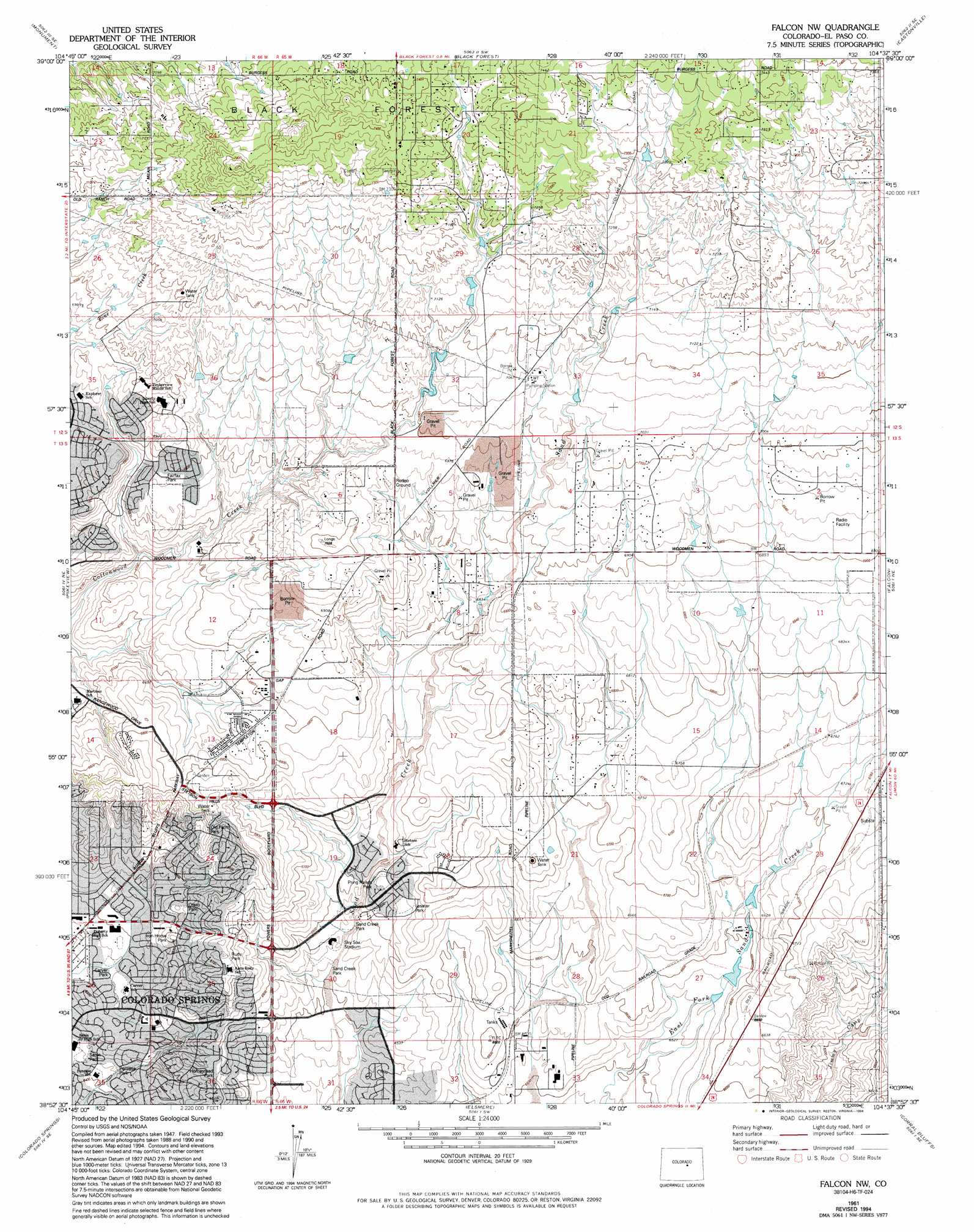
USGS Topo Quad 38104h6 - 1:24,000 scale
| Topo Map Name: | Falcon Nw |
| USGS Topo Quad ID: | 38104h6 |
| Print Size: | ca. 21 1/4" wide x 27" high |
| Southeast Coordinates: | 38.875° N latitude / 104.625° W longitude |
| Map Center Coordinates: | 38.9375° N latitude / 104.6875° W longitude |
| U.S. State: | CO |
| Filename: | o38104h6.jpg |
| Download Map JPG Image: | Falcon Nw topo map 1:24,000 scale |
| Map Type: | Topographic |
| Topo Series: | 7.5´ |
| Map Scale: | 1:24,000 |
| Source of Map Images: | United States Geological Survey (USGS) |
| Alternate Map Versions: |
Falcon NW CO 1948, updated 1960 Download PDF Buy paper map Falcon NW CO 1950 Download PDF Buy paper map Falcon NW CO 1950 Download PDF Buy paper map Falcon NW CO 1961, updated 1963 Download PDF Buy paper map Falcon NW CO 1961, updated 1970 Download PDF Buy paper map Falcon NW CO 1961, updated 1970 Download PDF Buy paper map Falcon NW CO 1961, updated 1977 Download PDF Buy paper map Falcon NW CO 1961, updated 1986 Download PDF Buy paper map Falcon NW CO 1961, updated 1994 Download PDF Buy paper map Falcon NW CO 2010 Download PDF Buy paper map Falcon NW CO 2013 Download PDF Buy paper map Falcon NW CO 2016 Download PDF Buy paper map |
1:24,000 Topo Quads surrounding Falcon Nw
Larkspur |
Greenland |
Cherry Valley School |
Elbert |
Bijou Basin |
Palmer Lake |
Monument |
Black Forest |
Eastonville |
Peyton |
Cascade |
Pikeview |
Falcon Nw |
Falcon |
Haegler Ranch |
Manitou Springs |
Colorado Springs |
Elsmere |
Corral Bluffs |
Ellicott |
Mount Big Chief |
Cheyenne Mountain |
Fountain |
Fountain Ne |
Hanover Nw |
> Back to 38104e1 at 1:100,000 scale
> Back to 38104a1 at 1:250,000 scale
> Back to U.S. Topo Maps home
Falcon Nw topo map: Gazetteer
Falcon Nw: Airports
G W Flanders Ranch Strip elevation 2214m 7263′Falcon Nw: Dams
Banning Lewis Number 1 Dam elevation 2007m 6584′Falcon Nw: Populated Places
Shirley elevation 2035m 6676′Falcon Nw: Reservoirs
Banning Lewis Reservoir Number 1 elevation 2007m 6584′Falcon Nw digital topo map on disk
Buy this Falcon Nw topo map showing relief, roads, GPS coordinates and other geographical features, as a high-resolution digital map file on DVD: