Photograph Gap Topo Map Utah
To zoom in, hover over the map of Photograph Gap
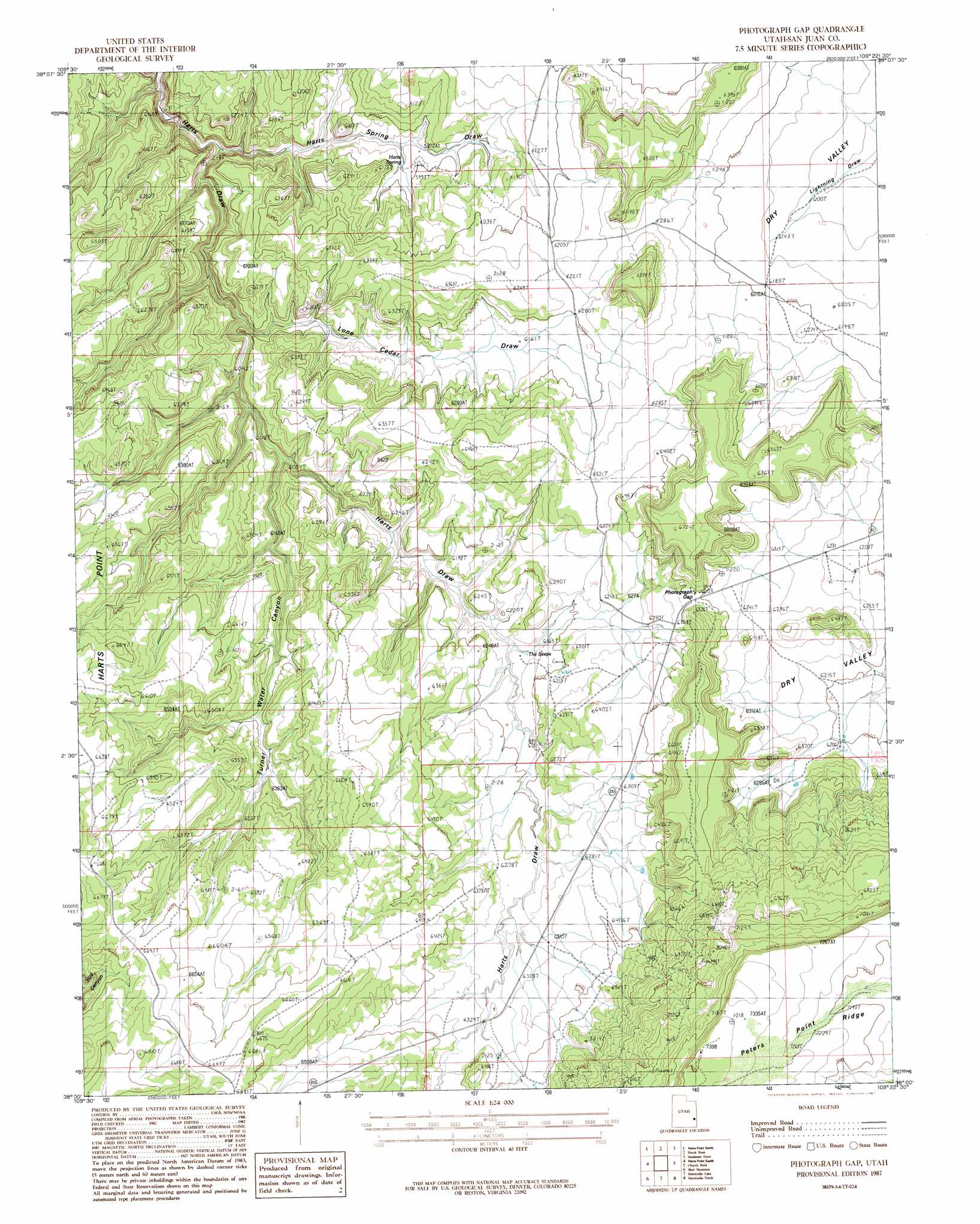
USGS Topo Quad 38109a4 - 1:24,000 scale
| Topo Map Name: | Photograph Gap |
| USGS Topo Quad ID: | 38109a4 |
| Print Size: | ca. 21 1/4" wide x 27" high |
| Southeast Coordinates: | 38° N latitude / 109.375° W longitude |
| Map Center Coordinates: | 38.0625° N latitude / 109.4375° W longitude |
| U.S. State: | UT |
| Filename: | o38109a4.jpg |
| Download Map JPG Image: | Photograph Gap topo map 1:24,000 scale |
| Map Type: | Topographic |
| Topo Series: | 7.5´ |
| Map Scale: | 1:24,000 |
| Source of Map Images: | United States Geological Survey (USGS) |
| Alternate Map Versions: |
Mt Peale 3 SW UT 1954, updated 1955 Download PDF Buy paper map Photograph Gap UT 1987, updated 1987 Download PDF Buy paper map Photograph Gap UT 2011 Download PDF Buy paper map Photograph Gap UT 2014 Download PDF Buy paper map |
1:24,000 Topo Quads surrounding Photograph Gap
Lockhart Basin |
Eightmile Rock |
La Sal Junction |
La Sal West |
La Sal East |
North Six-Shooter Peak |
Harts Point North |
Hatch Rock |
Sandstone Draw |
Lisbon Valley |
South Six-Shooter Peak |
Harts Point South |
Photograph Gap |
Church Rock |
Sop Canyon |
Cathedral Butte |
Shay Mountain |
Monticello Lake |
Monticello North |
Eastland Nw |
Chippean Rocks |
Mount Linnaeus |
Abajo Peak |
Monticello South |
Eastland |
> Back to 38109a1 at 1:100,000 scale
> Back to 38108a1 at 1:250,000 scale
> Back to U.S. Topo Maps home
Photograph Gap topo map: Gazetteer
Photograph Gap: Capes
Peters Point elevation 2218m 7276′Photograph Gap: Springs
Harts Spring elevation 1807m 5928′Photograph Gap: Valleys
Cedar Draw elevation 1777m 5830′Harts Spring Draw elevation 1720m 5643′
Lone Cedar Draw elevation 1780m 5839′
Turner Water Canyon elevation 1814m 5951′
Photograph Gap digital topo map on disk
Buy this Photograph Gap topo map showing relief, roads, GPS coordinates and other geographical features, as a high-resolution digital map file on DVD: