Angle Topo Map Utah
To zoom in, hover over the map of Angle
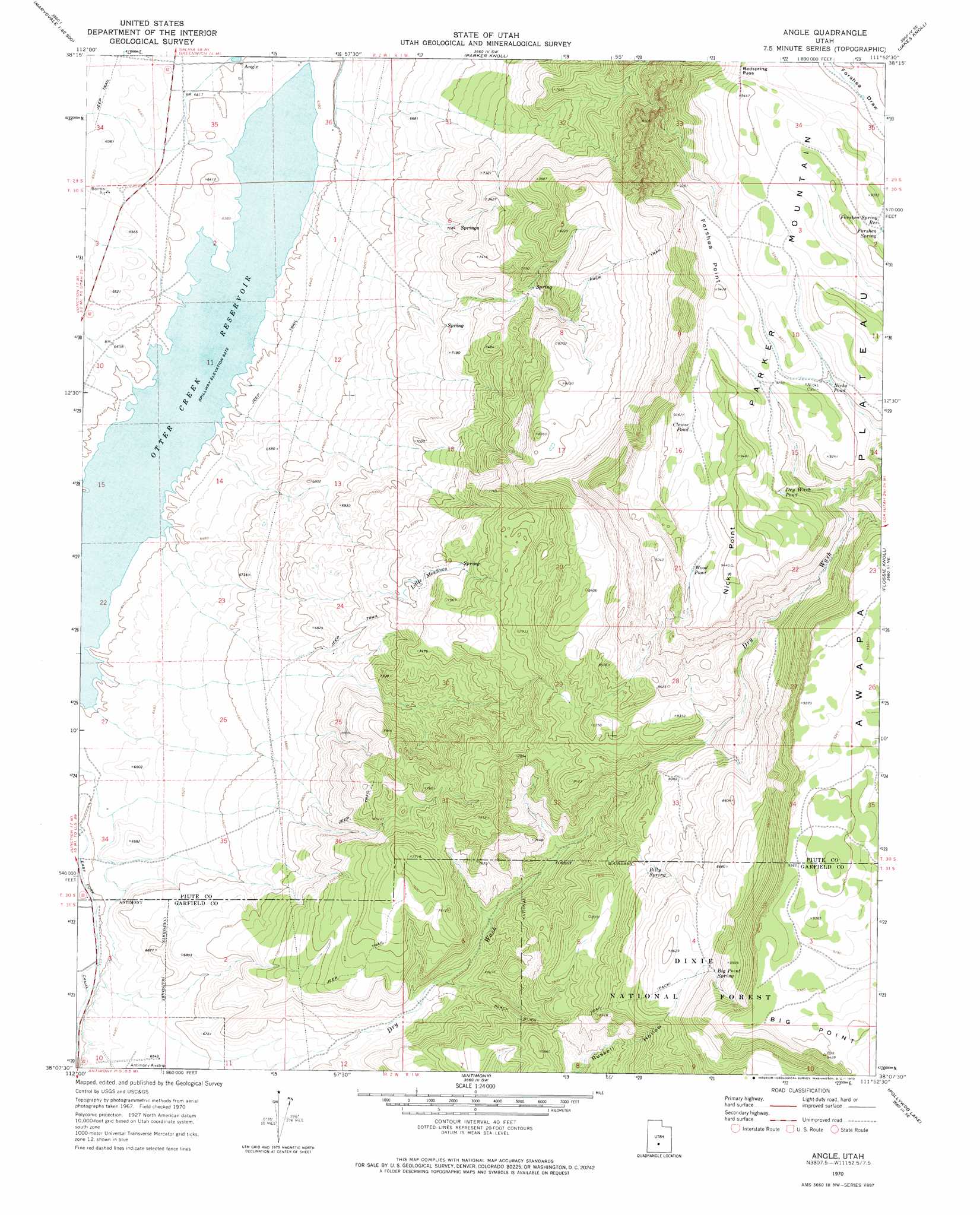
USGS Topo Quad 38111b8 - 1:24,000 scale
| Topo Map Name: | Angle |
| USGS Topo Quad ID: | 38111b8 |
| Print Size: | ca. 21 1/4" wide x 27" high |
| Southeast Coordinates: | 38.125° N latitude / 111.875° W longitude |
| Map Center Coordinates: | 38.1875° N latitude / 111.9375° W longitude |
| U.S. State: | UT |
| Filename: | o38111b8.jpg |
| Download Map JPG Image: | Angle topo map 1:24,000 scale |
| Map Type: | Topographic |
| Topo Series: | 7.5´ |
| Map Scale: | 1:24,000 |
| Source of Map Images: | United States Geological Survey (USGS) |
| Alternate Map Versions: |
Angle UT 1970, updated 1972 Download PDF Buy paper map Angle UT 2002, updated 2005 Download PDF Buy paper map Angle UT 2011 Download PDF Buy paper map Angle UT 2014 Download PDF Buy paper map |
| FStopo: | US Forest Service topo Angle is available: Download FStopo PDF Download FStopo TIF |
1:24,000 Topo Quads surrounding Angle
Marysvale |
Marysvale Peak |
Greenwich |
Abes Knoll |
Loa |
Piute Reservoir |
Malmsten Peak |
Parker Knoll |
Jakes Knoll |
Moroni Peak |
Junction |
Phonolite Hill |
Angle |
Flossie Knoll |
Smooth Knoll |
Mount Dutton |
Deep Creek |
Antimony |
Pollywog Lake |
Big Lake |
Adams Head |
Cow Creek |
Grass Lakes |
Barker Reservoir |
Posy Lake |
> Back to 38111a1 at 1:100,000 scale
> Back to 38110a1 at 1:250,000 scale
> Back to U.S. Topo Maps home
Angle topo map: Gazetteer
Angle: Canals
East Fork Canal elevation 1947m 6387′Angle: Capes
Forshea Point elevation 2821m 9255′Angle: Flats
Little Meadows elevation 2204m 7230′Angle: Gaps
Bedspring Pass elevation 2846m 9337′Angle: Lakes
Clause Pond elevation 2837m 9307′Dry Wash Pond elevation 2799m 9183′
Nicks Pond elevation 2803m 9196′
Wood Pond elevation 2817m 9242′
Angle: Populated Places
Angle elevation 1952m 6404′Angle: Reservoirs
Forshea Spring Reservoir elevation 2832m 9291′Angle: Springs
Big Point Spring elevation 2642m 8667′Billy Spring elevation 2467m 8093′
Forshea Spring elevation 2837m 9307′
Angle: Streams
Otter Creek elevation 1944m 6377′Angle: Summits
Big Point elevation 2867m 9406′Nicks Point elevation 2870m 9416′
Angle: Trails
Black Burn Trail elevation 2431m 7975′Angle digital topo map on disk
Buy this Angle topo map showing relief, roads, GPS coordinates and other geographical features, as a high-resolution digital map file on DVD: