Pine Valley Hardpan North Topo Map Utah
To zoom in, hover over the map of Pine Valley Hardpan North
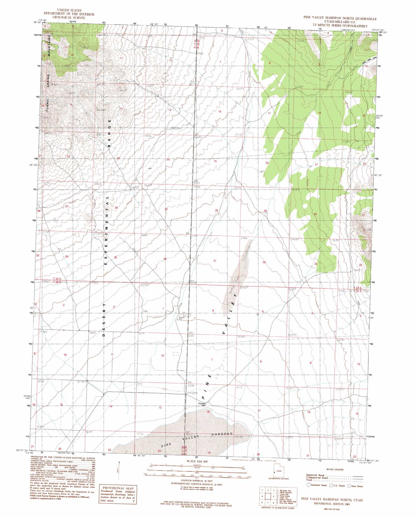
USGS Topo Quad 38113f6 - 1:24,000 scale
| Topo Map Name: | Pine Valley Hardpan North |
| USGS Topo Quad ID: | 38113f6 |
| Print Size: | ca. 21 1/4" wide x 27" high |
| Southeast Coordinates: | 38.625° N latitude / 113.625° W longitude |
| Map Center Coordinates: | 38.6875° N latitude / 113.6875° W longitude |
| U.S. State: | UT |
| Filename: | o38113f6.jpg |
| Download Map JPG Image: | Pine Valley Hardpan North topo map 1:24,000 scale |
| Map Type: | Topographic |
| Topo Series: | 7.5´ |
| Map Scale: | 1:24,000 |
| Source of Map Images: | United States Geological Survey (USGS) |
| Alternate Map Versions: |
Pine Valley Hardpan North UT 1989, updated 1989 Download PDF Buy paper map Pine Valley Hardpan North UT 2010 Download PDF Buy paper map Pine Valley Hardpan North UT 2014 Download PDF Buy paper map |
| FStopo: | US Forest Service topo Pine Valley Hardpan North is available: Download FStopo PDF Download FStopo TIF |
1:24,000 Topo Quads surrounding Pine Valley Hardpan North
Burbank Pass |
Deadman Point |
Pyramid Knoll |
King Top |
The Barn |
Cedar Pass |
Big Jensen Pass |
Middle Mountain |
Crystal Peak |
Warm Point |
Mormon Gap |
Tunnel Spring |
Pine Valley Hardpan North |
Grassy Cove |
Fifteenmile Point |
Mountain Home Pass |
Halfway Summit |
Pine Valley Hardpan South |
Wah Wah Summit |
Wah Wah Cove |
Lopers Spring |
Sawtooth Peak |
Lamerdorf Peak Nw |
Sewing Machine Pass |
Wallaces Peak |
> Back to 38113e1 at 1:100,000 scale
> Back to 38112a1 at 1:250,000 scale
> Back to U.S. Topo Maps home
Pine Valley Hardpan North topo map: Gazetteer
Pine Valley Hardpan North: Wells
Guyman Well elevation 1551m 5088′Pine Valley Hardpan North digital topo map on disk
Buy this Pine Valley Hardpan North topo map showing relief, roads, GPS coordinates and other geographical features, as a high-resolution digital map file on DVD: