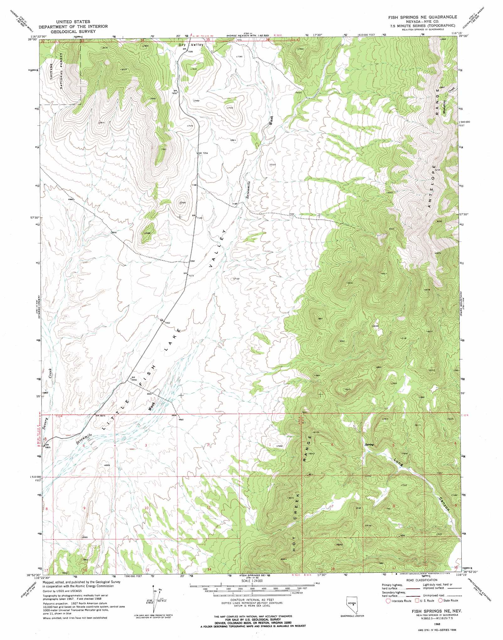
Fish Springs Ne Topo Map Nevada
To zoom in, hover over the map of Fish Springs Ne
USGS Topo Quad 38116h3 - 1:24,000 scale
| Topo Map Name: | Fish Springs Ne |
| USGS Topo Quad ID: | 38116h3 |
| Print Size: | ca. 21 1/4" wide x 27" high |
| Southeast Coordinates: | 38.875° N latitude / 116.25° W longitude |
| Map Center Coordinates: | 38.9375° N latitude / 116.3125° W longitude |
| U.S. State: | NV |
| Filename: | o38116h3.jpg |
| Download Map JPG Image: | Fish Springs Ne topo map 1:24,000 scale |
| Map Type: | Topographic |
| Topo Series: | 7.5´ |
| Map Scale: | 1:24,000 |
| Source of Map Images: | United States Geological Survey (USGS) |
| Alternate Map Versions: |
Fish Springs NE NV 1968, updated 1972 Download PDF Buy paper map Fish Springs NE NV 1968, updated 1972 Download PDF Buy paper map Fish Springs NE NV 2012 Download PDF Buy paper map Fish Springs NE NV 2014 Download PDF Buy paper map |
| FStopo: | US Forest Service topo Fish Springs NE is available: Download FStopo PDF Download FStopo TIF |
1:24,000 Topo Quads surrounding Fish Springs Ne
White Sage Canyon |
Horse Heaven Mountain |
Ninemile Peak |
Cockalorum Spring |
Eightmile Well |
Butler Ranch |
Savory Mountain |
Segura Ranch |
Snowball Ranch |
East Of Snowball Ranch |
Dobbin Summit |
Stargo Creek |
Fish Springs Ne |
Park Mountain |
Summit Station |
Danville |
Fish Springs |
Fish Springs Se |
Pritchards Station |
Red Ring Mountain |
Green Monster Canyon |
Upper Fish Lake |
Morey Peak |
Moores Station |
Chaos Creek |
> Back to 38116e1 at 1:100,000 scale
> Back to 38116a1 at 1:250,000 scale
> Back to U.S. Topo Maps home
Fish Springs Ne topo map: Gazetteer
Fish Springs Ne: Springs
Road Canyon Spring elevation 2237m 7339′Snowball Spring Number Seven elevation 2495m 8185′
Snowball Spring Number Six elevation 2628m 8622′
Willow Spring elevation 2281m 7483′
Willow Spring Two elevation 2228m 7309′
Fish Springs Ne: Valleys
Dry Valley elevation 2290m 7513′Fish Springs Ne digital topo map on disk
Buy this Fish Springs Ne topo map showing relief, roads, GPS coordinates and other geographical features, as a high-resolution digital map file on DVD: