Mitchell Spring Topo Map Nevada
To zoom in, hover over the map of Mitchell Spring
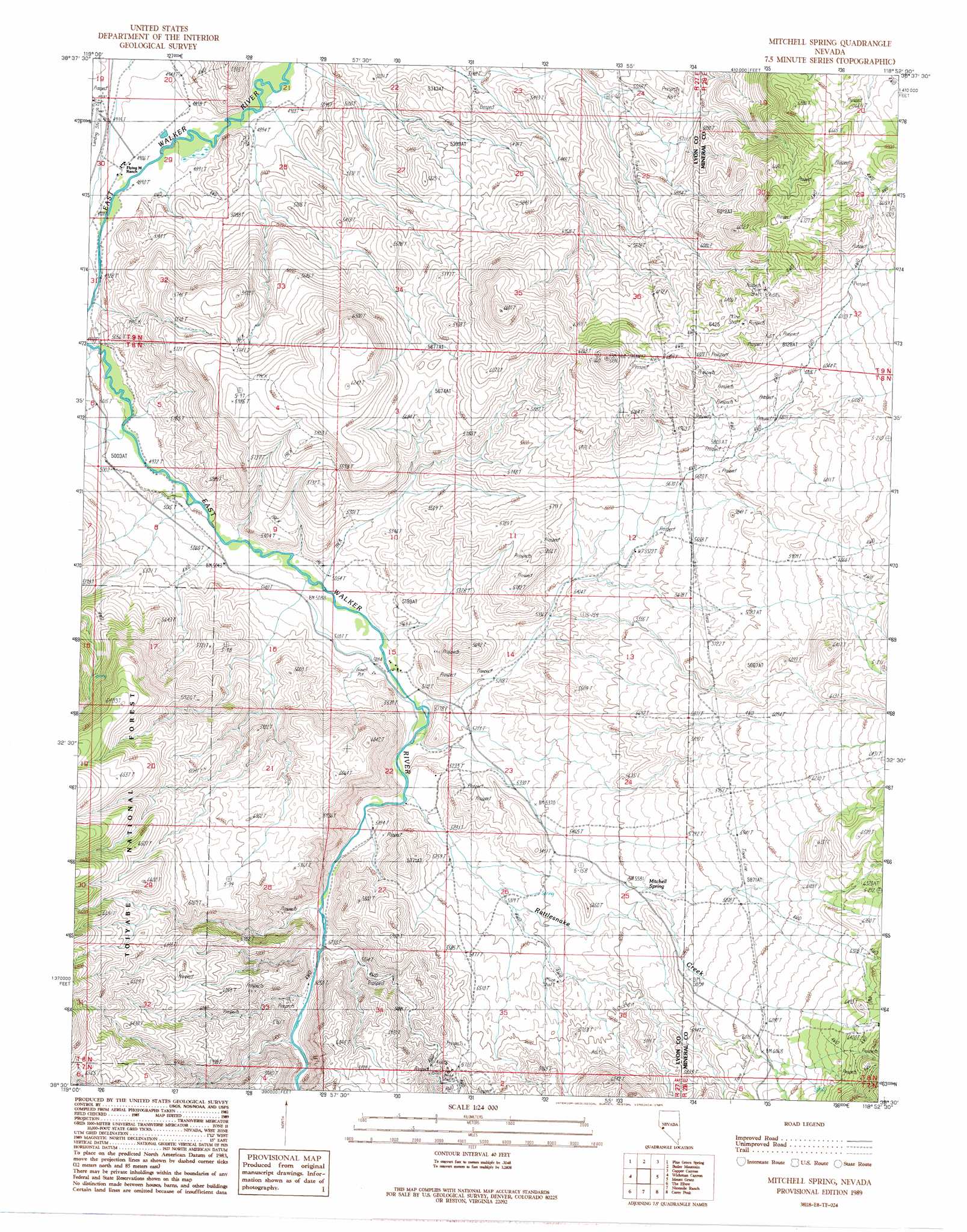
USGS Topo Quad 38118e8 - 1:24,000 scale
| Topo Map Name: | Mitchell Spring |
| USGS Topo Quad ID: | 38118e8 |
| Print Size: | ca. 21 1/4" wide x 27" high |
| Southeast Coordinates: | 38.5° N latitude / 118.875° W longitude |
| Map Center Coordinates: | 38.5625° N latitude / 118.9375° W longitude |
| U.S. State: | NV |
| Filename: | o38118e8.jpg |
| Download Map JPG Image: | Mitchell Spring topo map 1:24,000 scale |
| Map Type: | Topographic |
| Topo Series: | 7.5´ |
| Map Scale: | 1:24,000 |
| Source of Map Images: | United States Geological Survey (USGS) |
| Alternate Map Versions: |
Mitchell Spring NV 1989, updated 1989 Download PDF Buy paper map Mitchell Spring NV 2011 Download PDF Buy paper map Mitchell Spring NV 2014 Download PDF Buy paper map |
| FStopo: | US Forest Service topo Mitchell Spring is available: Download FStopo PDF Download FStopo TIF |
1:24,000 Topo Quads surrounding Mitchell Spring
Wilson Canyon |
Yerington Se |
Buck Brush Spring |
Reese River Canyon |
Gillis Canyon |
Mount Etna |
Pine Grove Spring |
Butler Mountain |
Copper Canyon |
Walker Lake |
Nye Canyon |
Wichman Canyon |
Mitchell Spring |
Mount Grant |
Hawthorne West |
Sweetwater Creek |
The Elbow |
Ninemile Ranch |
Corey Peak |
Lucky Boy |
Bridgeport |
Dome Hill |
Aurora |
Mount Hicks |
Powell Mountain |
> Back to 38118e1 at 1:100,000 scale
> Back to 38118a1 at 1:250,000 scale
> Back to U.S. Topo Maps home
Mitchell Spring topo map: Gazetteer
Mitchell Spring: Arroyos
Cottonwood Creek elevation 1507m 4944′Mitchell Spring: Mines
Lewis Coal Mine elevation 1640m 5380′Mitchell Spring: Populated Places
Wichman elevation 1539m 5049′Mitchell Spring: Post Offices
Washington Post Office (historical) elevation 1581m 5187′Wichman Post Office (historical) elevation 1539m 5049′
Mitchell Spring: Springs
Dickey Spring elevation 1732m 5682′Mitchell Spring elevation 1718m 5636′
Mitchell Spring: Streams
Rattlesnake Creek elevation 1588m 5209′Mitchell Spring: Valleys
Lapon Canyon elevation 1749m 5738′Mitchell Spring digital topo map on disk
Buy this Mitchell Spring topo map showing relief, roads, GPS coordinates and other geographical features, as a high-resolution digital map file on DVD: