Lynchburg Topo Map Ohio
To zoom in, hover over the map of Lynchburg
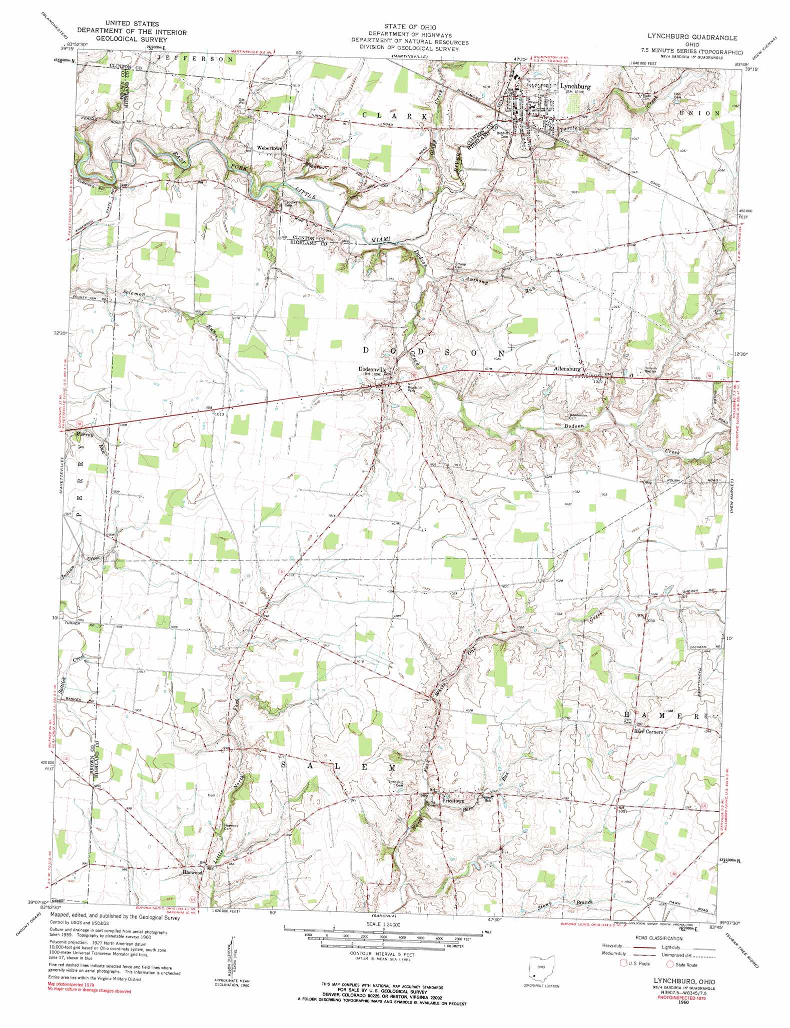
USGS Topo Quad 39083b7 - 1:24,000 scale
| Topo Map Name: | Lynchburg |
| USGS Topo Quad ID: | 39083b7 |
| Print Size: | ca. 21 1/4" wide x 27" high |
| Southeast Coordinates: | 39.125° N latitude / 83.75° W longitude |
| Map Center Coordinates: | 39.1875° N latitude / 83.8125° W longitude |
| U.S. State: | OH |
| Filename: | o39083b7.jpg |
| Download Map JPG Image: | Lynchburg topo map 1:24,000 scale |
| Map Type: | Topographic |
| Topo Series: | 7.5´ |
| Map Scale: | 1:24,000 |
| Source of Map Images: | United States Geological Survey (USGS) |
| Alternate Map Versions: |
Lynchburg OH 1960, updated 1962 Download PDF Buy paper map Lynchburg OH 1960, updated 1962 Download PDF Buy paper map Lynchburg OH 1960, updated 1990 Download PDF Buy paper map Lynchburg OH 2010 Download PDF Buy paper map Lynchburg OH 2013 Download PDF Buy paper map Lynchburg OH 2016 Download PDF Buy paper map |
1:24,000 Topo Quads surrounding Lynchburg
Oregonia |
Clarksville |
Wilmington |
Sabina |
Memphis |
Pleasant Plain |
Blanchester |
Martinsville |
New Vienna |
Leesburg |
Newtonsville |
Fayetteville |
Lynchburg |
New Market |
Hillsboro |
Williamsburg |
Mount Orab |
Sardinia |
Sugar Tree Ridge |
Belfast |
Bethel |
Hamersville |
Ash Ridge |
Winchester |
Seaman |
> Back to 39083a1 at 1:100,000 scale
> Back to 39082a1 at 1:250,000 scale
> Back to U.S. Topo Maps home
Lynchburg topo map: Gazetteer
Lynchburg: Bridges
Lynchburg Bridge elevation 299m 980′Lynchburg: Populated Places
Allensburg elevation 314m 1030′Dodsonville elevation 303m 994′
Harwood elevation 301m 987′
Honolulu (historical) elevation 303m 994′
Luttleton (historical) elevation 310m 1017′
Lynchburg elevation 307m 1007′
Pricetown elevation 306m 1003′
Webertown elevation 306m 1003′
Lynchburg: Post Offices
Allensburgh Post Office (historical) elevation 314m 1030′Dodsonville Post Office (historical) elevation 304m 997′
Honolulu Post Office (historical) elevation 305m 1000′
Lynchburg Post Office elevation 307m 1007′
Pricetown Post Office (historical) elevation 306m 1003′
Webertown Post Office (historical) elevation 305m 1000′
Lynchburg: Streams
Anthony Run elevation 296m 971′Barr Run elevation 298m 977′
Dodson Creek elevation 295m 967′
Glady Creek elevation 295m 967′
Turtle Creek elevation 299m 980′
Lynchburg digital topo map on disk
Buy this Lynchburg topo map showing relief, roads, GPS coordinates and other geographical features, as a high-resolution digital map file on DVD:
 map DVD")