Cyrene Topo Map Missouri
To zoom in, hover over the map of Cyrene
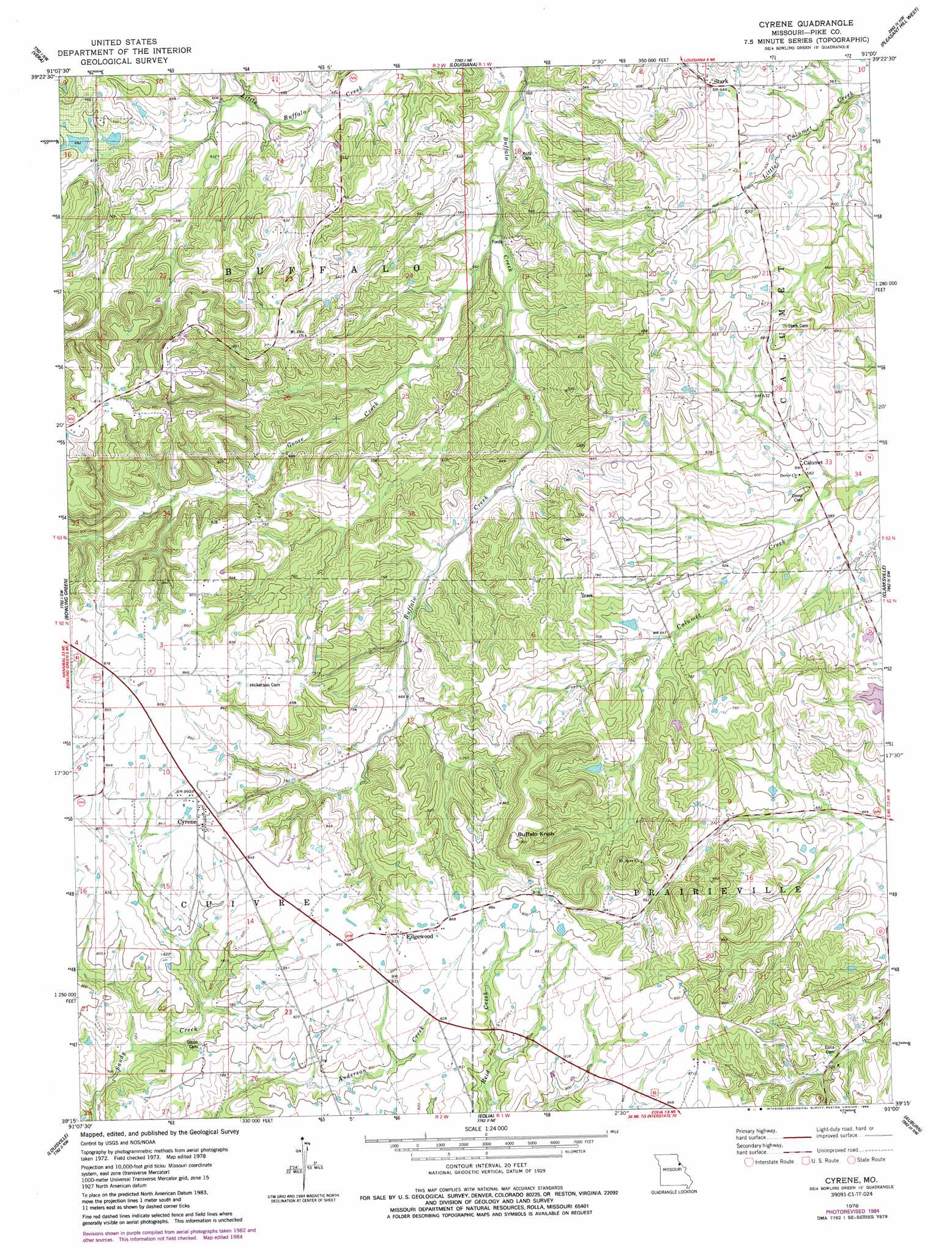
USGS Topo Quad 39091c1 - 1:24,000 scale
| Topo Map Name: | Cyrene |
| USGS Topo Quad ID: | 39091c1 |
| Print Size: | ca. 21 1/4" wide x 27" high |
| Southeast Coordinates: | 39.25° N latitude / 91° W longitude |
| Map Center Coordinates: | 39.3125° N latitude / 91.0625° W longitude |
| U.S. State: | MO |
| Filename: | o39091c1.jpg |
| Download Map JPG Image: | Cyrene topo map 1:24,000 scale |
| Map Type: | Topographic |
| Topo Series: | 7.5´ |
| Map Scale: | 1:24,000 |
| Source of Map Images: | United States Geological Survey (USGS) |
| Alternate Map Versions: |
Cyrene MO 1978, updated 1978 Download PDF Buy paper map Cyrene MO 1978, updated 1985 Download PDF Buy paper map Cyrene MO 2012 Download PDF Buy paper map Cyrene MO 2014 Download PDF Buy paper map |
1:24,000 Topo Quads surrounding Cyrene
Hannibal Se |
Ashburn |
Rockport |
Summer Hill |
Pittsfield |
Frankford |
Vera |
Louisana |
Pleasant Hill West |
Pleasant Hill East |
Curryville |
Bowling Green |
Cyrene |
Clarksville |
Annada |
New Hartford |
Louisville |
Eolia |
Auburn |
Elsberry |
Bellflower North |
Truxton |
Silex |
Okete |
Luckett Ridge |
> Back to 39091a1 at 1:100,000 scale
> Back to 39090a1 at 1:250,000 scale
> Back to U.S. Topo Maps home
Cyrene topo map: Gazetteer
Cyrene: Dams
J R Wilson Dam elevation 213m 698′Number 150 Dam elevation 203m 666′
Wertz Lake Dam elevation 213m 698′
Cyrene: Populated Places
Calumet elevation 179m 587′Cyrene elevation 259m 849′
Edgewood elevation 256m 839′
Stark elevation 195m 639′
Cyrene: Reservoirs
Wertz Lake elevation 213m 698′Wilson Lake elevation 213m 698′
Cyrene: Streams
Goose Creek elevation 160m 524′Cyrene: Summits
Buffalo Knob elevation 305m 1000′Cyrene digital topo map on disk
Buy this Cyrene topo map showing relief, roads, GPS coordinates and other geographical features, as a high-resolution digital map file on DVD: