Clay Center Sw Topo Map Kansas
To zoom in, hover over the map of Clay Center Sw
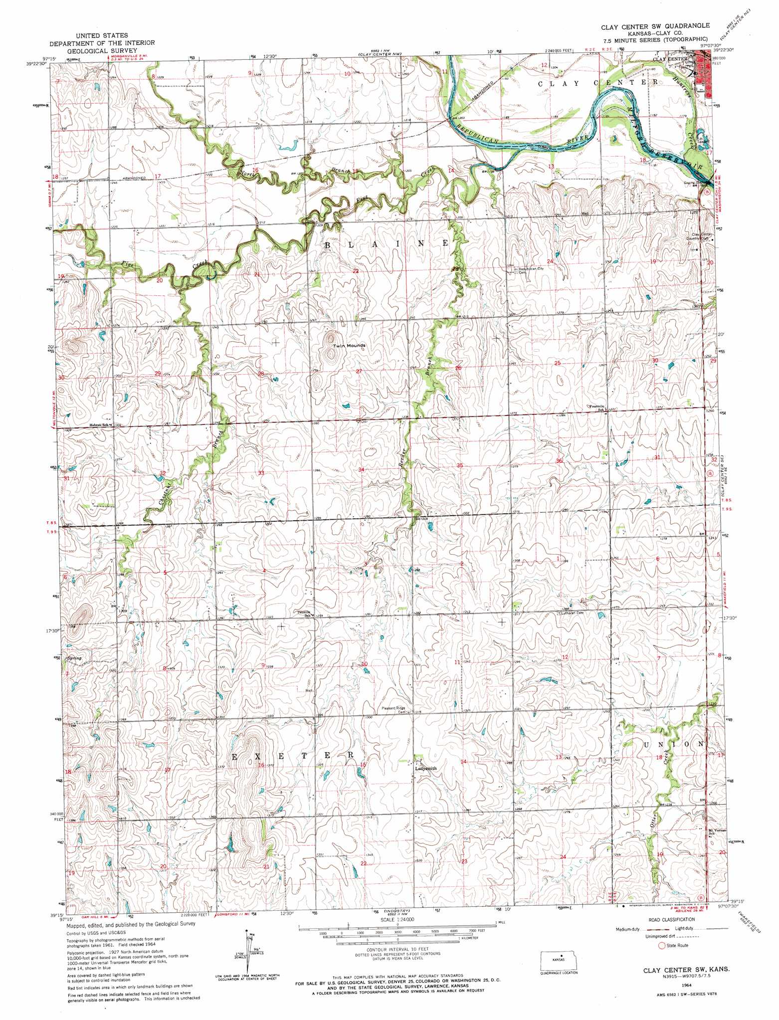
USGS Topo Quad 39097c2 - 1:24,000 scale
| Topo Map Name: | Clay Center Sw |
| USGS Topo Quad ID: | 39097c2 |
| Print Size: | ca. 21 1/4" wide x 27" high |
| Southeast Coordinates: | 39.25° N latitude / 97.125° W longitude |
| Map Center Coordinates: | 39.3125° N latitude / 97.1875° W longitude |
| U.S. State: | KS |
| Filename: | o39097c2.jpg |
| Download Map JPG Image: | Clay Center Sw topo map 1:24,000 scale |
| Map Type: | Topographic |
| Topo Series: | 7.5´ |
| Map Scale: | 1:24,000 |
| Source of Map Images: | United States Geological Survey (USGS) |
| Alternate Map Versions: |
Clay Center SW KS 1964, updated 1965 Download PDF Buy paper map Clay Center SW KS 2009 Download PDF Buy paper map Clay Center SW KS 2012 Download PDF Buy paper map Clay Center SW KS 2015 Download PDF Buy paper map |
1:24,000 Topo Quads surrounding Clay Center Sw
Clyde |
Clifton |
Linn Sw |
Linn Se |
Kimeo |
Miltonvale Nw |
Miltonvale Ne |
Clay Center Nw |
Clay Center Ne |
Lasita |
Miltonvale |
Idana |
Clay Center Sw |
Clay Center Se |
Bala |
Manchester Nw |
Longford |
Industry |
Wakefield |
Milford |
Vine Creek |
Manchester |
Buckeye |
Upland |
Milford Dam |
> Back to 39097a1 at 1:100,000 scale
> Back to 39096a1 at 1:250,000 scale
> Back to U.S. Topo Maps home
Clay Center Sw topo map: Gazetteer
Clay Center Sw: Populated Places
Ladysmith elevation 400m 1312′Clay Center Sw: Streams
Chestnut Branch elevation 366m 1200′Five Creek elevation 359m 1177′
Huntress Creek elevation 357m 1171′
North Branch Five Creek elevation 367m 1204′
Reeder Branch Five Creek elevation 361m 1184′
Clay Center Sw: Summits
Twin Mounds elevation 406m 1332′Clay Center Sw digital topo map on disk
Buy this Clay Center Sw topo map showing relief, roads, GPS coordinates and other geographical features, as a high-resolution digital map file on DVD: