Clifton Topo Map Kansas
To zoom in, hover over the map of Clifton
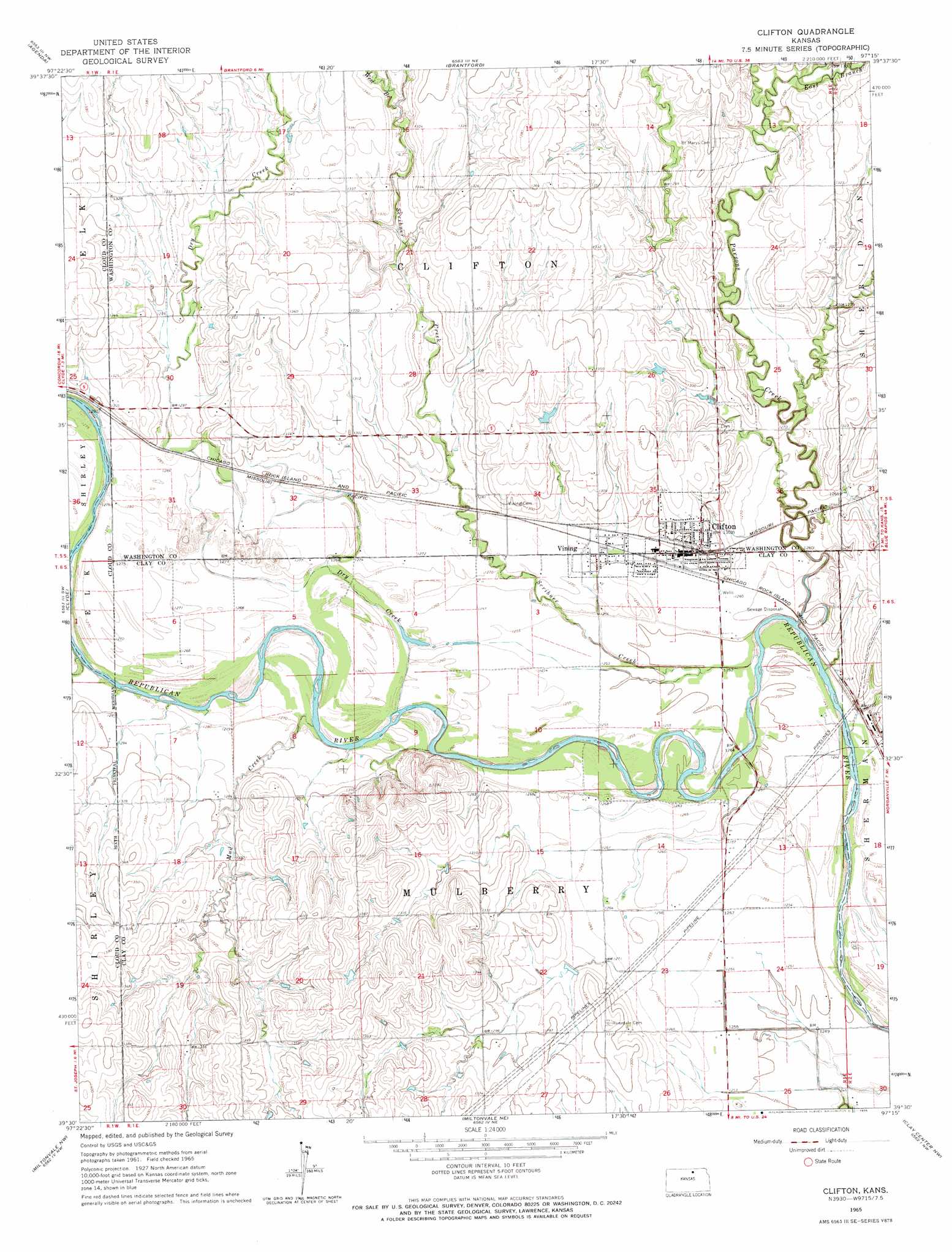
USGS Topo Quad 39097e3 - 1:24,000 scale
| Topo Map Name: | Clifton |
| USGS Topo Quad ID: | 39097e3 |
| Print Size: | ca. 21 1/4" wide x 27" high |
| Southeast Coordinates: | 39.5° N latitude / 97.25° W longitude |
| Map Center Coordinates: | 39.5625° N latitude / 97.3125° W longitude |
| U.S. State: | KS |
| Filename: | o39097e3.jpg |
| Download Map JPG Image: | Clifton topo map 1:24,000 scale |
| Map Type: | Topographic |
| Topo Series: | 7.5´ |
| Map Scale: | 1:24,000 |
| Source of Map Images: | United States Geological Survey (USGS) |
| Alternate Map Versions: |
Clifton KS 1965, updated 1966 Download PDF Buy paper map Clifton KS 2009 Download PDF Buy paper map Clifton KS 2012 Download PDF Buy paper map Clifton KS 2016 Download PDF Buy paper map |
1:24,000 Topo Quads surrounding Clifton
Belleville Se |
Cuba |
Haddam |
Morrowville |
Washington |
Wayne |
Agenda |
Brantford |
Palmer |
Linn |
Rice |
Clyde |
Clifton |
Linn Sw |
Linn Se |
Aurora |
Miltonvale Nw |
Miltonvale Ne |
Clay Center Nw |
Clay Center Ne |
Lamar |
Miltonvale |
Idana |
Clay Center Sw |
Clay Center Se |
> Back to 39097e1 at 1:100,000 scale
> Back to 39096a1 at 1:250,000 scale
> Back to U.S. Topo Maps home
Clifton topo map: Gazetteer
Clifton: Populated Places
Clifton elevation 397m 1302′Vining elevation 387m 1269′
Clifton: Streams
Dry Creek elevation 383m 1256′East Branch Parsons Creek elevation 393m 1289′
Mud Creek elevation 384m 1259′
Parsons Creek elevation 379m 1243′
Scribner Creek elevation 378m 1240′
West Branch Scribner Creek elevation 397m 1302′
Clifton digital topo map on disk
Buy this Clifton topo map showing relief, roads, GPS coordinates and other geographical features, as a high-resolution digital map file on DVD: