Big Pack Mountain Nw Topo Map Utah
To zoom in, hover over the map of Big Pack Mountain Nw
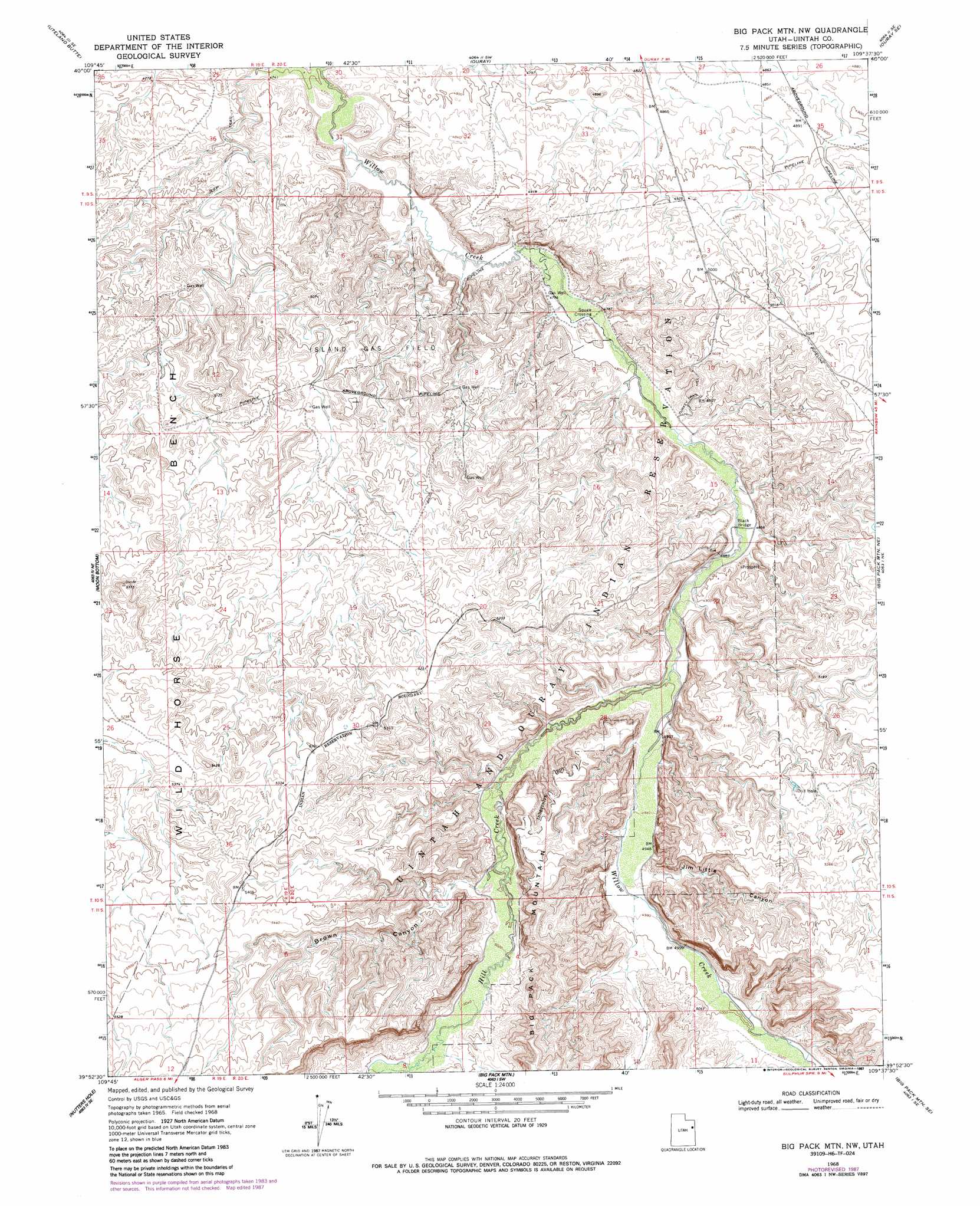
USGS Topo Quad 39109h6 - 1:24,000 scale
| Topo Map Name: | Big Pack Mountain Nw |
| USGS Topo Quad ID: | 39109h6 |
| Print Size: | ca. 21 1/4" wide x 27" high |
| Southeast Coordinates: | 39.875° N latitude / 109.625° W longitude |
| Map Center Coordinates: | 39.9375° N latitude / 109.6875° W longitude |
| U.S. State: | UT |
| Filename: | o39109h6.jpg |
| Download Map JPG Image: | Big Pack Mountain Nw topo map 1:24,000 scale |
| Map Type: | Topographic |
| Topo Series: | 7.5´ |
| Map Scale: | 1:24,000 |
| Source of Map Images: | United States Geological Survey (USGS) |
| Alternate Map Versions: |
Big Pack Mtn. NW UT 1968, updated 1970 Download PDF Buy paper map Big Pack Mtn. NW UT 1968, updated 1985 Download PDF Buy paper map Big Pack Mtn. NW UT 1968, updated 1987 Download PDF Buy paper map Big Pack Mountain NW UT 2011 Download PDF Buy paper map Big Pack Mountain NW UT 2014 Download PDF Buy paper map |
1:24,000 Topo Quads surrounding Big Pack Mountain Nw
Windy Ridge |
Randlett |
Pelican Lake |
Brennan Basin |
Red Wash Nw |
Pariette Draw Sw |
Uteland Butte |
Ouray |
Ouray Se |
Red Wash Sw |
Crow Knoll |
Moon Bottom |
Big Pack Mountain Nw |
Big Pack Mountain Ne |
Archy Bench |
Duches Hole |
Nutters Hole |
Big Pack Mountain |
Big Pack Mountain Se |
Buck Camp Canyon |
Firewater Canyon North |
Dog Knoll |
Agency Draw Nw |
Agency Draw Ne |
Bates Knolls |
> Back to 39109e1 at 1:100,000 scale
> Back to 39108a1 at 1:250,000 scale
> Back to U.S. Topo Maps home
Big Pack Mountain Nw topo map: Gazetteer
Big Pack Mountain Nw: Bridges
Black Bridge elevation 1477m 4845′Big Pack Mountain Nw: Oilfields
Island Gas Field elevation 1519m 4983′Big Pack Mountain Nw: Populated Places
Squaw Crossing elevation 1457m 4780′Big Pack Mountain Nw: Streams
Hill Creek elevation 1485m 4872′Big Pack Mountain Nw: Valleys
Brown Canyon elevation 1534m 5032′Jim Little Canyon elevation 1645m 5396′
Big Pack Mountain Nw digital topo map on disk
Buy this Big Pack Mountain Nw topo map showing relief, roads, GPS coordinates and other geographical features, as a high-resolution digital map file on DVD: