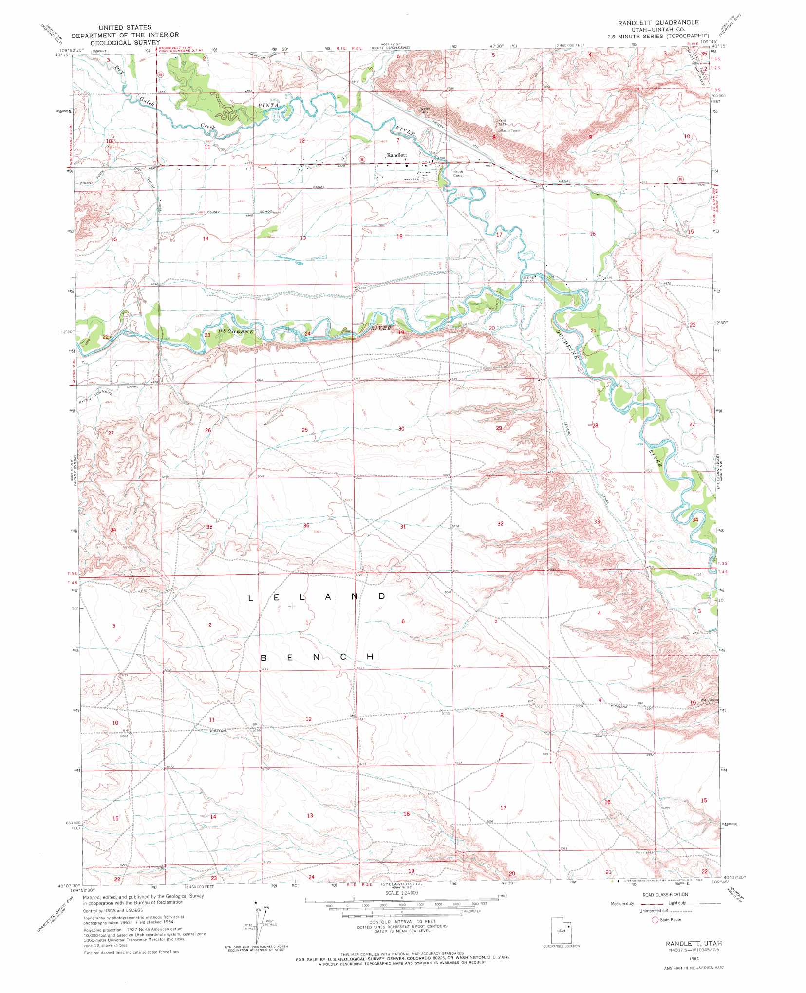
Randlett Topo Map Utah
To zoom in, hover over the map of Randlett
USGS Topo Quad 40109b7 - 1:24,000 scale
| Topo Map Name: | Randlett |
| USGS Topo Quad ID: | 40109b7 |
| Print Size: | ca. 21 1/4" wide x 27" high |
| Southeast Coordinates: | 40.125° N latitude / 109.75° W longitude |
| Map Center Coordinates: | 40.1875° N latitude / 109.8125° W longitude |
| U.S. State: | UT |
| Filename: | o40109b7.jpg |
| Download Map JPG Image: | Randlett topo map 1:24,000 scale |
| Map Type: | Topographic |
| Topo Series: | 7.5´ |
| Map Scale: | 1:24,000 |
| Source of Map Images: | United States Geological Survey (USGS) |
| Alternate Map Versions: |
Randlett UT 1964, updated 1966 Download PDF Buy paper map Randlett UT 2011 Download PDF Buy paper map Randlett UT 2014 Download PDF Buy paper map |
1:24,000 Topo Quads surrounding Randlett
Neola |
Whiterocks |
Lapoint |
Vernal Nw |
Vernal Ne |
Hancock Cove |
Roosevelt |
Fort Duchesne |
Vernal Sw |
Vernal Se |
Myton |
Windy Ridge |
Randlett |
Pelican Lake |
Brennan Basin |
Myton Se |
Pariette Draw Sw |
Uteland Butte |
Ouray |
Ouray Se |
Wilkin Ridge |
Crow Knoll |
Moon Bottom |
Big Pack Mountain Nw |
Big Pack Mountain Ne |
> Back to 40109a1 at 1:100,000 scale
> Back to 40108a1 at 1:250,000 scale
> Back to U.S. Topo Maps home
Randlett topo map: Gazetteer
Randlett: Benches
Leland Bench elevation 1565m 5134′Randlett: Canals
Henry Jim Canal elevation 1472m 4829′Ouray School Canal elevation 1485m 4872′
Randlett: Populated Places
Randlett elevation 1468m 4816′Randlett: Streams
Dry Gulch Creek elevation 1473m 4832′Uinta River elevation 1452m 4763′
Randlett digital topo map on disk
Buy this Randlett topo map showing relief, roads, GPS coordinates and other geographical features, as a high-resolution digital map file on DVD: