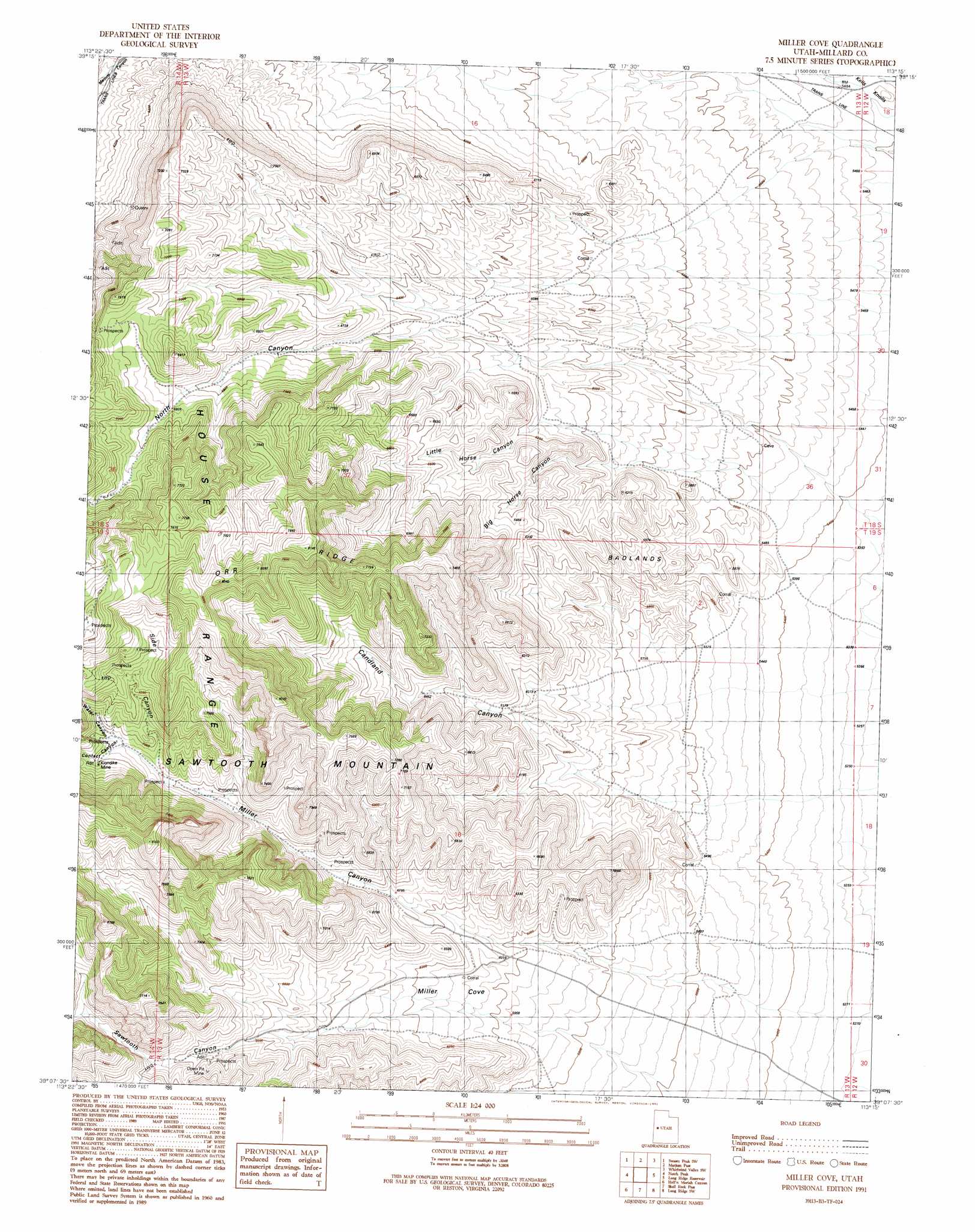
Miller Cove Topo Map Utah
To zoom in, hover over the map of Miller Cove
USGS Topo Quad 39113b3 - 1:24,000 scale
| Topo Map Name: | Miller Cove |
| USGS Topo Quad ID: | 39113b3 |
| Print Size: | ca. 21 1/4" wide x 27" high |
| Southeast Coordinates: | 39.125° N latitude / 113.25° W longitude |
| Map Center Coordinates: | 39.1875° N latitude / 113.3125° W longitude |
| U.S. State: | UT |
| Filename: | o39113b3.jpg |
| Download Map JPG Image: | Miller Cove topo map 1:24,000 scale |
| Map Type: | Topographic |
| Topo Series: | 7.5´ |
| Map Scale: | 1:24,000 |
| Source of Map Images: | United States Geological Survey (USGS) |
| Alternate Map Versions: |
Miller Cove UT 1991, updated 1991 Download PDF Buy paper map Miller Cove UT 2010 Download PDF Buy paper map Miller Cove UT 2014 Download PDF Buy paper map |
1:24,000 Topo Quads surrounding Miller Cove
Coyote Knolls |
Swasey Peak Nw |
Swasey Peak |
Whirlwind Valley Nw |
Little Drum Pass |
Chalk Knolls |
Swasey Peak Sw |
Marjum Pass |
Whirlwind Valley Sw |
Red Knolls |
Dowdell Canyon |
Notch Peak |
Miller Cove |
Long Ridge Reservoir |
Long Ridge |
Bullgrass Knoll |
Hell'N Maria Canyon |
Skull Rock Pass |
Long Ridge Sw |
Long Ridge Se |
King Top |
The Barn |
Burnout Canyon |
Needle Point |
Sevier Lake Ne |
> Back to 39113a1 at 1:100,000 scale
> Back to 39112a1 at 1:250,000 scale
> Back to U.S. Topo Maps home
Miller Cove topo map: Gazetteer
Miller Cove: Areas
Badlands elevation 1837m 6026′Miller Cove: Mines
Klondike Mine elevation 2145m 7037′Miller Cove: Ridges
Orr Ridge elevation 2481m 8139′Miller Cove: Valleys
Amasa Valley elevation 2436m 7992′Big Horse Canyon elevation 1801m 5908′
Candland Canyon elevation 1751m 5744′
Contact Canyon elevation 2121m 6958′
Little Horse Canyon elevation 1868m 6128′
Miller Canyon elevation 1857m 6092′
Miller Cove elevation 1790m 5872′
North Canyon elevation 1953m 6407′
Sawtooth Canyon elevation 2050m 6725′
Side Canyon elevation 2108m 6916′
Water Canyon elevation 2120m 6955′
Miller Cove digital topo map on disk
Buy this Miller Cove topo map showing relief, roads, GPS coordinates and other geographical features, as a high-resolution digital map file on DVD: