Thirtymile Ranch Topo Map Nevada
To zoom in, hover over the map of Thirtymile Ranch
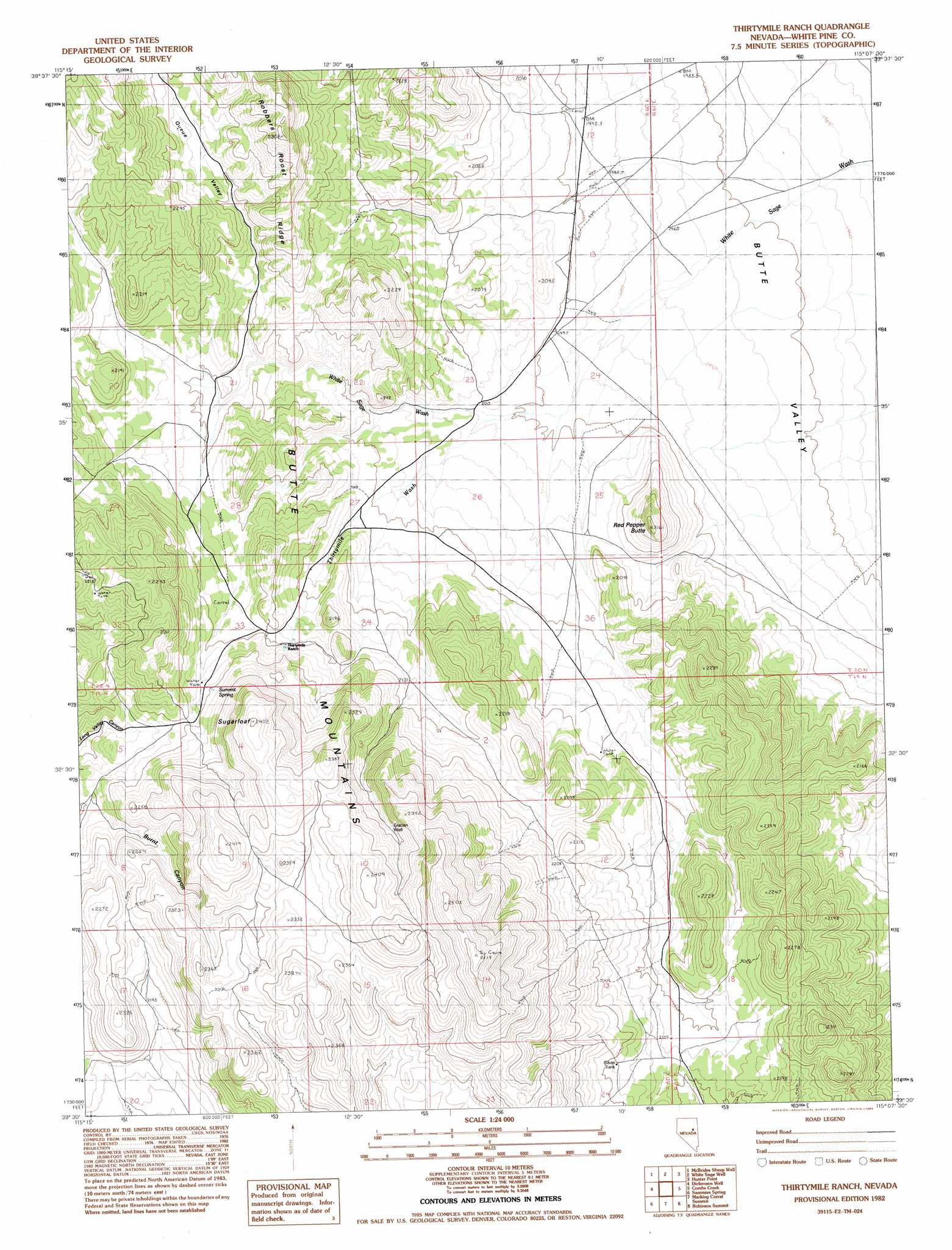
USGS Topo Quad 39115e2 - 1:24,000 scale
| Topo Map Name: | Thirtymile Ranch |
| USGS Topo Quad ID: | 39115e2 |
| Print Size: | ca. 21 1/4" wide x 27" high |
| Southeast Coordinates: | 39.5° N latitude / 115.125° W longitude |
| Map Center Coordinates: | 39.5625° N latitude / 115.1875° W longitude |
| U.S. State: | NV |
| Filename: | o39115e2.jpg |
| Download Map JPG Image: | Thirtymile Ranch topo map 1:24,000 scale |
| Map Type: | Topographic |
| Topo Series: | 7.5´ |
| Map Scale: | 1:24,000 |
| Source of Map Images: | United States Geological Survey (USGS) |
| Alternate Map Versions: |
Thirtymile Ranch NV 1982, updated 1982 Download PDF Buy paper map Thirtymile Ranch NV 2012 Download PDF Buy paper map Thirtymile Ranch NV 2014 Download PDF Buy paper map |
1:24,000 Topo Quads surrounding Thirtymile Ranch
Long Valley Slough |
Cabin Spring |
Cow Camp |
Franks Well |
Egan Canyon |
Sunshine Well Nw |
Mcbrides Sheep Well |
White Sage Well |
Hunter Point |
Telegraph Peak |
Sunshine Well |
Dickenson Well |
Thirtymile Ranch |
Combs Creek |
Steptoe Ranch |
Antelope Mountain |
Sammys Springs |
Marking Corral Summit |
Robinson Summit |
Lusetti Canyon |
Hamilton |
Illipah |
Waldy Pond |
Riepetown |
Ruth |
> Back to 39115e1 at 1:100,000 scale
> Back to 39114a1 at 1:250,000 scale
> Back to U.S. Topo Maps home
Thirtymile Ranch topo map: Gazetteer
Thirtymile Ranch: Reservoirs
Silver Tank elevation 2191m 7188′Thirtymile Ranch: Ridges
Robbers Roost Ridge elevation 2278m 7473′Thirtymile Ranch: Springs
Summit Spring elevation 2207m 7240′Thirtymile Spring elevation 2166m 7106′
Thirtymile Ranch: Streams
Thirtymile Wash elevation 2001m 6564′Thirtymile Ranch: Summits
Red Pepper Butte elevation 2099m 6886′Sugarloaf elevation 2398m 7867′
Thirtymile Ranch: Valleys
Queue Valley elevation 2079m 6820′Thirtymile Ranch: Wells
Gracian Well elevation 2289m 7509′Thirtymile Ranch digital topo map on disk
Buy this Thirtymile Ranch topo map showing relief, roads, GPS coordinates and other geographical features, as a high-resolution digital map file on DVD: