Hall Creek North Topo Map Nevada
To zoom in, hover over the map of Hall Creek North
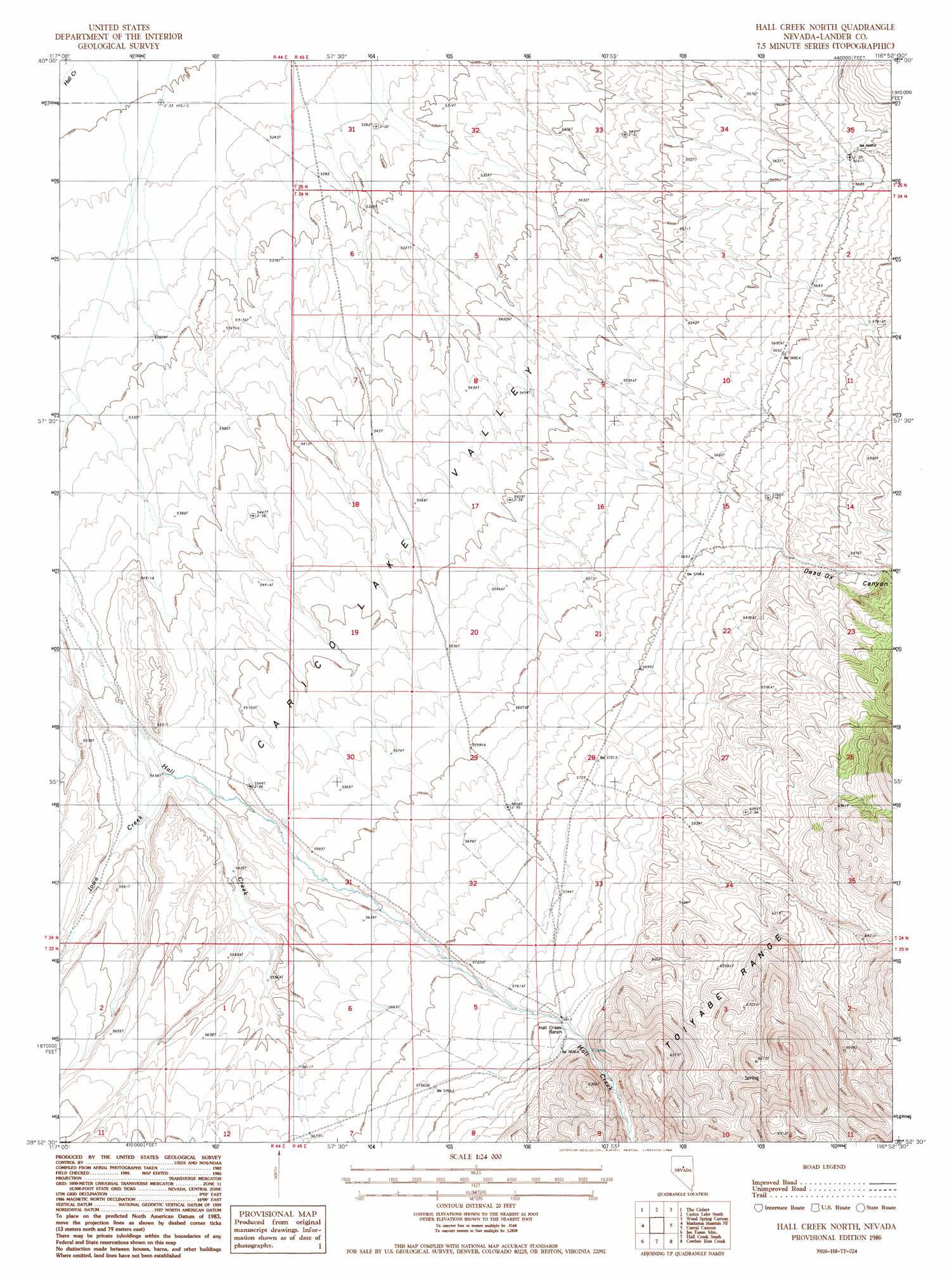
USGS Topo Quad 39116h8 - 1:24,000 scale
| Topo Map Name: | Hall Creek North |
| USGS Topo Quad ID: | 39116h8 |
| Print Size: | ca. 21 1/4" wide x 27" high |
| Southeast Coordinates: | 39.875° N latitude / 116.875° W longitude |
| Map Center Coordinates: | 39.9375° N latitude / 116.9375° W longitude |
| U.S. State: | NV |
| Filename: | o39116h8.jpg |
| Download Map JPG Image: | Hall Creek North topo map 1:24,000 scale |
| Map Type: | Topographic |
| Topo Series: | 7.5´ |
| Map Scale: | 1:24,000 |
| Source of Map Images: | United States Geological Survey (USGS) |
| Alternate Map Versions: |
Hall Creek North NV 1986, updated 1986 Download PDF Buy paper map Hall Creek North NV 2012 Download PDF Buy paper map Hall Creek North NV 2014 Download PDF Buy paper map |
1:24,000 Topo Quads surrounding Hall Creek North
Fish Creek Ranch |
Moss Creek |
Carico Lake North |
Rocky Pass |
Cortez Canyon |
The Cedars Sw |
The Cedars |
Carico Lake South |
Wood Spring Canyon |
Wenban Spring |
Manhattan Mountain Nw |
Manhattan Mountain Ne |
Hall Creek North |
Corral Canyon |
Little Hot Springs |
Manhattan Mountain |
Joe Eason Mountain |
Hall Creek South |
Cowboy Rest Creek |
West Of Fagin Mountain |
Vigus Butte Nw |
Vigus Butte Ne |
Mount Callaghan |
Grass Valley Ranch |
Salt Marsh Canyon |
> Back to 39116e1 at 1:100,000 scale
> Back to 39116a1 at 1:250,000 scale
> Back to U.S. Topo Maps home
Hall Creek North topo map: Gazetteer
Hall Creek North: Streams
Iowa Creek elevation 1660m 5446′Hall Creek North: Valleys
Dead Ox Canyon elevation 1764m 5787′Hall Creek North digital topo map on disk
Buy this Hall Creek North topo map showing relief, roads, GPS coordinates and other geographical features, as a high-resolution digital map file on DVD: